Calendar An icon of a desk calendar. Cancel An icon of a circle with a diagonal line across. Caret An icon of a block arrow pointing to the right. Email An icon of a paper envelope. Facebook An icon of the Facebook "f" mark. Google An icon of the Google "G" mark. Linked In An icon of the Linked In "in" mark. Logout An icon representing logout. Profile An icon that resembles human head and shoulders. Telephone An icon of a traditional telephone receiver. Tick An icon of a tick mark. Is Public An icon of a human eye and eyelashes. Is Not Public An icon of a human eye and eyelashes with a diagonal line through it. Pause Icon A two-lined pause icon for stopping interactions. Quote Mark A opening quote mark. Quote Mark A closing quote mark. Arrow An icon of an arrow. Folder An icon of a paper folder. Breaking An icon of an exclamation mark on a circular background. Camera An icon of a digital camera. Caret An icon of a caret arrow. Clock An icon of a clock face. Close An icon of the an X shape. Close Icon An icon used to represent where to interact to collapse or dismiss a component Comment An icon of a speech bubble. Comments An icon of a speech bubble, denoting user comments. Comments An icon of a speech bubble, denoting user comments. Ellipsis An icon of 3 horizontal dots. Envelope An icon of a paper envelope. Facebook An icon of a facebook f logo. Camera An icon of a digital camera. Home An icon of a house. Instagram An icon of the Instagram logo. LinkedIn An icon of the LinkedIn logo. Magnifying Glass An icon of a magnifying glass. Search Icon A magnifying glass icon that is used to represent the function of searching. Menu An icon of 3 horizontal lines. Hamburger Menu Icon An icon used to represent a collapsed menu. Next An icon of an arrow pointing to the right. Notice An explanation mark centred inside a circle. Previous An icon of an arrow pointing to the left. Rating An icon of a star. Tag An icon of a tag. Twitter An icon of the Twitter logo. Video Camera An icon of a video camera shape. Speech Bubble Icon A icon displaying a speech bubble WhatsApp An icon of the WhatsApp logo. Information An icon of an information logo. Plus A mathematical 'plus' symbol. Duration An icon indicating Time. Success Tick An icon of a green tick. Success Tick Timeout An icon of a greyed out success tick. Loading Spinner An icon of a loading spinner. Facebook Messenger An icon of the facebook messenger app logo. Facebook An icon of a facebook f logo. Facebook Messenger An icon of the Twitter app logo. LinkedIn An icon of the LinkedIn logo. WhatsApp Messenger An icon of the Whatsapp messenger app logo. Email An icon of an mail envelope. Copy link A decentered black square over a white square.

UAVs could help potato growers

UAVs could help farmers

Unmanned Aerial Vehicles (UAVs) are now on the point of becoming important agricultural tools according to SRUC post graduate researcher Simon Gibson-Poole.

“UAVs can be fixed wing or multi-rotored but don’t call them drones. The military tell me a drone tends to go “bang” at the end of its journey whereas a UAV certainly shouldn’t,” he told the SAC Association of Potato Producers.

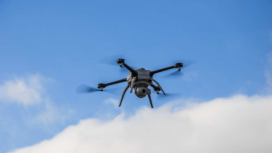
Mr Gibson-Poole has been using two sizes of multi-rotor UAVs and one fixed wing model with the latter having flight endurance of up to an hour.

The multi-rotor type has only a flight time of about ten minutes but with its vertical take-off and landing capability is generally more flexible.

Both types should be kept within sight of the operator which in practical terms means within 500 metres. An altitude of 130 metres is the allowable maximum.

“These are very useful tools for inspection work but analytical uses are a bit further away. At the simplest level they are ideal for inspecting fields and irrigation systems. They are even handy for checking on valley gutters without having to go on the roof,” said Mr Gibson-Poole.

Typically potato growers would send an UAV with a fitted camera on a “way-pointed mission” which would see it fly up and down the field at a set distance between passes to ensure sufficient overlap in the photographs.

To give a field view over a 16 hectare field around 150 images to then be stitched together. That might seem a lengthy task but there is software available to do the task in the time it takes to make a cup of coffee. Experience has shown that a 60m altitude is about right to give sufficient crop detail.

The next stage, said Mr Gibson-Poole, would be to use a Geographical Information System (GIS) so that measurements of buffer zones and field margins can be calculated. It could also be used to measure poor patches in crops.

More sophisticated Near Infra-Red cameras can identify vegetation allowing for checks on crop emergence or spotting patches of inter-row weeds. Crop senescence could also be gauged and with care blackleg plants identified and counted.

“There will be more to come with advanced sensors such as expensive thermal imagers to estimate irrigation requirements . Narrow band multi-spectral imagers can be used to estimate crop nutrition needs,” said Mr Gibson-Poole.

Precision spraying lies in the future and is really constrained by the small payload of a multi-rotored UAV. The current generation are not designed to carry more than 1kg but the Israeli forces have developed a UAV for use as an air ambulance with a payload of 500kg.

“Could this be the tractor of the future?” asked Mr Gibson-Poole.