Calendar An icon of a desk calendar. Cancel An icon of a circle with a diagonal line across. Caret An icon of a block arrow pointing to the right. Email An icon of a paper envelope. Facebook An icon of the Facebook "f" mark. Google An icon of the Google "G" mark. Linked In An icon of the Linked In "in" mark. Logout An icon representing logout. Profile An icon that resembles human head and shoulders. Telephone An icon of a traditional telephone receiver. Tick An icon of a tick mark. Is Public An icon of a human eye and eyelashes. Is Not Public An icon of a human eye and eyelashes with a diagonal line through it. Pause Icon A two-lined pause icon for stopping interactions. Quote Mark A opening quote mark. Quote Mark A closing quote mark. Arrow An icon of an arrow. Folder An icon of a paper folder. Breaking An icon of an exclamation mark on a circular background. Camera An icon of a digital camera. Caret An icon of a caret arrow. Clock An icon of a clock face. Close An icon of the an X shape. Close Icon An icon used to represent where to interact to collapse or dismiss a component Comment An icon of a speech bubble. Comments An icon of a speech bubble, denoting user comments. Comments An icon of a speech bubble, denoting user comments. Ellipsis An icon of 3 horizontal dots. Envelope An icon of a paper envelope. Facebook An icon of a facebook f logo. Camera An icon of a digital camera. Home An icon of a house. Instagram An icon of the Instagram logo. LinkedIn An icon of the LinkedIn logo. Magnifying Glass An icon of a magnifying glass. Search Icon A magnifying glass icon that is used to represent the function of searching. Menu An icon of 3 horizontal lines. Hamburger Menu Icon An icon used to represent a collapsed menu. Next An icon of an arrow pointing to the right. Notice An explanation mark centred inside a circle. Previous An icon of an arrow pointing to the left. Rating An icon of a star. Tag An icon of a tag. Twitter An icon of the Twitter logo. Video Camera An icon of a video camera shape. Speech Bubble Icon A icon displaying a speech bubble WhatsApp An icon of the WhatsApp logo. Information An icon of an information logo. Plus A mathematical 'plus' symbol. Duration An icon indicating Time. Success Tick An icon of a green tick. Success Tick Timeout An icon of a greyed out success tick. Loading Spinner An icon of a loading spinner. Facebook Messenger An icon of the facebook messenger app logo. Facebook An icon of a facebook f logo. Facebook Messenger An icon of the Twitter app logo. LinkedIn An icon of the LinkedIn logo. WhatsApp Messenger An icon of the Whatsapp messenger app logo. Email An icon of an mail envelope. Copy link A decentered black square over a white square.

Scottish crop map will inform future land-use planning

The data was recorded using radar images from the European Space Agency (ESA) Copernicus satellite programme.

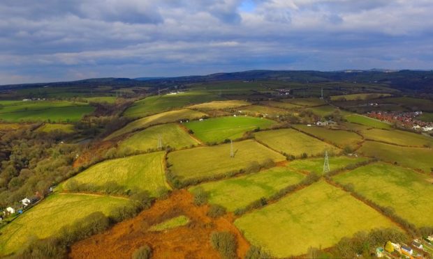
Every crop grown in almost 400,000 Scottish fields has been recorded by satellite imagery and can be viewed on a new interactive map published by the Scottish Government.

The government says the data, which was recorded in 2019 using radar images from the European Space Agency (ESA) Copernicus satellite programme, will be used to provide greater insight into rural land use and save farmers the trouble of responding to surveys.

Rural Affairs Secretary Mairi Gougeon added that future versions of the map could have a “significantly broader scope of use” by providing real time data that would help with land-use planning and management.

She said: “The statistics we have on Scotland’s agricultural sector typically rely on surveys being completed by a large number of farmers.  Gathering data in this way would reduce the amount of time our farmers and crofters have to spend reporting this.

Rural Affairs Secretary, Mairi Gougeon.

“In order to help improve the accuracy of the map, and before further developments are made to track minor crops, farmers and crofters are being asked to review the current map and report any inaccuracies in the crop identified.

“Engagement with farmers and crofters with their local knowledge is vital and will help develop future iterations of the map and enable us to extend and enhance what the map could do.”

The farmers’ union (NFUS) said the map was an important development in helping to underpin policy decisions with clearer evidence, although  without further layers relating to livestock management, agri-environment management, habitats, woodlands and Scotland’s vast swathes of rough grazing, it could only provide a partial picture.

The union added: “Visual and digital data on agricultural land use will be an increasingly important tool in helping define and design future agricultural and land use policy.

“Having a greater degree of spatial information, rather than aggregated area figures, can enable policy makers to better align measures to desired outcomes.

“On the assumption that the data is accurate, it could help guide the development of measures and management actions that could be undertaken in pursuit of, for example, climate and biodiversity goals.”

Every crop grown  in almost every field can be seen on the interactive map for 2019.

The map was developed by the Scottish Government’s Rural & Environmental Science and Analytical Services (RESAS), working in collaboration with EDINA – a world-class centre of excellence in geospatial and satellite data –  at the University of Edinburgh

Initial analysis predicts that the model was working with an accuracy of 85% and above 90% for barley and wheat.