The drive to the foot of Ben More, Mull’s highest mountain, is a memorable experience.
The single-track road hugs the shore where oystercatchers, eider ducks and curlews go about their business in the yellow kelp. Old wooden fishing boats in various states of disrepair have been drawn up on to the pebbles, telling stories of days when they were in their prime and the seaways were rich with fish.
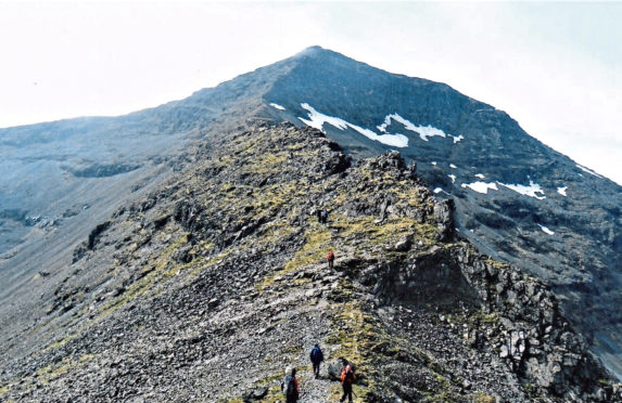
Park just beyond the bridge over the Abhainn na h-Uamha and begin walking up the lovely Gleann na Beinne Fada. A notch in the skyline marks the bealach between Beinn Fada and A’ Chioch. Head for this and from there begin scrambling up the bare rock to A’ Chioch, a pointed top on Ben More’s north-east ridge.
This is a fine place to view Mull’s fantastic landscape, one shaped by dramatic geological events. To the east of Ben More, prolific Tertiary basalt volcanoes collapsed under their own weight, forming giant calderas. The volcanic activity increased and an enormous volcano grew above them.
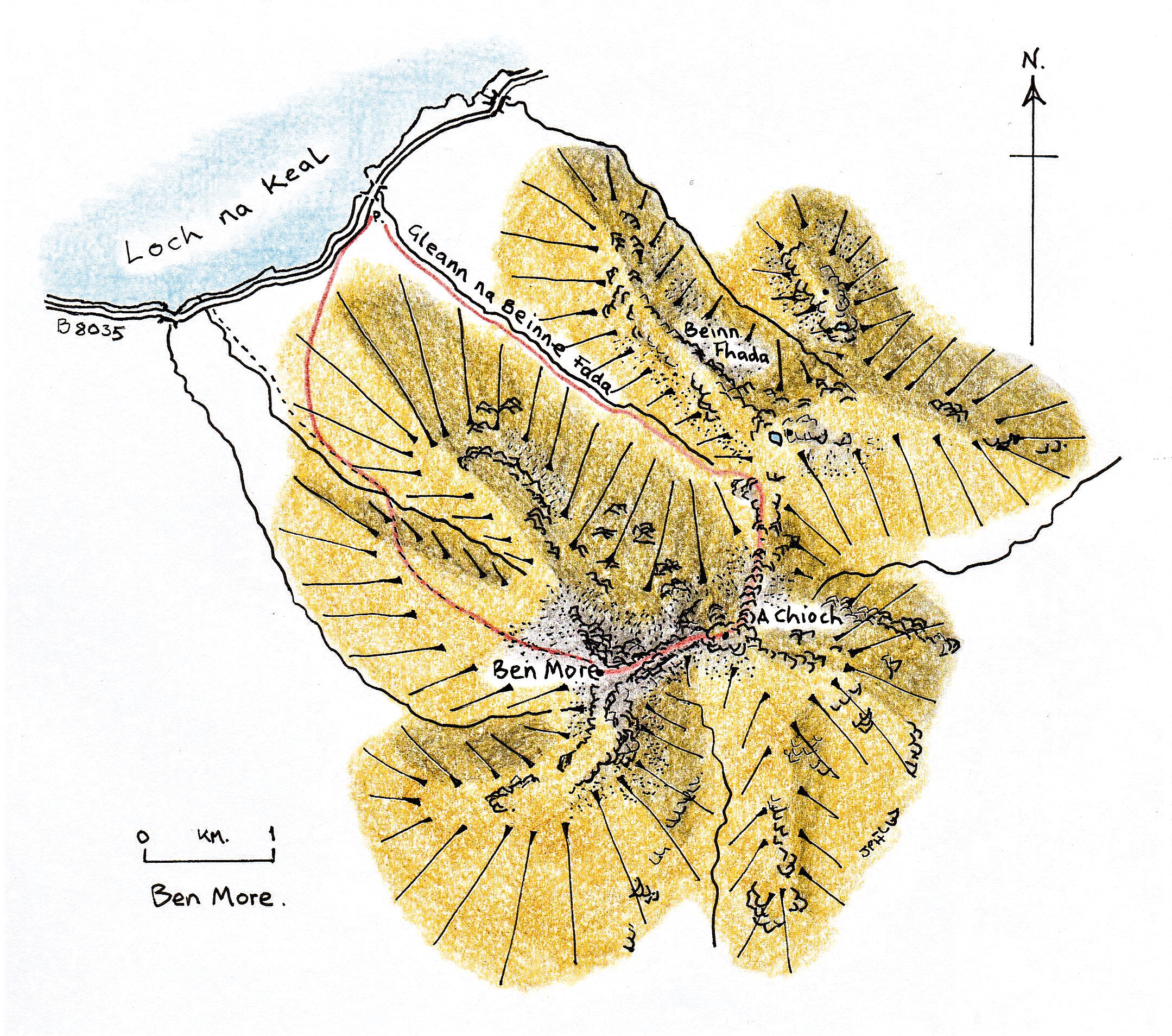
After thousands of years of erosion, particularly by ice (Mull had its own ice cap), the landscape has been determined by these Tertiary “bones”. Ben More is on the western edge of the old volcano and is made of resistant lavas. Looking down to An Gearna you will clearly see these lava flows, one on top of another, stepping right down into Gleann na Beinne Fada. This igneous activity was a major event in Britain’s geological history, with Mull’s dykes radiating out to Harris in the north and to Northumberland in the south.
The climb up to Ben More from A’ Chioch is steep and exposed, a real challenge for most hillwalkers. At one point a deep, narrow gully with smooth, vertical walls has to be crossed. This is a dyke formed of material less resistant than that of the ridge itself and now weathered away. A second of these dykes provides a gully up which walkers should climb to reach the crest of the ridge again, just before the top.
Those who complete this ascent will feel considerable pride in their achievement in climbing Ben More by that airy staircase and will be ready to sit down in the big shelter cairn. The views from the top on a fine day are truly spectacular, of rugged and beautiful Mull itself, across to the mountainous mainland and over the sparkling, island- studded Hebridean Sea.
The descent by the clear path down the north-west ridge is straightforward and it quickly takes walkers back to the lark song of the lower slopes.
I climbed Ben More with a group of friends by the route described and, when back at the cars, I volunteered to remain to get a lift back in the last vehicle with the stragglers. I sat down and dreamily watched a curlew make its way along the shore.
The broad head of a large dog otter emerged from the water and this fine Mull resident began to hunt among the rocks and pools. I watched his sinuous run, which reminded me of the way a weasel or stoat moves and saw him stop to examine a rock where droppings demarcated territory. I watched him finish his exploration then dive back into the water, barely disturbing the surface, leaving only a few little bubbles.
This walk will be included in the third volume of Jack Harland’s Highland Journal series. The second book, Highland Journal 2, In My Stride, is currently available in all local bookshops.
The route
- Directions: The ferry from Oban will take you to Craignure on the Isle of Mull. Drive north-west along the A849 to Salen then take the B8035 for 10 kilometres to park at 507 367, where there is plenty of space on the grass by the road.
- Distance: 11 kilometres
- Time: 6 hours
- Difficulty: This route up on to Ben More goes over the rocky A’ Chioch, a satellite summit, then up the exposed north-east arête, with much scrambling necessary.
- Map used: Ordnance Survey Landranger 48