I’ve often walked the lower part of this route, but have been put off going further by forestry operations.
On a warm afternoon at the end of summer, I’d set off for a short walk but soon found myself admiring the views and walked far further than planned.
Craiglich is situated just off the B9119 Aberdeen to Tarland road, turning off at the A980 towards Lumphanan. Here the road forks, with the offshoot leading to Dess.
I followed this road, and not far along on the right there is a small forest track with room for one or two cars to park without blocking the gate.
Bundling my two dogs out of the boot, we set off up the gradual hill. The track is wide enough for a car for most of the walk, though it can be a little uneven in places.
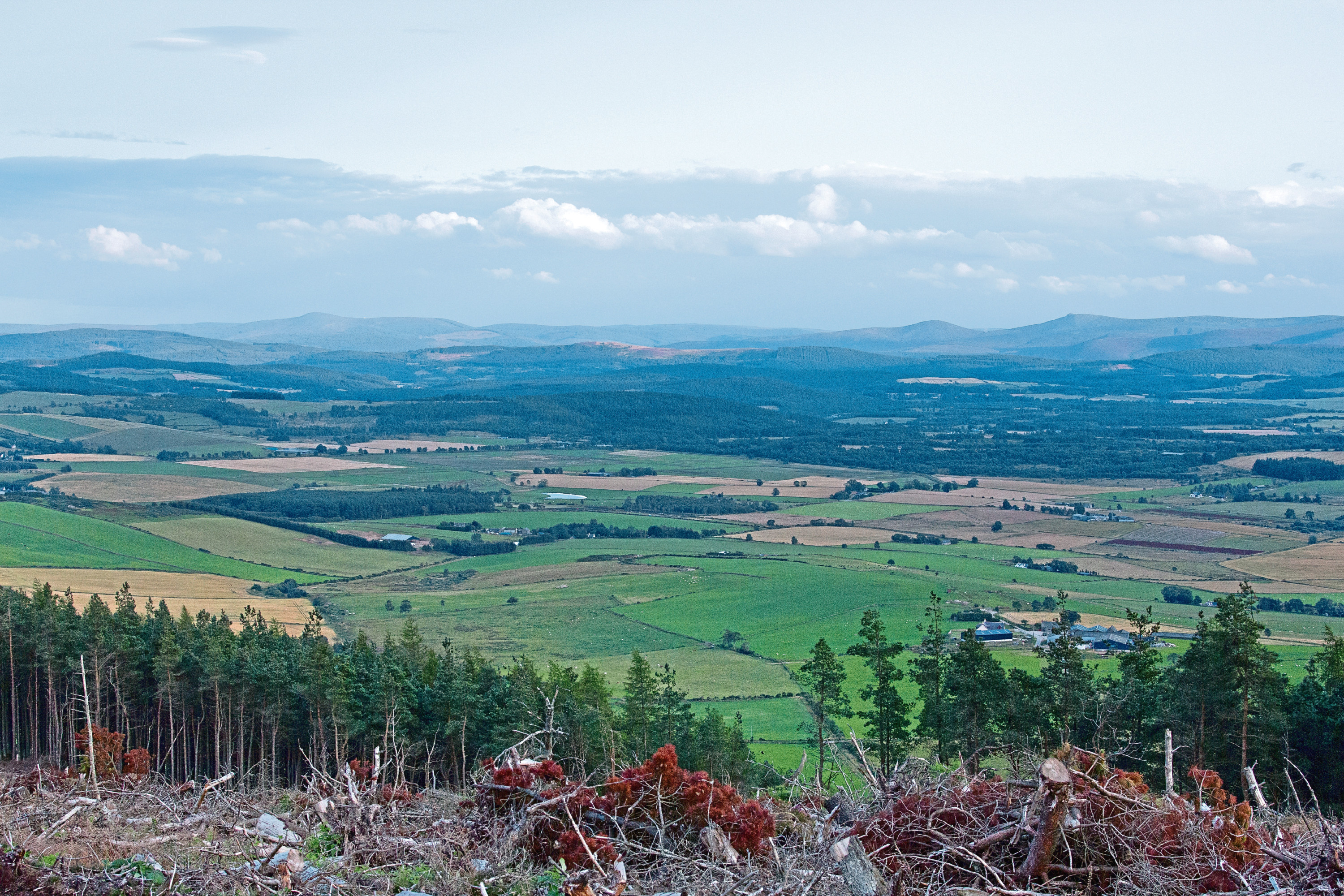
The slope continues through the forest up to an area where heavy machinery has clearly been used in recent years. On the right side lies a scene of devastation, logs and branches littering the open moorland, while to the left are young trees as far as the eye can see.

I continued along the track, steering the dogs around a few small pools of murky bog water. They both love to paddle in water, and dirty puddles are a favourite.
The track splits and I took the right fork. You can see the route leading past a folly and up the hill. I noticed the distinctive cairn on top of Craiglich from here but continued, thinking I’d be turning back any time soon.
After the trees, the view opens up. I could see for miles to the south and could easily make out the top of Clachnaben. It’s surprising how many prominent hills Aberdeenshire has on display on a clear day.
I could see the track ahead and kept telling myself that I’d turn around soon and head back, but I became addicted to the views, trying to make out each hill on the horizon.
So much so, that before I knew it, I was approaching the end of the path. The track narrowed and continued through a break in some fencing.
Following a worn path through the heather, I stood at the bottom, looking up towards the summit. It looked steep, but only a couple of hundred metres away. I’d got this far, so thought I may as well see the view from the top.
The track was muddy, with dense forest at each side, so the views temporarily disappeared. It didn’t take long to reach the top, and once I was there it was an amazing sight. The sun was not far from setting and created a silhouette of nearby Morven.
I’ve wanted to tackle this hill for a long time, and to see it cast in such a stunning light has moved it up my list of hills considerably. I took a few photos, though I don’t think they do it justice.
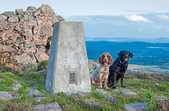
There is a big cairn on Craiglich so I posed up my two dogs for the usual photo as the warm evening sunlight cast a beautiful glow across the scene. They even sat together without an edible bribe!
Realising it would be dark soon, I hurried back downhill. As I did, I noticed a buzzard soaring above the moor, probably watching out for an unsuspecting rodent.
I’ve since found out there is another route up Craiglich – starting from a layby on the B9119 – but haven’t tried that yet. I think this has just become my new favourite walk.
The route
- Distance: 7.7km
- Time: 1.5 hours
- Dog bins: No
- Livestock: None seen
- Postcode: AB31 4RH (nearest)
- Difficulty: Easy