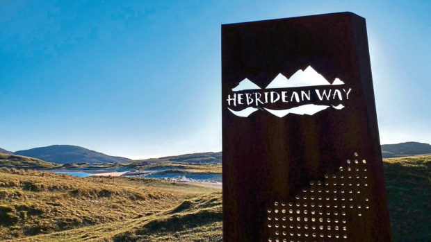
There has definitely been a growth in the number of people experiencing the Outer Hebrides by bike since the Hebridean Way cycling route was launched, but the islands have a lot to offer in the way of shorter cycling adventures too – and the Callanish circular from Stornoway is a great one.
It’s a fantastic cross-island route that goes, in brief, from Stornoway through Marybank, out the single-track Pentland Road to Breasclete, before joining the main road and passing through Callanish, Garynahine and Lochganvich until it turns off the main road again in Achmore to take another single-track road back to Stornoway.
So, starting from Stornoway at the Manor roundabout (GR 42632340 on OS Explorer map 459), take the exit to the west, towards the A859 to An Tairbeart (Tarbert).
This takes you up through Willowglen, and when you are just under a mile from the start, you will see a sign pointing right for an “Alternate Single Track Route” to Achmore, Breasclete and Carloway. Turn right here and very shortly afterwards take the immediate left after Lava’s Garage for the “Rathad Phentland” for “Carlabhaigh” and “Breascleit”. (Yes, the road signs are in Gaelic.)
This is the start of the Pentland Road across the interior of the island, to the villages of Breasclete and Carloway on the west side.
Around 6km after joining the Pentland Road at Marybank – having left all the houses behind you – you will come to the Beinn Ghrideag wind farm, and then a three-way junction, pointing up to the left to Achmore or ahead to Breasclete and Carloway.
Carry on straight ahead and enjoy the long stretch across the moor. You will be on this road for nearly 10km before coming to the Carloway/Breasclete junction. Here, take the road on the left, towards Breasclete. Within 5km you will have reached the village and come to a crossroads. There are a couple of options here for reaching the main road. I prefer to go left at the crossroads, then downhill, following the road as it bends round to the right before meeting the main road.
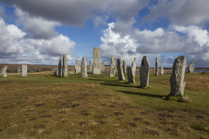
Join the A858 here, turning left and heading south out of Breasclete towards Callanish, which is only about 1km away. This village is, of course, home to the world-famous Callanish Stones, but there is a much newer attraction on the block too – the Callanish alpacas!
There are a couple of ways to reach the stones from the main road through Callanish. You can see them up on the hill to your right and just follow the signs.
The alpacas are also located just off the main road in Callanish, up a wee driveway to the right. They too are signposted and this is where Mollans Cafe is.
It’s possible to go to see the Callanish Stones anytime at all but the alpacas should be booked ahead.
Back on the main road, and the cycle continues out of Callanish, passing shortly afterwards through Garynahine. Keep going straight here, ignoring the turning for Uig, and stay on the A858 westwards for about 5km until you reach the wee settlement of Lochganvich.
Just after Lochganvich you come to Achmore, which is where you leave the main road again.
This single track route, about 1km into the village of Achmore, is signposted to the left, uphill. It’s known locally as the Beinn a’ Bhuna road, after its highest point.
There’s a bit of an up at first – make sure you accelerate hard to get over the cattle grid – but it soon levels off and climbs in a very manageable way before setting you up for a terrific ride downhill. Nearly 2km of it, with views over Stornoway, Broad Bay and the Minch, and across to the mainland mountains. Sheer joy.
From the bottom, it’s only around 2km before you are back at the wind farm junction. There, turn right and follow the straight road back to Marybank and to town.
The route
- Route: Callanish circular from Stornoway
- Distance: 48km
- Time: 2.5 hours cycling at 12mph
- Difficulty: Moderately challenging
- Maps used: Ordnance Survey Explorer 459 Central Lewis and Stornoway
Katie Laing is an award-winning journalist and PR consultant based in the Isle of Lewis.