I had never climbed the complete Clisham horseshoe before – the whole Clisham ridge – and had been harbouring ambitions to do so for a while.
Finally, I decided to go for it. So I did the research and had a very close look at the map.
My usual start point for the Clisham is the parking place at the bridge on the A859 Stornoway to Tarbert road, to the south-east of the Clisham itself, and I decided to stick with that for the whole ridge too.
That would mean doing the ridge clockwise.
When the day came, there were perfect blue skies and great visibility.
The approach to the Clisham is not all that easy. There isn’t much in the way of paths – only scraps of track on the east side of the Allt Tomnabhal but nothing very useful for long – and the best way up is pretty much straight up, following your nose and heading for the shoulder.
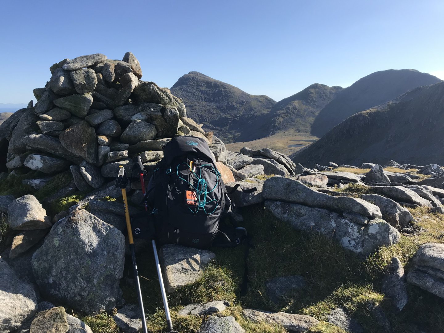
You will be climbing almost exactly north-west. Eventually a track will appear and take you through the rather bouldery top and to the summit cairn (799 metres, making it a good Corbett) but that’s only for the last 150 metres or so.
If you’re climbing the Clisham, you need to be prepared for a bit of a slog – along the boggier ground lower down and then up reasonably steep pathless slopes for a few hundred metres.
When you get to the summit cairn, the ridge is not yet visible. You have to go northwards past the cairn a little, until the ridge comes into view.
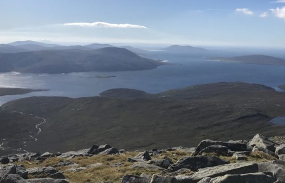
On a good day, like I had, you can see all along the peaks of the horseshoe – over An t-Isean to Mulla bho Dheas then Mulla bho Thuath and Mullach an Langa – and the only real challenge here is finding the best place to start dropping down to the bealach between Clisham and An t-Isean/Mulla who Dheas.
I wasn’t sure where to start dropping down but I had the good fortune to meet a couple of walkers, one of whom was the North Harris ranger.
The ranger, Michael, pointed out the bit of a track leading down from just past the Clisham cairn, which I was grateful for as it was easy to miss.
The path would disappear and then reappear. And I found that, as I approached the bealach, I could see a clear track along the right side of the ridge up Mulla bho Dheas.
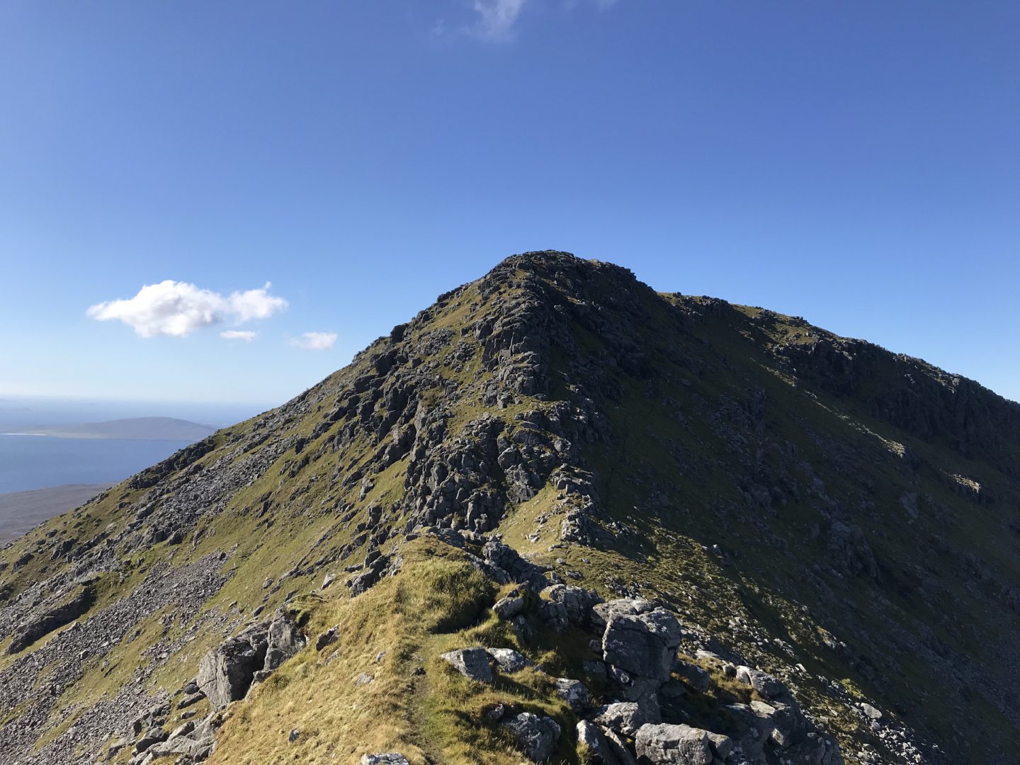
The Mulla bho Dheas ridge itself involves a fair amount of airy scrambling, but this path – although narrow and slippy – gives the option of avoiding all the scrambling altogether.
This track led all the way round and up the side of the hill, to the summit of Mulla bho Dheas – and when I reached the top, I honestly gasped out loud at the view. Miles and miles of expanse to the west and the south, down through the island chain to the Uists, and across so much blue ocean and sky. It was stunning.
At the top of Mulla bho Dheas, the ridge to Mulla bho Thuath is really obvious. It’s pretty narrow, although there are no difficulties, so in good conditions you can just follow your nose.
The ridge down off Mulla bho Thuath is wider and very bouldery, and it’s more difficult to see where to go. I just followed my nose again and came to a steep drop, because I’d gone too far east when I should have gone north.
My advice would be to walk on a bearing from the summit of Mulla bho Thuath, even in good visibility, to avoid making that mistake.
From there, it only remained to climb the final peak, Mullach an Langa. I decided to follow Michael out Glen Scaladale.
We went down the col between Mullach bho Thuath and Mullach an Langa, skirted along the northern edge of Loch Mhisteam and then generally followed the river all the way out of Glen Scaladale.
I will definitely be back along the Clisham ridge again. It’s a great walk and it’s up there for me, in the top five. It’s wild walking, with barely any paths – making them all the more welcome when they appear.
THE FACTS
- Route: Clisham horseshoe
- Distance: 12.5k
- Time: Seven hours plus
- Difficulty: A harder hill walk
- Map used: Ordnance Survey Explorer 456, North Harris and Loch Seaforth