Brown Cow Hill, Cock Bridge, Aberdeenshire
Brown Cow Hill is the less than enticing name for the highest point of a rolling circuit of rounded summits on the watershed between the River Don and the River Gairn.
Don’t let that cloud your judgement. There is much to enjoy in these wide open spaces, not least the different perspective of magnificent Ben Avon which gradually unfolds during this anti-clockwise tour.
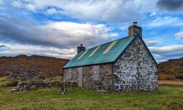
There is good parking below Corgarff Castle just off the infamous Cock Bridge-Tomintoul road. A wooden pedestrian gate gives access to a grassy track heading towards the castle, another gate on the right gaining entry to a field which should be crossed to eventually join the track running south by the Cock Burn.
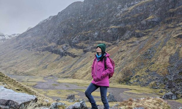
The threatening dark skies that greeted our arrival didn’t match the forecast. We had already moved our start time back by two hours in the hope of hitting the heights in tandem with the sunshine, but the discrepancy with reality was obvious.
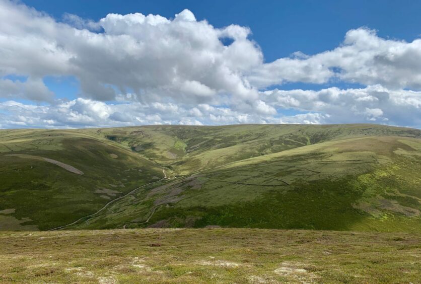
Sure enough, 20 minutes in and the rain came on. Despite this, the evidence of the recent dry spell was clear after we left the track at its high point to take the pathless line across rough terrain and peat hags. In ‘normal’ conditions this can be a real bog trot.
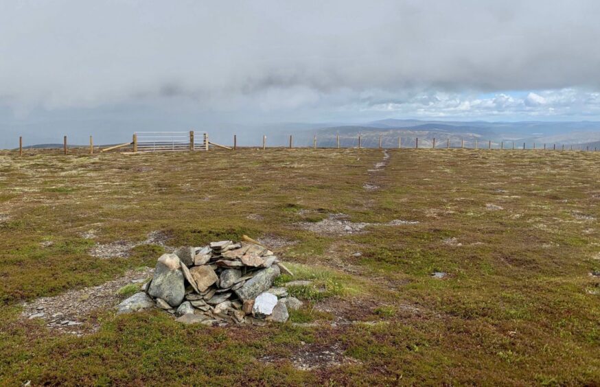
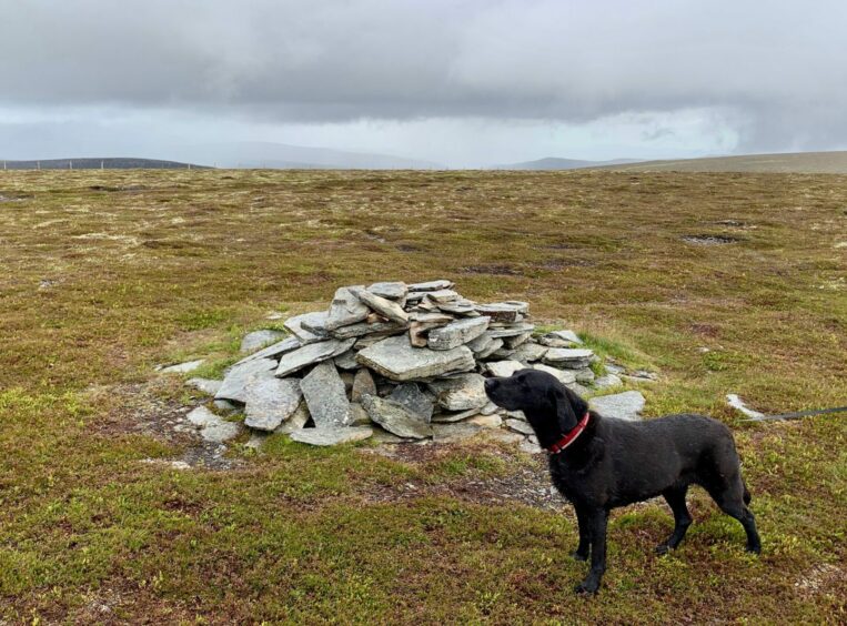
We reached the new fence running across the skyline, and went through the metal gate to the little cairn at the first high point, the eastern top of Brown Cow Hill. A short wander west on an imperceptible rise and we were at the main summit.
Sitting at 829 metres, Brown Cow Hill is a Corbett. As the name suggests, there is likely a long association with cattle, once a vital part of the local economy. The fact that the southern slope of the hill holds a late-lingering snow patch known as the White Calf further confirms the bovine connection.
The cloud had been in and out, but as we made our way up another short rise to the blink-and-you’ll-miss-it top of Cairn Sawvie, the heavens finally opened and the sudden drop in temperature highlighted how easy it would be to get caught out on this open ground.
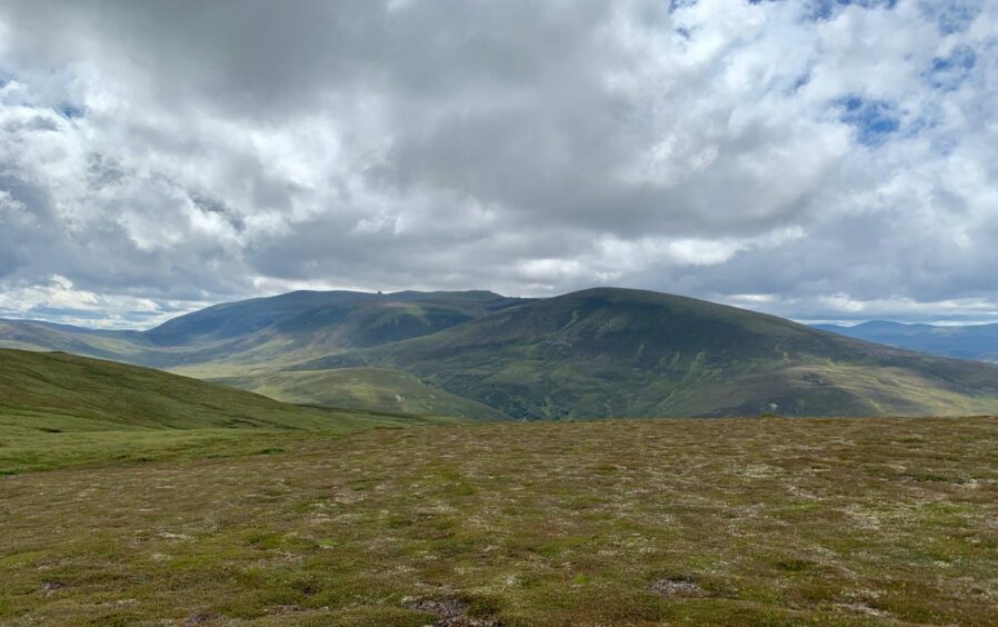
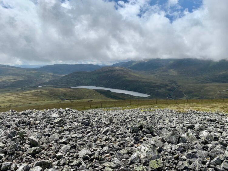
That ten-minute deluge appeared to have cleared the air and we were bathed in sunshine as we hit the white quartz on the top of Meikle Geal Charn. This summit has more prominence than its predecessors and it provides wonderful expansive views heading east over Glen Builg into the heart of the Cairngorms.
Ben Avon is the real star, however, its collection of granite tors and outcrops on the high ridges standing out in silhouette like rows of giant, broken teeth.
This outstanding vista sticks close during the crossing by the fenceline to Little Geal Charn, then starts to fade into the distance as the route turns north-east to the final top of the round, Cairn Culchavie. From here it’s all downhill through the heather – it just depends when it suits to start dropping off.
Much of the forestry marked on the maps has been cleared, but you can take any line aiming for the track. When the track splits in front of the house at Inchmore, swing right.
The main estate track heads east alongside the Don, passing the site of the former Delnadamph Lodge. The hunting lodge and estate were bought by the Queen in 1978 and given to Charles and Diana when they married, but Diana was said to have found it unappealing and it was never occupied. It was demolished in 1988 after being badly damaged by fire.
The white walls of Corgarff Castle were gleaming on our return, our hill circuit having been matched by a 360-degree weather turnaround. Brown Cow Hill turned out not to be so dull after all.
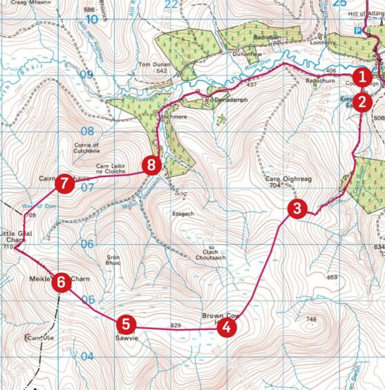
ROUTE
1. Leave car park to go through pedestrian gate and take grass track towards Corgarff Castle. Before reaching entry gate to castle grounds, break off to gate on right, cross field and exit by metal gate at top.
2. Follow path south by fence until it bends right to descend and join main track running alongside with the Cock Burn. Pass edge of small plantation and keep following track as it swings west.
3. At high point before it turns to climb Carn Oighreag, leave track and continue south on pathless ground across peat hags before swinging south-west to reach fence and metal gate. Go through to reach cairn – this marks lower 823-metre summit of Brown Cow Hill.
4. Go west along broad ridge (fence is handy navigation guide) to main summit, then continue over top of Cairn Sawvie.
5. Dip to col following fence line, then make short climb to stonier summit of Meikle Geal Charn.
6. Drop down to another gate and continue to follow route anti-clockwise over Little Geal Charn and then Carn Culchavie.
7. Keep heading down ridge for short distance before dropping east to reach track.
8. Pass house (Inchmore) to right and follow the track east alongside the River Don back to car park.
INFORMATION
Distance: 18km/11.5miles
Ascent: 575m/1890ft
Time: 5-7 hours
Grading: High-level circuit following estate tracks, hill paths, with sections of pathless walking. Suitable for well-equipped walkers with good level of fitness and navigation skills. Lots of rough, boggy ground, good footwear essential. Dogs under close control due to ground nesting birds and farm livestock.
Start/finish: Corgarff Castle parking (Grid ref: NJ 254089) access from A939 at Cock Bridge.
Map: Ordnance Survey 1:50,000 Landranger Maps 36 (Braemar & Blair Atholl) and 37 (Strathdon & Alford); Ordnance Survey 1:25,000 Explorer sheet 58.
Tourist Information: VisitScotland, Ballater iCentre, Station Square, Ballater, AB35 5QB (Tel 01339 755306).
Public transport: None to start point.
Conversation