Calendar An icon of a desk calendar. Cancel An icon of a circle with a diagonal line across. Caret An icon of a block arrow pointing to the right. Email An icon of a paper envelope. Facebook An icon of the Facebook "f" mark. Google An icon of the Google "G" mark. Linked In An icon of the Linked In "in" mark. Logout An icon representing logout. Profile An icon that resembles human head and shoulders. Telephone An icon of a traditional telephone receiver. Tick An icon of a tick mark. Is Public An icon of a human eye and eyelashes. Is Not Public An icon of a human eye and eyelashes with a diagonal line through it. Pause Icon A two-lined pause icon for stopping interactions. Quote Mark A opening quote mark. Quote Mark A closing quote mark. Arrow An icon of an arrow. Folder An icon of a paper folder. Breaking An icon of an exclamation mark on a circular background. Camera An icon of a digital camera. Caret An icon of a caret arrow. Clock An icon of a clock face. Close An icon of the an X shape. Close Icon An icon used to represent where to interact to collapse or dismiss a component Comment An icon of a speech bubble. Comments An icon of a speech bubble, denoting user comments. Comments An icon of a speech bubble, denoting user comments. Ellipsis An icon of 3 horizontal dots. Envelope An icon of a paper envelope. Facebook An icon of a facebook f logo. Camera An icon of a digital camera. Home An icon of a house. Instagram An icon of the Instagram logo. LinkedIn An icon of the LinkedIn logo. Magnifying Glass An icon of a magnifying glass. Search Icon A magnifying glass icon that is used to represent the function of searching. Menu An icon of 3 horizontal lines. Hamburger Menu Icon An icon used to represent a collapsed menu. Next An icon of an arrow pointing to the right. Notice An explanation mark centred inside a circle. Previous An icon of an arrow pointing to the left. Rating An icon of a star. Tag An icon of a tag. Twitter An icon of the Twitter logo. Video Camera An icon of a video camera shape. Speech Bubble Icon A icon displaying a speech bubble WhatsApp An icon of the WhatsApp logo. Information An icon of an information logo. Plus A mathematical 'plus' symbol. Duration An icon indicating Time. Success Tick An icon of a green tick. Success Tick Timeout An icon of a greyed out success tick. Loading Spinner An icon of a loading spinner. Facebook Messenger An icon of the facebook messenger app logo. Facebook An icon of a facebook f logo. Facebook Messenger An icon of the Twitter app logo. LinkedIn An icon of the LinkedIn logo. WhatsApp Messenger An icon of the Whatsapp messenger app logo. Email An icon of an mail envelope. Copy link A decentered black square over a white square.

Wintry conditions to stay for rest of the week

Post Thumbnail

Wintry conditions are set to continue into the weekend across the north-east, according to the Met Office.

A yellow ‘be aware’ alert is likely to be in place for the rest of the week and into the weekend, indicating that ice is likely to remain a major hazard across Grampian, Highlands and Islands.

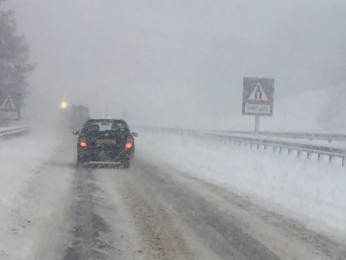
North schools: The closures, delays and transport issues due to wintry conditions

Nine schools in Aberdeenshire closed yesterday and many more rural transport routes were affected.

In the Highlands, 14 schools and 10 nurseries were forced to close due to severe road and weather conditions, but all schools in Morayshire remained open as usual.

In the village of Dalwhinnie, the mercury dipped to -12.4C in the early hours of Monday morning – the lowest temperature recorded anywhere in the UK so far in 2017.

Elsewhere, the temperature stood at -11.9C in Braemar, -10.3C in Tyndrum, and -9C in Balmoral.

Aberdeen-based Met Office forecaster Stuart Brooks last night said he could not anticipate any melt or milder conditions until Monday at the earliest.

He said: “Tuesday should be quite nice and dry across the whole area with some good spells of sunshine.

“There’s some occurrence of showers on higher ground. It will remain on the cold side for the rest of the week.

“I don’t think there will be much melting at all, so we will still see a lot of snow on the ground and night time temperatures will stay below freezing every day this week.

“There will still be some snow showers on lower levels, but not as bad as it was on Saturday.

“There is possibly the chance of milder conditions from Monday of next week – so that is when we finally see the snow move.”

Mr Brooks explained that warnings would be issued on a daily basis, adding: “When it is these kinds of low impact warnings, we tend to assess them on the day.

“When we expect heavier snow, then we would put them out a few days ahead.”

Some Scottish ski centres were expected to partially open today, with the Lecht, Glencoe and Cairngorm ranges planning to operate runs and lifts.

Least affected seemed to be the Moray coast, with no snowfall recorded and Stornoway only measured 1cm of the white stuff.

Yesterday, Craigdam, near Tarves had a recording of 11cm and Aberdeen Airport measured 5cm.