There is an escalating emergency response situation developing across multiple areas of Aberdeenshire.
Aberdeenshire Council have released a comprehensive statement updating residents on the current situation but stressed that it was a “moving picture and the situation is likely to change rapidly.”
In Aberdeen the city council have warned that the banks of the River Don are expected to burst this evening.
Need to know
There is a possibility both the Deveron and Banff Bridges may have to be closed for safety reasons and road conditions throughout the area are changing rapidly, with a significant number of road closures and difficult conditions in many places.
Roads teams have been working flat out to minimise disruption in very difficult circumstances.
Police are advising people not to travel unless absolutely necessary and are reiterating messages about heeding road closures adding that “these are in place for good reason.”
Please don't travel by car tonight. Folk are getting trapped in their cars in flooded areas. Check weather reports overnight and in the am
— NorthEastPolice (@NorthEPolice) January 7, 2016
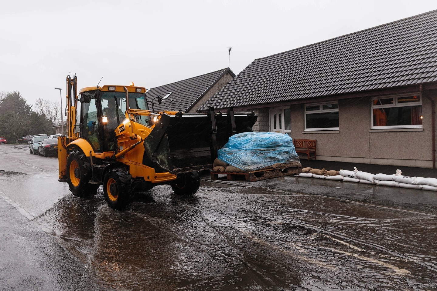
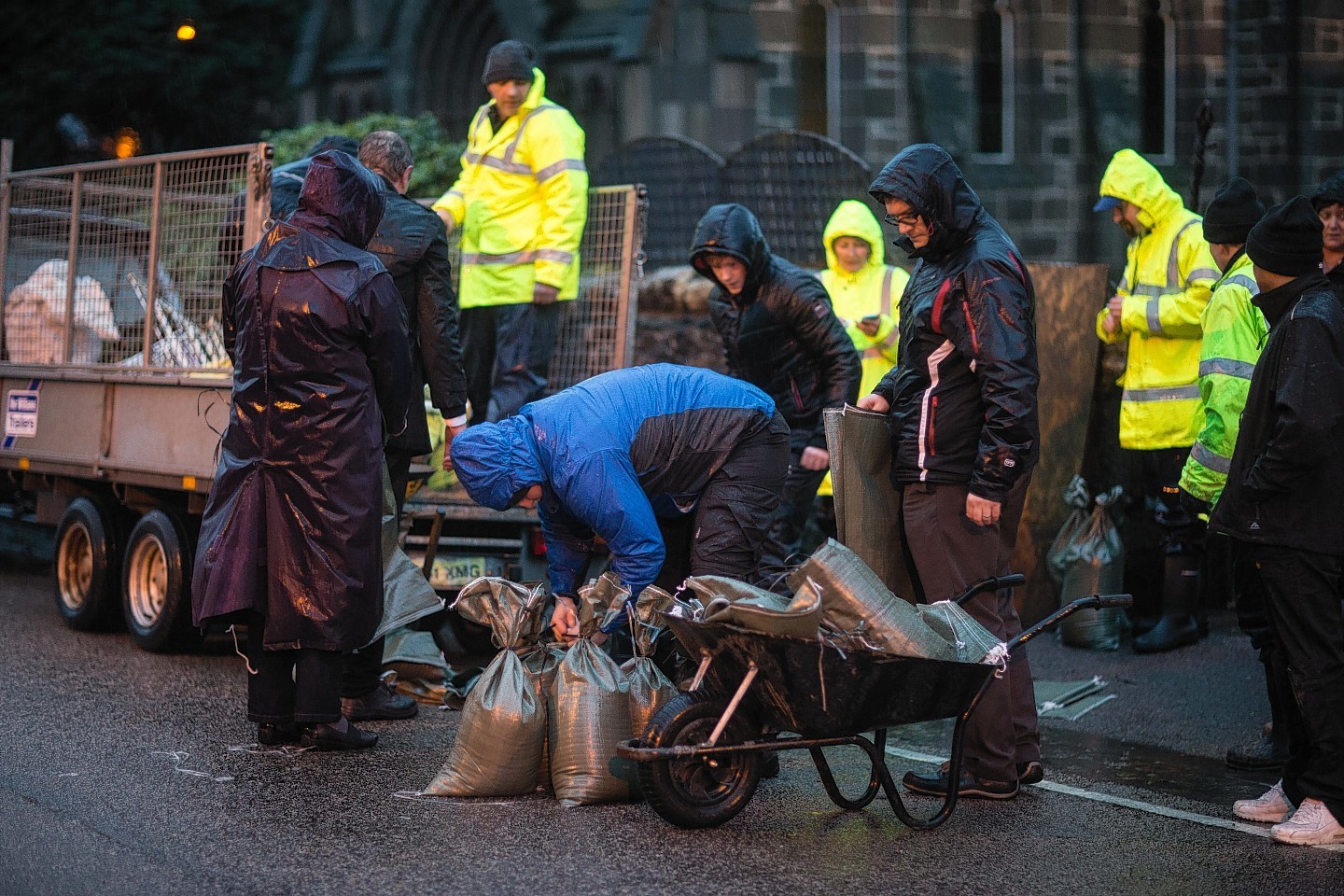
Sandbags are being deployed to affected areas for collection.
People are advised to stay away from flood water and not to take unnecessary risks.
In line with advice from SEPA and the Met Office the following work is in progress:
The Rivers Don and Ury (affecting Inverurie, Port Elphinstone and Kintore)
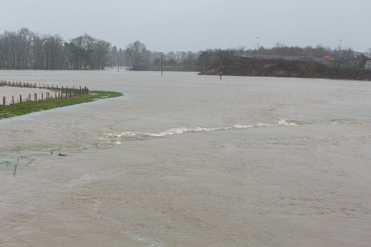
Sepa has issued a severe flood warning for Kintore and Inverurie.
River levels will significantly exceed those experienced in 2002 and 2009 and are not expected to peak until the early hours of Friday morning.
Be aware that flooding impacts will also extend up the River Ury where levels are expected to be the highest in recent history
Extensive flooding is expected to properties and businesses including those in Port Elphinstone, along Old Canal Road, and Inverurie Paper Mill. The Waste Water Treatment Works and railway line will also be significantly affected. Many roads, including the B993, will be impassable in and around Inverurie.
In Kintore extensive flooding is expected to properties and businesses including those in Castle Hill and Kingsfield Road. Many roads, including the B977, will be impassable.
Engineers are inspecting bridges on the Don, as some may have to be closed as a precaution.
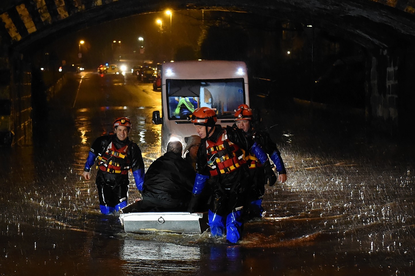
Some evacuations have been advised; please follow any advice provided by the emergency services.
Rest centres have been set up at Inverurie Academy and at Kintore Community Hall.
Conditions in Kemnay are being monitored and teams are ready to respond if required.
The River Deveron (affecting Huntly and Turriff areas)
An evacuation of the Meadows area of Huntly has been instigated in light of information from Sepa and partner agencies. The Emergency Alert Plan has been put into action, leading to the evacuation of the Meadows Care Home.
The Linden Centre has been established as a Rest Centre.
A flood warning has been issued for Turriff. From late Thursday evening, there is a risk of flooding to the golf course, the waste water treatment works and low lying agricultural land adjacent to the River Deveron. There may also be a risk of flooding to low points of the B9025 to the west of the Deveron Bridge. Levels on the River Deveron will continue to rise throughout Thursday night into Friday morning.
Residents likely to be affected have been advised and a rest centre has been established at the Fife Arms Hotel.
Kincardine and Mearns
Flood barriers have been deployed in Stonehaven and Mackie Academy has been opened as a Rest Centre. Flooding is expected at Low Wood Road and on Carron Terrace, with a number of properties likely to be affected.
Due to the nature of the river catchment, flooding can take place extremely quickly and with minimal warning.
Sepa predictions indicate the next peak in river levels will be at 2.30am.
Aberdeenshire Council will continue to monitor the situation in Marykirk, Fettercairn and St Cyrus and are ready to respond should conditions worsen.
A Rest Centre has been set up at Marykirk Primary School.
Deeside
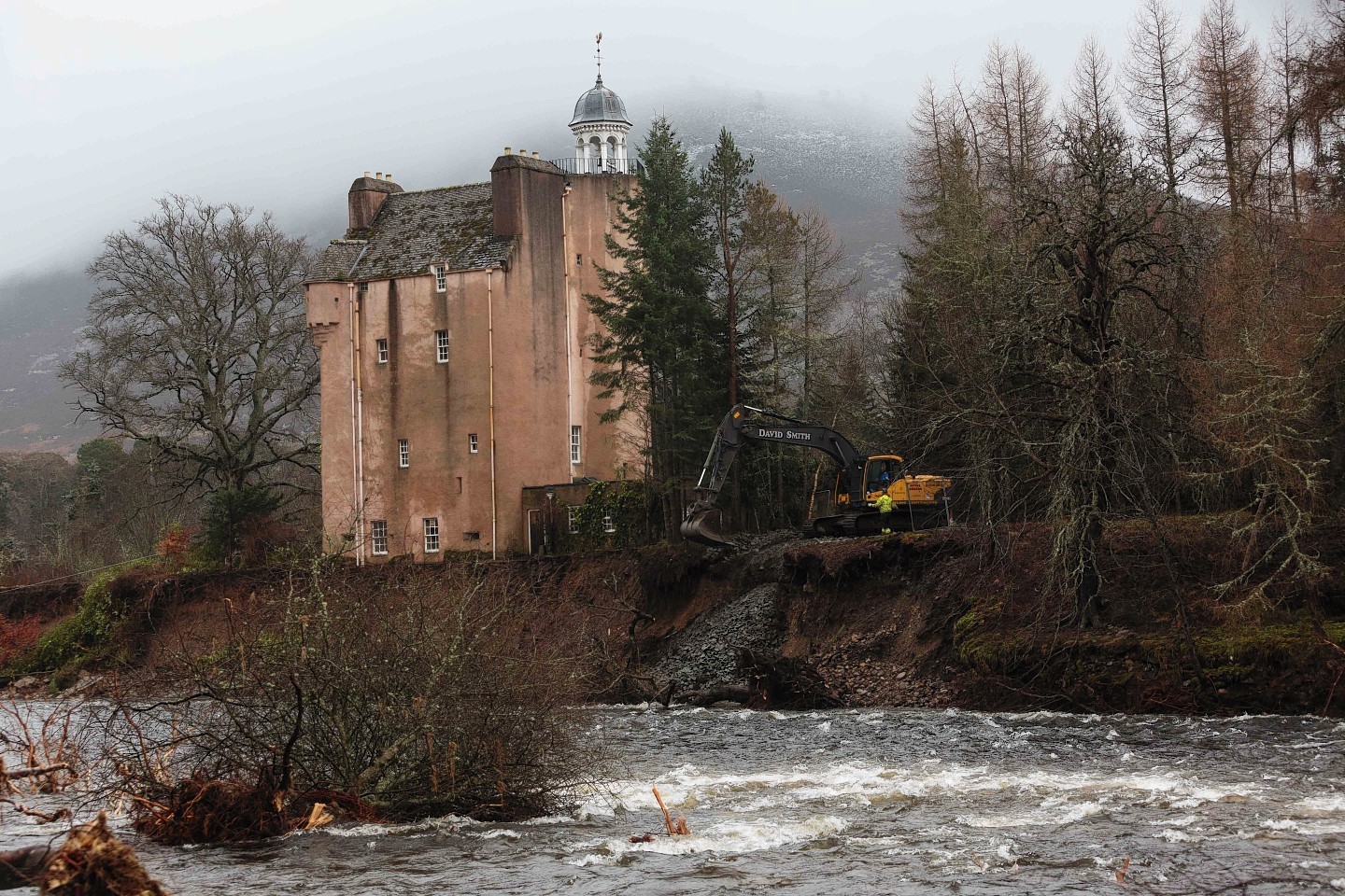
River Dee levels are expected to be higher than those experienced on January 4 with a peak between 6pm and midnight.
Seven more homes have been hit by flooding in Ballater above those affected earlier in the week. An updated flood warning has been issued for the town. There have been reports of flooding to the lower end of Dee Street and water ingress onto the golf course.
Some river banks have been damaged during Storm Frank and may allow flooding at lower levels than in normal circumstances.
Aberdeenshire Council continues to work in the area to reduce further impacts from river flooding after the damage experienced on December 30.
A flood warning has been issued for Aboyne. There is a risk of flooding to low lying properties around river banks including Low Road.
This is a result of the heavy persistent rain across the area, increased impacts from ground saturation and surface water and smaller watercourses including the Tarland Burn.
The A980 bridge at Lumphanan is being closed due to structural concerns.
Conditions around Maryculter Bridge are being monitored and it is likely it may also have to close.
Road/bridge closures
Many roads are only passable with care and a significant number have been closed due to flooding, structural damage and landslips.
Trunk routes
In addition to very difficult conditions caused by standing water on the A96 and A90 north of Aberdeen, the A90 has been reduced to one lane each way at Stracathro and is severely flooded at Brechin.
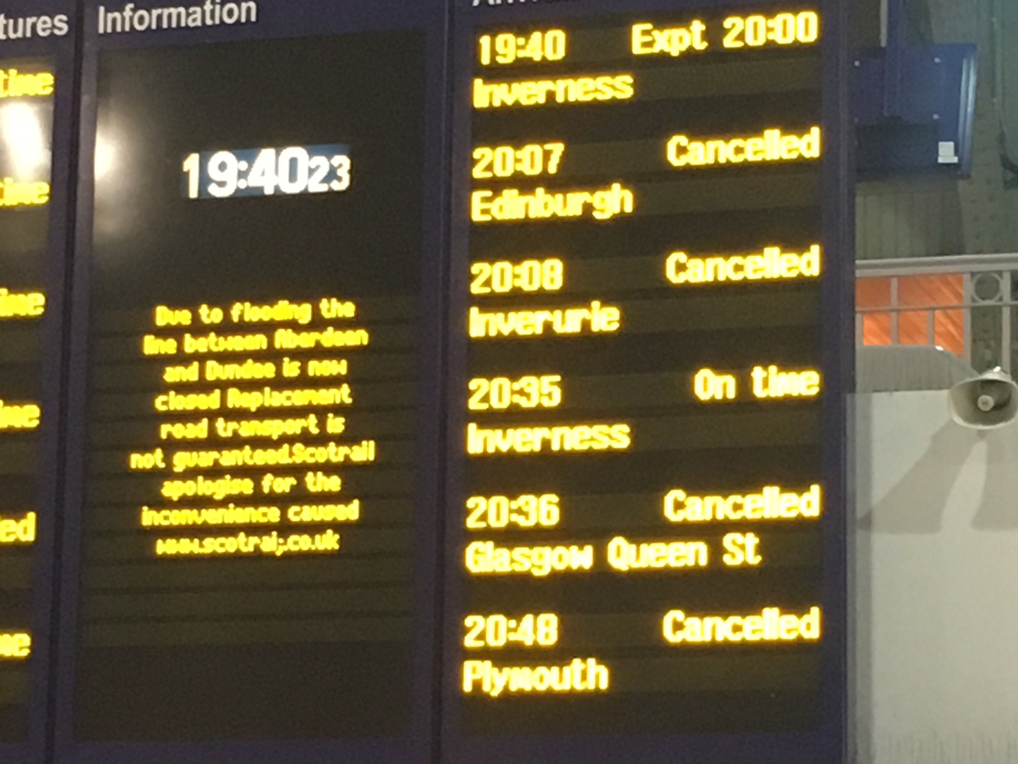
Railways
Railway lines are currently impassable between Aberdeen and Dundee, Aberdeen and Inverurie and Aberdeen and Inverness.
Appeal for volunteers
Aberdeenshire Council is requesting any employees who are able to help in Kintore or Inverurie areas this evening to emailbanffandbuchanamo@aberdeenshire.gov.uk
Anyone being affected by flooding should contact the emergency services on 999.