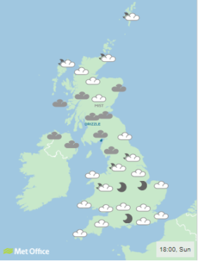
Despite a relatively mild festive period, residents across the Grampian, Highland and Island regions will need to brace themselves for severe wind today and tomorrow.
The weather is to be so extreme that forecasters have warned that there is a risk of some homes losing power.
The first yellow warning of 2019 was issued by the Met Office yesterday for regions across the country.
Currently the warning is in place from 9am today until 6am on Tuesday morning.
On Saturday night, the mercury dropped to -6.3C in Balmoral, Aberdeenshire, and similar temperatures are expected to be a feature of the north-east for the remainder of the week.
Less than ten miles from Balmoral, the coldest night of the entire winter period was recorded – with a -10.5 C reading for Braemar on January 2.
Forecasters have warned that temperatures could drop in the region, with bitter wind chills lowering the temperature.
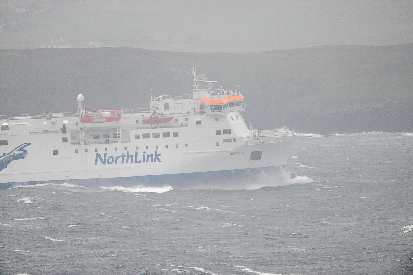
Across the Grampians and Highlands, and particular for those on islands, commuters are being warned that ferry transport may be delayed, or even cancelled, due to the winds.
Northlink ferries have said their Lerwick to Aberdeen service, due to depart at 7pm this evening has a “high possibility of cancellation”.
Scotland’s coastline sea fronts and coastal communities will likely be affected by spray and large waves.
A Met Office spokesman told the Press and Journal that: “Wind is going to be the most noticeable thing on Monday and Tuesday.
“That being said, particularly in the north-east, the temperatures will be quite high in the morning.
*Advance Warning of Disruptions*
Mon 7th January 2019
Southbound Sailing
MV Hrossey sched to depart Lerwick sailing for Aberdeen 1900
Due to change in forecasts sailing is now under review with high possibility of cancellation
Update tomorrow morninghttps://t.co/xs7xfl33mW
— NorthLink Ferries (@NLFerries) January 6, 2019
“However as the wind increases it will suddenly feel a lot colder in the evening.
“Blustery showers and gale force winds will roll in – there will easily winds of up to 65mph winds across Grampian and the Highlands, leading to some tricky evening commuting.
“The Western Isles will also see some strong wind.”
In addition, rail, air and road delays are also expected.
In the case the colder temperatures caused by high winds lead to snow, BEAR Scotland have 120 vehicles on hand.
The transport company had 24 gritters out in the north-east alone on Saturday including ‘Plougher O’Scotland’ on the A90 between Dundee and Aberdeen.
Iain Murray, BEAR Scotland’s managing director, said: “While we remain as committed as ever to doing as much as possible to keep routes passable during inclement weather we are keen to remind members of the public to ensure their vehicles are well maintained and that they pay close attention to local and national media and online information to help plan journeys and be prepared should conditions deteriorate.”
A spokesman from the Scottish Fire Service added: “Take care on the roads, be aware of debris and check public transport before travelling.”