Calendar An icon of a desk calendar. Cancel An icon of a circle with a diagonal line across. Caret An icon of a block arrow pointing to the right. Email An icon of a paper envelope. Facebook An icon of the Facebook "f" mark. Google An icon of the Google "G" mark. Linked In An icon of the Linked In "in" mark. Logout An icon representing logout. Profile An icon that resembles human head and shoulders. Telephone An icon of a traditional telephone receiver. Tick An icon of a tick mark. Is Public An icon of a human eye and eyelashes. Is Not Public An icon of a human eye and eyelashes with a diagonal line through it. Pause Icon A two-lined pause icon for stopping interactions. Quote Mark A opening quote mark. Quote Mark A closing quote mark. Arrow An icon of an arrow. Folder An icon of a paper folder. Breaking An icon of an exclamation mark on a circular background. Camera An icon of a digital camera. Caret An icon of a caret arrow. Clock An icon of a clock face. Close An icon of the an X shape. Close Icon An icon used to represent where to interact to collapse or dismiss a component Comment An icon of a speech bubble. Comments An icon of a speech bubble, denoting user comments. Comments An icon of a speech bubble, denoting user comments. Ellipsis An icon of 3 horizontal dots. Envelope An icon of a paper envelope. Facebook An icon of a facebook f logo. Camera An icon of a digital camera. Home An icon of a house. Instagram An icon of the Instagram logo. LinkedIn An icon of the LinkedIn logo. Magnifying Glass An icon of a magnifying glass. Search Icon A magnifying glass icon that is used to represent the function of searching. Menu An icon of 3 horizontal lines. Hamburger Menu Icon An icon used to represent a collapsed menu. Next An icon of an arrow pointing to the right. Notice An explanation mark centred inside a circle. Previous An icon of an arrow pointing to the left. Rating An icon of a star. Tag An icon of a tag. Twitter An icon of the Twitter logo. Video Camera An icon of a video camera shape. Speech Bubble Icon A icon displaying a speech bubble WhatsApp An icon of the WhatsApp logo. Information An icon of an information logo. Plus A mathematical 'plus' symbol. Duration An icon indicating Time. Success Tick An icon of a green tick. Success Tick Timeout An icon of a greyed out success tick. Loading Spinner An icon of a loading spinner. Facebook Messenger An icon of the facebook messenger app logo. Facebook An icon of a facebook f logo. Facebook Messenger An icon of the Twitter app logo. LinkedIn An icon of the LinkedIn logo. WhatsApp Messenger An icon of the Whatsapp messenger app logo. Email An icon of an mail envelope. Copy link A decentered black square over a white square.

Schools closed and warning over coastal flooding as Storm Brendan heads for the north and north-east

Schools in the Western Isles are all closed today with gales of up to 100mph poised to batter parts of the north and north-east well into Wednesday.

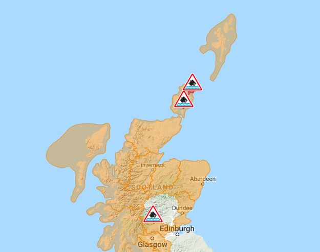
The Met Office has issued a yellow warning to coastal routes and communities which could be particularly badly affected by the impact of Storm Brendan as large waves batter seafronts.

Many parts of the north and north-east will feel the blistering winds from noon today to midnight.

Met Office forecaster Marco Petagna said the Cairngorms could witness winds of up to 100mph – and they could be even higher on the mountain tops.

The Western Isles is expected to experience gusts of up to 80mph and a flood alert has been issued with officials admitting there is a risk of “significant coastal flooding” in some places.

A number of public services will be affected, including the Bràighe which will be shut around today’s high tides at 8am and at 9pm due to high waves and strong southerly to southwesterly winds.

The council said: “There is a risk of significant coastal flooding on Monday and Tuesday.”

The ferry and bus services in the Western isles are likely to be disrupted and the public has been advised to avoid any journeys unless absolutely necessary.

Mr Petagna added: “Aberdeen will see up to 50mph to 60mph winds and it will be a little bit higher in the suburbs.

“The Highlands will feel some fairly windy gales developing which will be coming in from the west.”

The weather warning is in place until tomorrow midnight, but some gales are expected again on Wednesday morning and afternoon.

The yellow weather warnings are also in place for Northern Ireland and much of the western half of the UK.

Frank Saunders, of the Met Office, added that the other parts of the UK and Ireland will turn increasingly windy as the storm sweeps in.

Looking ahead to the rest of the week, he said: “It is going to stay very unsettled and there is the potential for further disruptive weather in places.”