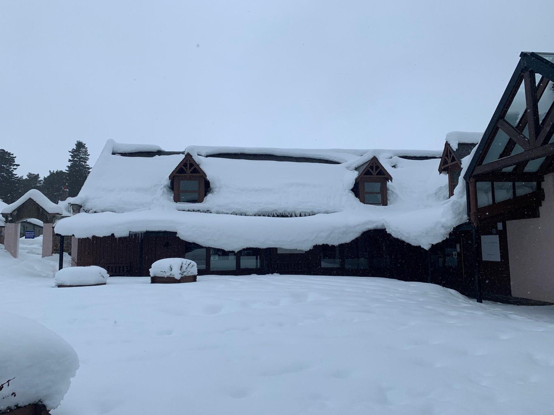
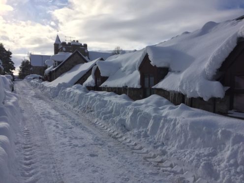
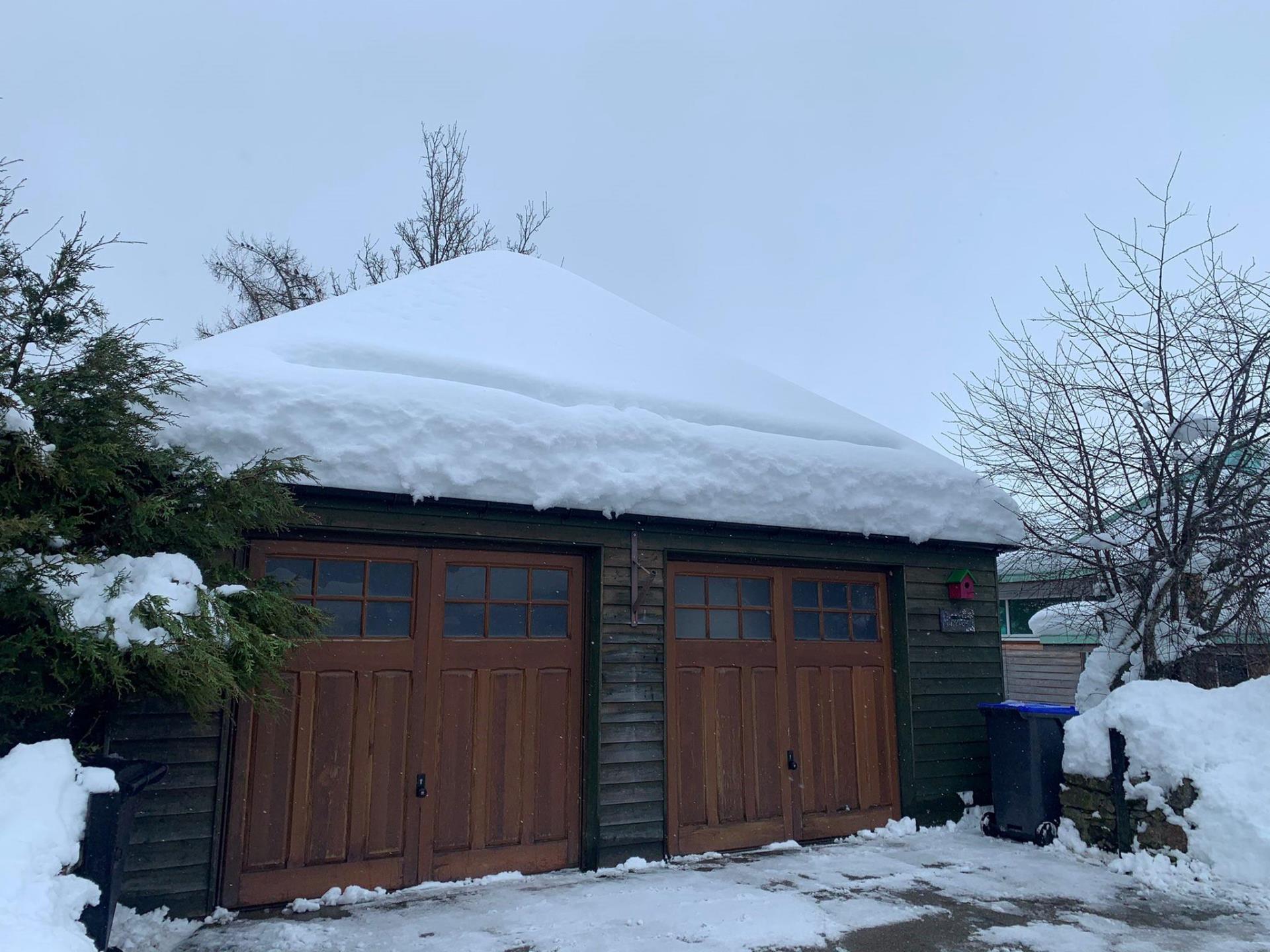
Snow levels in Braemar have now reached more than 2ft – breaking all previous local records.
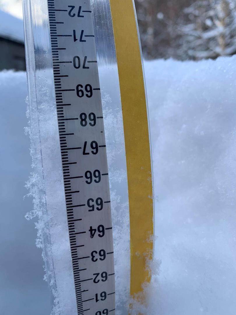
Keen weather watcher Chris Booth has measured 27.5ins (70cms) of snow in the Deeside village, which would exceed an unofficial record of 26.7ins (68cm) from 20 years ago.
Mr Booth, who has been documenting the snowfall in the area for numerous years, said temperatures dropped to as low as -14c in the area last night.
He said: “This is the worst I have ever seen it.
“I know everybody talks about 2010 but this dwarfs 2010 by quite a bit. It is just the sheer amount of snow.
“It doesn’t really snow much during the day, all the snow is coming in at night.
“I live in Banchory and I have driven through over a foot of snow to get to work.
“It has just been absolutely crazy.”
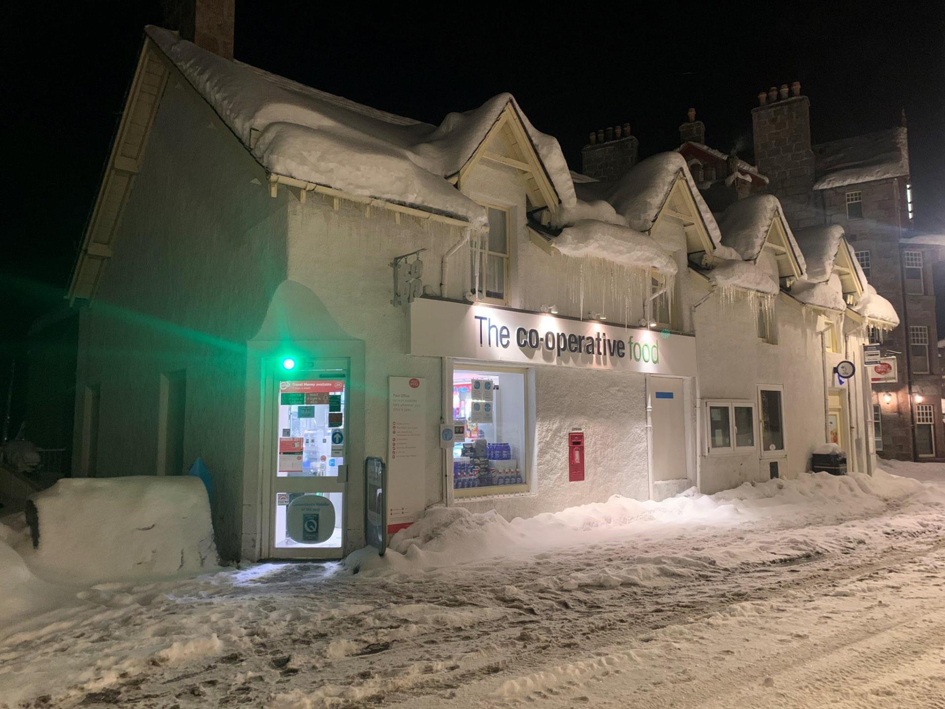
Mr Booth, who is the team manager at Braemar Coop, said that that the difference in weather been his home and work is unbelievable.
He continued: “Driving from Banchory up to the top of the Craigendarroch, the roads are completely fine, then you turn the corner and it just goes from three, four, five inches to 20 inches.
“I have got stuck once. I got stuck on the Craigendarroch hill for about an hour. I have got extra stuff in the car just in case, but so far I have been OK.
“I don’t really know what has happened until I leave Banchory and get up to Ballater.”
Mr Booth has been sharing his pictures and measurements on social media.
“I have always been quite fixated on the weather, especially British weather,” he added.
“I don’t know why – it is just something I have a massive interest in.
“Especially up here because you can have nothing to then two-feet of snow in a couple of days.
“You always think are the forecasts going to be right this time, but I think this has perhaps exceeded forecasters expectations with just the amount of snow there is.”
No official records in Braemar
The Met Office does not have an official snow depth observation site in Braemar to compare Mr Booth’s measurement against.
However, the forecaster said the nearest site is Aboyne where 11ins (29cm) of snowfall has been recorded.
The nearest manual recording site at Fettercairn has also recorded 11ins.
The deepest snowdepth recorded in Scotland for February dates back to 1963, where an incredible 91cm fell in Whitchester in Berwick on February 17.
Weather warning extended
A yellow weather warning for snow along the east coast and through Orkney and Shetland is currently in place, however, the Met Office has warned that further disruption and delays are expected as snow and ice are to continue throughout Thursday and Friday.
The current weather warning was due to expire on Wednesday evening, however, forecasters are anticipating further snowy and icy weather to come.
Wrap up warmly if you're heading out on an essential journey this afternoon 🧣
Not only will there be further ❄️ #snow showers in places, but the 🌬️ wind will make it feel well below freezing 📉 for everyone
Stay #WeatherAware pic.twitter.com/ouODYQI188
— Met Office (@metoffice) February 9, 2021
What to expect for coming days?
Nicola Maxey, of the Met Office, has said despite weather warnings for the days ahead, the temperature is expected to rise by the weekend.
She said: “Keep an eye on the forecast because this is where weather conditions can change quickly.
“We have got a showery picture for today but you only need a couple of those showers to band together in a sense and you have a period of prolonged snowfall and then you start seeing snow depth increasing again and the accumulations building up.
“The risk of seeing some snow will continue through today and tomorrow.
“It is more showery and as we get to the end of tomorrow that kind of eases up a little bit but we are still at risk, particularly down that east side of Scotland where we are seeing this continued risk of snow.
“You could see 2-5cms (0.7-1.9ins) building up today and tomorrow.”
She continued: “What we will start to see as we go towards the weekend is a change in type.
“At the moment we have got cold air that is coming in from the east and that is bringing this bitterly cold air from Russia and Eastern Europe and crossing the North Sea, picking up some mositure.
“As it hits the land, it falls as snow, bringing this risk of snow anywhere down the east but also these cold easterly winds.
“As we go through the end of the week, we have got a low pressure system building in the Atlantic which is going to start pushing less cold air into the south-west of England and that will slowly push across the country.
“There is a lot of uncertainty at the moment in terms of how quickly that will move across but certainly as we head towards the end of the weekend we will be in more southerly airflow.
“The easterly wind is making it feel like -2c or -3c in areas just above freezing, but by the time we get to Sunday, the temperature will be around 5c to 6c but feel 5c to 6c because you are losing that easterly wind chill.”