Councillors have criticised plans to protect communities across Aberdeenshire from flooding – as they fail to take into account those struck by Storm Frank.
Local members of the Garioch area committee were yesterday asked to back Aberdeenshire Council’s £825,000 flood management and coast protection measures for the next year.
But councillors said they felt those who were worst affected by the storms which battered the north-east at the beginning of the year had not been considered.
The only proposed work put before the committee yesterday for the Garioch area was proposals to spend £4,500 to stop flooding at the Brodiach Burn near Westhill.
Members have now called for a revised paper to appear before them to take into account issues facing Garioch’s towns and villages following Storm Frank.
West Garioch councillor, Sheena Lonchay, said Kemnay “should have been included” within the Scottish Environment Protection Agency’s (Sepa’s) flood risk management strategy, which sets out the requirement for the programme.
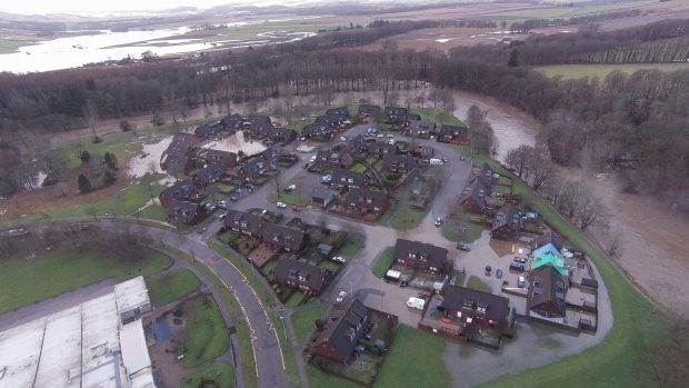
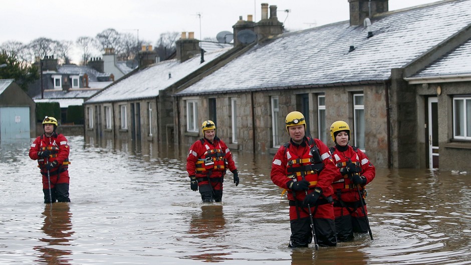
According to council figures there were 47 houses in Kemnay affected by flooding when the River Don burst its banks in January – with water also overflowing from drains and sewers.
In Inverurie and Port Elphinstone 94 houses and 14 businesses were hit by water along with 36 homes in Kintore.
The programme before councillors outlined work to improve existing flood and coastal defences in order to protect properties, following inspections last year.
However, Mrs Lonchay said the figure for flooded homes in Kemnay was, in reality, nearer 62.

Mrs Lonchay added: “In Kemnay there has been significant surface water problems going on for probably the last decade. Sepa should have known about it but appears not to have known.”
She added the village “has to be included” in the programme of work in order to bring “comfort to the people of Kemnay”.
Aberdeenshire provost and Inverurie and District councillor, Hamish Vernal, said he was “concerned” the paper was coming before them just days before being discussed by the council’s infrastructure services committee.
He added: “I don’t think we should be approving these without reference to that overall flood event.”
Acting chairman of the committee, Martin Ford, said the recent floods “clearly have changed things”.
The committee called for a revised paper with a “full report” which included mention of issues being faced across the Garioch area.
A Sepa spokesman said Kemnay had not been deemed to be a “potentially vulnerable area” – but that may soon change.
Aberdeenshire Council is in discussions with Sepa as to why Kemnay was not deemed vulnerable to flooding prior to the floods which followed Storm Frank.
Garioch area manager Douglas Milne, yesterday told councillors: “Kemnay, as you know, wasn’t identified as a potentially vulnerable area or it wasn’t when Sepa carried out the national flood risk assessment.
“We are in discussions with Sepa and Scottish Water around this because of what happened in January.”
A Sepa spokesman said: “Parts of Kemnay and the surrounding area were identified to be at risk of flooding, however it was not considered to be a PVA (potentially vulnerable area) because the level of risk was below the threshold set for a nationally significant risk.
“This decision was taken based on the best information available at that time, including flood maps and historical flood data held for the area.
He added more recent flood maps should Kemnay has a “greater risk of flooding than originally assessed”.
He said: “There is a high probability that Kemnay will be classed as a PVA under the new assessment.
“It is important to note that the north-east flood risk management strategy does identify actions to manage flood risk which apply everywhere where there is a risk of flooding.”