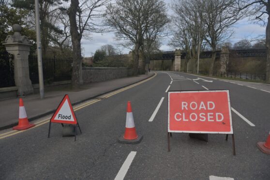
The rain has been lashing down in Inverness this week, but at least we can be thankful it’s nowhere near as bad as this was.
Back on February 7, 1989, the heavens opened in the Highland capital.
More rain fell in a 24-hour period than had done in the previous month entirely.
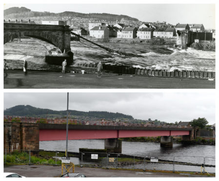
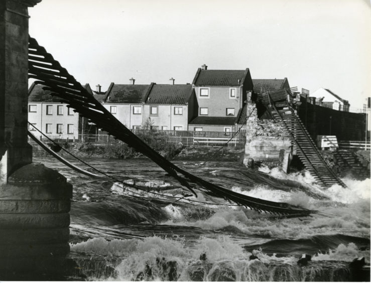
The result was a ferocious flood that washed away an apparently sturdy stone rail bridge that crossed the River Ness.
As we reported on February 8, the central parapet and two 73ft spans of the 127-year-old Ness viaduct simply vanished into the torrent, with a roar and a massive surge of water.
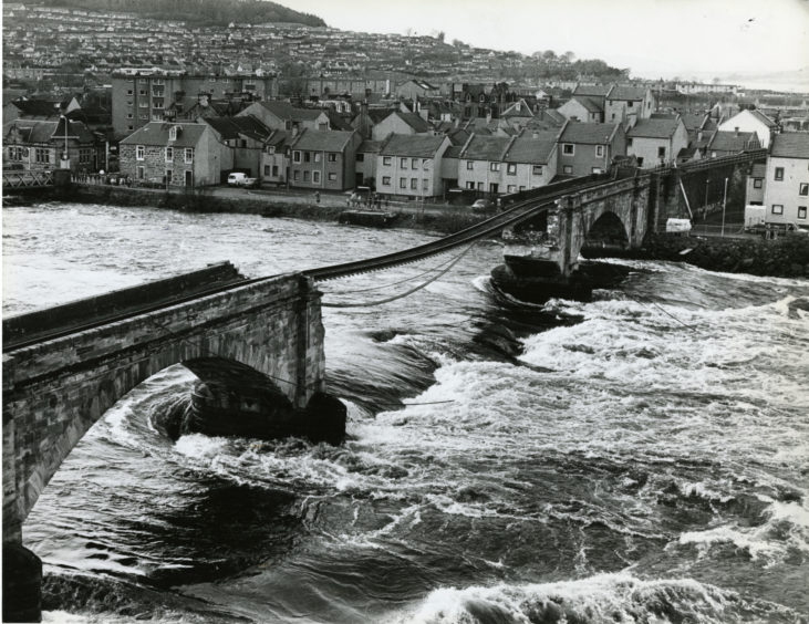
That happened at 8.30am. By 6.30pm, crowds had gathered to witness the devastation as a further span and parapet crashed into the river.
Around 9pm, with the area still crowded and cars parked solidly on nearby streets, two further sections of the bridge gave way.
Just before 10pm, the rail line itself – which had dropped forlornly since the early morning collapse – fell too.
It was a dramatic, stunning and unexpected destruction. How such huge sections of masonry could vanish so quickly and without warning was alarming.
But at the same time, there was great relief that there was no loss of life.
Eye-witness to Ness viaduct collapse
The north rail line was not the busiest of routes, although an Invergordon-bound freight train made the crossing 30 minutes before the collapse, as well as a 6.40am passenger train.
Eye-witness Brian Kay was one of the first people to raise the alarm.
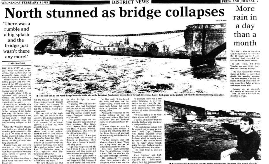
The then 32-year-old VDU operator with McGruther and Marshall told The Press and Journal: “I was looking out the window of the office when the centre of the bridge went down like a pack of cards.
“There was a rumble and a huge splash and the bridge just wasn’t there any more.”
Inverness harbourmaster, Captain Derrick Gilmour, said at the time that low tide may have contributed to the bridge’s demise.
He explained: “I estimate there was a two-metre difference in level between the river and the harbour, causing a waterfall effect, and accelerating the huge amount of water coming down the Ness.
“It would take a lot to withstand a force such as that.”
Cut off from the rest of Scotland
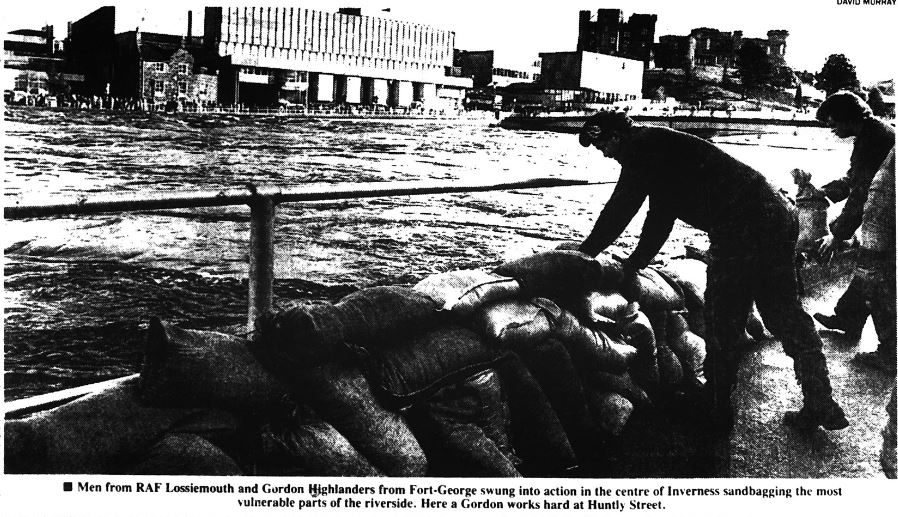
An emergency team, comprising 76 Gordon Highlanders and 37 RAF servicemen from Kinloss, was drafted in to carry out a massive sandbagging operation.
Nearly 20,000 sandbags were used – with a further 50,000 in reserve – along the river banks and in riverside doorways.
The result of the floods was a difficult 15 month period where all rail services north of Inverness were cut off from the rest of the country.
Scotrail incurred significant extra cost to keep the 270 miles of track north of Inverness operating.
Rolling stock and locomotives were transported across the river by road and a temporary maintenance depot was built in Muir of Ord.
Train passengers were taken by bus between Inverness and Dingwall, where they would then hop back on.
In the aftermath, there was speculation that the collapse could deal a fatal blow to the future of the Wick/Thurso and Kyle of Lochalsh lines. Their closures had been heavily rumoured in the years leading up to the disaster.
Sir Russell Johnston, MP for Inverness, Nairn and Lochaber, called for a financial commitment from the UK Government for the bridge to be rebuilt and John Ellis, Scotrail’s general manager, eased Highlanders’ worries with an assurance that it would be.
There had been plenty of scare stories in the wake of the collapse too.
Mr Ellis eased these somewhat by confirming the bridge had undergone a full underwater inspection in November 1987 and another 18 months prior in April 1986.
He blamed the collapse on the “totally exceptional circumstances”.
Many have disputed the need for such a scheme but a quick look back at the history books will point to what could happen without it.
Ultimately, the new bridge opened on May 9, 1990 at a cost of £3.4 million. At the time, experts estimated it would last for around 125 years.
Early warning, get May 9, 2115 marked in your diary if it hasn’t been replaced by then!