Calendar An icon of a desk calendar. Cancel An icon of a circle with a diagonal line across. Caret An icon of a block arrow pointing to the right. Email An icon of a paper envelope. Facebook An icon of the Facebook "f" mark. Google An icon of the Google "G" mark. Linked In An icon of the Linked In "in" mark. Logout An icon representing logout. Profile An icon that resembles human head and shoulders. Telephone An icon of a traditional telephone receiver. Tick An icon of a tick mark. Is Public An icon of a human eye and eyelashes. Is Not Public An icon of a human eye and eyelashes with a diagonal line through it. Pause Icon A two-lined pause icon for stopping interactions. Quote Mark A opening quote mark. Quote Mark A closing quote mark. Arrow An icon of an arrow. Folder An icon of a paper folder. Breaking An icon of an exclamation mark on a circular background. Camera An icon of a digital camera. Caret An icon of a caret arrow. Clock An icon of a clock face. Close An icon of the an X shape. Close Icon An icon used to represent where to interact to collapse or dismiss a component Comment An icon of a speech bubble. Comments An icon of a speech bubble, denoting user comments. Comments An icon of a speech bubble, denoting user comments. Ellipsis An icon of 3 horizontal dots. Envelope An icon of a paper envelope. Facebook An icon of a facebook f logo. Camera An icon of a digital camera. Home An icon of a house. Instagram An icon of the Instagram logo. LinkedIn An icon of the LinkedIn logo. Magnifying Glass An icon of a magnifying glass. Search Icon A magnifying glass icon that is used to represent the function of searching. Menu An icon of 3 horizontal lines. Hamburger Menu Icon An icon used to represent a collapsed menu. Next An icon of an arrow pointing to the right. Notice An explanation mark centred inside a circle. Previous An icon of an arrow pointing to the left. Rating An icon of a star. Tag An icon of a tag. Twitter An icon of the Twitter logo. Video Camera An icon of a video camera shape. Speech Bubble Icon A icon displaying a speech bubble WhatsApp An icon of the WhatsApp logo. Information An icon of an information logo. Plus A mathematical 'plus' symbol. Duration An icon indicating Time. Success Tick An icon of a green tick. Success Tick Timeout An icon of a greyed out success tick. Loading Spinner An icon of a loading spinner. Facebook Messenger An icon of the facebook messenger app logo. Facebook An icon of a facebook f logo. Facebook Messenger An icon of the Twitter app logo. LinkedIn An icon of the LinkedIn logo. WhatsApp Messenger An icon of the Whatsapp messenger app logo. Email An icon of an mail envelope. Copy link A decentered black square over a white square.

Reduced speed limits on Churchill Barrier following deterioration

Churchill Barrier number one between Lamb Holm and Mainland

Inspections have found deterioration on the road surface on one of Orkney’s Churchill Barriers.

The discovery has prompted a 40mph limit to be introduced from next week on the first barrier linking Lamb Holm and the Orkney Mainland.

A detailed 3D scan of the barrier is also due to be carried out later this month to assess for further damage.

Darren Richardson, Orkney Islands Council’s head of infrastructure, said: “We carry out regular road surface condition inspections every three months as part of the council’s roads management maintenance plan.

“For some time, we have been planning a specialised survey of the first barrier, which will produce a detailed 3D picture of the road surface. This is due to be carried out later this month.

“In preparation for the 3D survey, we recently undertook an additional and detailed visual inspection. From this we could see that there has been a progressive and recent deterioration of the road surface on part of the barrier.

“The level of deterioration is such that we need to ask drivers to take greater care when crossing the causeway.

“As a result, we have taken the operational decision to introduce an advisory speed limit of 40mph on the first barrier. We will be putting up signs next week that advise drivers to keep to this speed limit and be aware of the uneven road surface.”

Information from the 3D survey will be used to draw-up options to address the problems.

Lane closures will be needed while the 3D survey is taking place.

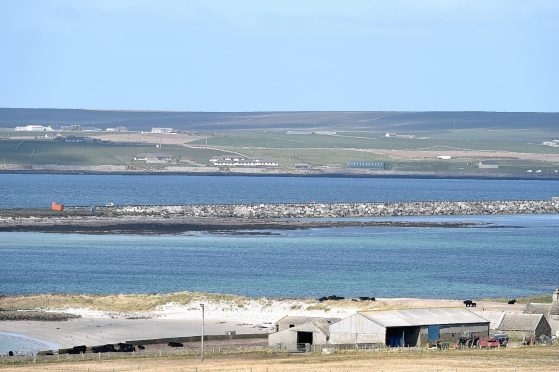
The barriers are a series of causeways which were built in the 1940s to protect ships anchored in Scapa Flow after a German U-boat was able to enter the harbour and sink the HMS Royal Oak.

Now they carry the A861 road from Kirkwall to Burwick on South Ronaldsay.