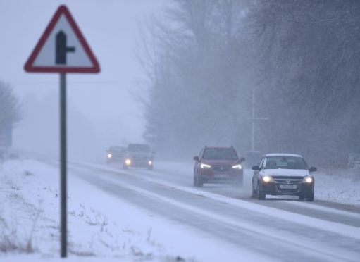
The north and north-east are forecast to be hit by more snowfall as Scotland prepares for what could be the coldest night of the winter so far.
Forecasters have warned that lows of -15C could grip the country overnight into Friday, marking the chilliest night since February 2019, as the frozen spell endures.
Two Met Office yellow warnings are coming into force from Thursday into Friday with up to 4in of snow possible in places.
On Thursday the forecaster warned of travel disruption ahead of further wintry showers, with icy road conditions expected to continue.
One of the severe snow and ice warnings, which covers the whole of Aberdeen and Aberdeenshire will be in place from 3pm on Thursday until midnight.
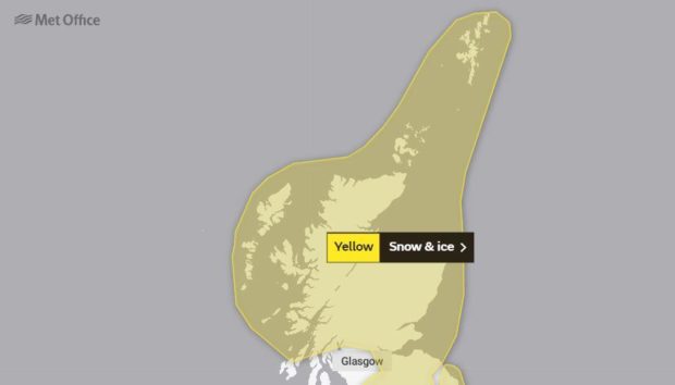
Another will take hold from midnight until noon on Friday and encompass the north-east and much of the wider east coast. It warns of “heavy snow showers” across the affected area.
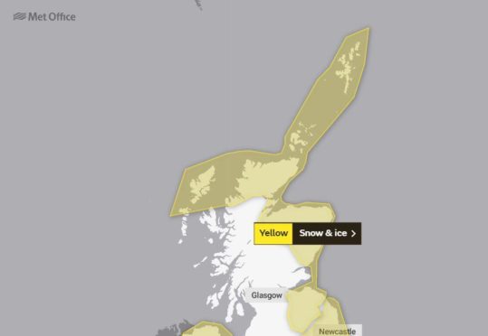
Met Office spokesman Oli Claydon said: “The (snow and ice) warning is taking in the north of Scotland and down the east coast into the south-east of Scotland from midnight into 12pm on Friday morning.
“That is really down to some showers that will be feeding in that could see snow even down to low levels.
“The warning is for 2-5cm (0.8in-1.9in) of snow quite widely in that area and up to 10cm (3.9in) on a few places above 150m (492ft). This is more likely for the north.
“Showers feeding in from the north are likely to fall as snow. Even where they fall as rain we are likely to see a risk of ice.
“Things are looking drier after some showers clear in the morning. It is drying out through the day.
“There are still some cold nights ahead though.”
Cold night ahead
He added as Friday’s weather front clears to the south-east of Scotland there could be “lows down possibly as low as -15C”.
He added: “It is a cold night ahead.”
Mr Claydon said slightly milder conditions will arrive at the weekend and into next week, but added: “There will still be snow over the hills – predominately over the Highlands.
“The rest will probably land more as rain. Gradually the temperatures start to increase as well.”
Tuesday was the coldest night of the winter season so far with the mercury plunging to -12.3C at Loch Glascarnoch in the Highlands. Temperatures hadn’t been this low in Scotland since February 3 2019.
The lowest minimum temperature of 2020 was the -10.2C recorded at Dalwhinnie on December 30.
Is a ‘big freeze’ on the way?
This week’s biting weather has fuelled speculation of another big freeze in Scotland similar to the Beast from the East in 2018.
Mr Claydon said a sudden stratospheric warming event has taken place; however, forecasters are still unsure if it will lead to an enduring cold spell.
He said: “What has caused people to get a bit excited is the sudden stratospheric warming event, which is what caused the so-called Beast from the East in 2018.”
He added that the outcome is “uncertain”, and that such events do not always lead to long spells of cold weather.
Mr Claydon said: “That has happened but what that means is uncertain. In 2019 we had a sudden stratospheric warming event and saw record mild temperatures. It might be too far ahead to say at the moment.
“We know that a sudden stratospheric warming event has happened. It can be two to three weeks or so to see any impact on the surface.”
However, he added there is an “increasing likelihood of cold conditions”.