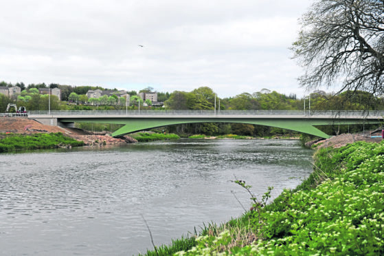
Plans have been unveiled showing potential new transport links across Aberdeen – including another new bridge over the River Don.
Nine options have been drawn up as part of a study examining how to connect new and existing areas of the city.
Areas in line for major development, such as Blackdog – where more than 500 homes are planned – and Countesswells are included in the project, which aims to provide direct links and encourage people to leave the car at home in favour of public transport.
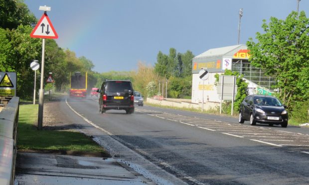
The options include a new ring-road linking Blackdog, Dyce Rail Station, Kirkhill Industrial Estate, Craibstone Park and Ride and Westhill, with a new bridge over the River Don.
Other options include a direct route between Dubford and Grandhome with a new bridge over the river, and another links the park and ride services at Craibstone, Kingswells and Countesswells with a potential extension to Portlethen and Chapelton of Elsick.
A new circular service linking new developments north of the A93 Aberdeen to Banchory road and Dyce railway station is also out for consideration.
Council transport spokesman Ross Grant said: “Officers have looked at the various options for transport connections between new areas of development on the outskirts of Aberdeen and into Aberdeenshire with the aim of providing viable direct linkages and improved accessibility as an alternative to the private car.
>> Keep up to date with the latest news with The P&J newsletter
“The options also examine the advantages and disadvantages of each option for residents, people who work in the area and visitors, and it’s really important we get feedback from the public, as it really helps to assess the final options put forward.
“Investing in cross city connections ensures that our newly developed areas are best and most effectively connected, through improved connections, better public transport and incentives for active travel.
“I’d encourage people, and particularly those who live and work in the new areas of development on the periphery of Aberdeen, and in areas of Aberdeenshire close to Aberdeen City boundary, to go online to the council website to view the options and give their feedback.”
Aberdeen Donside MSP Mark McDonald last night said he hoped that improvements to the city’s public transport network could mean that certain bus routes which have been scrapped are restored.
He said: “It’s important that public transport connectivity evolves alongside the big changes to the road network in the north-east.
“I hope that the options presented, while uncosted, present realistic options which can improve the experience of public transport for people in the city.
“And I hope that they might help communities who have lost connections, or faced difficulty in maintaining connections, to see a more regular service restored.”
Residents’ views were sought in November 2016 for the first phase of the project, and these have been used to shape the study as it progressed. The council now wants feedback on the final set of options, which are still being appraised and costed.
Visit
https://consultation.aberdeencity.gov.uk/planning/aberdeen-cross-city-transport-connections
to take part in the study.
The proposals under consideration are:
- Option A1 – Ring-road linking Blackdog, Dyce Rail Station, Kirkhill Industrial Estate, Craibstone Park and Ride, Kingswells Park and Ride and Westhill with new bridge over the River Don
- Option A2 – As Option A1, but without routeing via Dyce Railway Station with new bridge over the River Don
- Option B1 – As Option A1 but with a direct route between Dubford and Grandhome sites and a new bridge over the River Don, a new public transport only link connecting Grandhome and Dubford
- Option B2 – As Option A2 but without routeing via Dyce Railway Station with a new bridge over the River Don, and a new public transport only link connecting Grandhome and Dubford
- Option C1 – Ring-road linking Craibstone Park and Ride, Kingswells Park and Ride and Countesswells with potential extension to Portlethen Park and Ride and Chapelton of Elsick
- Option C2 – As Option C1 but with direct route between Craibstone Park and Ride and Kingswells Park and Ride via AWPR
- Option D1 – Similar to Option A1 but utilising existing roads without any new infrastructure
- Option D2 – As Option D1 but without routeing via Dyce Railway Station
- Option E1 – New circular service linking development sites north of the A93 with Dyce Railway Station, Craibstone Park and Ride, Kingswells Park and Ride and city centre with new infrastructure over the River Don, and new public transport only link connecting Grandhome and Dubford.