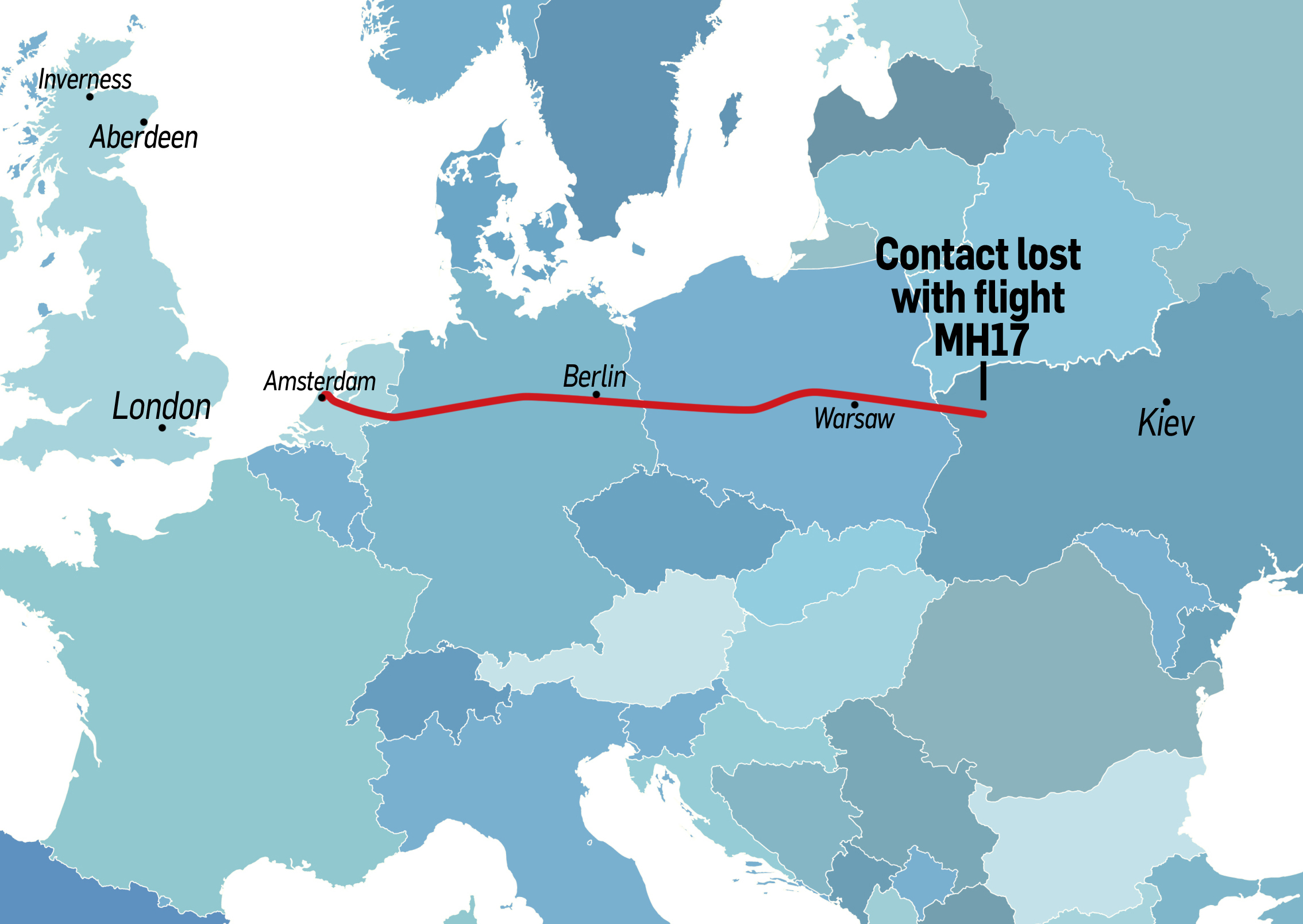
Map shows location all contact was lost with Malaysian plane By Martin Little July 17 2014, 5:29 pm July 17 2014, 5:29 pm Share Map shows location all contact was lost with Malaysian plane Share via Facebook Twitter Whatsapp Messenger Linkedin Email Post link https://www.pressandjournal.co.uk/fp/news/world/289757/map-shows-location-contact-lost-malaysian-plane/ Copy Link A map showing where the aircraft last had contact This map shows the route taken by Malaysia Airlines flight MH17 after it set off from Amsterdam to Kuala Lumpur with 295 people on board. The Boeing 777 passenger airliner is thought to have come down at Torez, near Shakhtersk in Ukraine. Malaysia Airlines has lost contact of MH17 from Amsterdam. The last known position was over Ukrainian airspace. More details to follow. — Malaysia Airlines (@MAS) July 17, 2014 The area – about 25 miles from the Russian border – has been the scene of escalationg tensions between Ukrainian forces and pro-Russian rebels. A Ukrainian official said it was flying at 33,000 feet – a typical cruising altitude for airliners – when it disappeared from radar. A map showing where the aircraft last had contact