Aberdeen was once surrounded by country mansions and farmland, but a move to improve living conditions after the First World War saw new housing estates built on old pastures.
Many inner city tenements were crowded slums, with several families sharing just a few rooms and a communal outdoor toilet.
And after the war, Prime Minster David Lloyd George spoke of a need to provide housing for the soldiers who did return from the trenches, so-called “homes fit for heroes”.
The old buildings were pulled down, and the first of Aberdeen’s new housing was constructed in the lands of Foresterhill, Hazlehead and Powis.
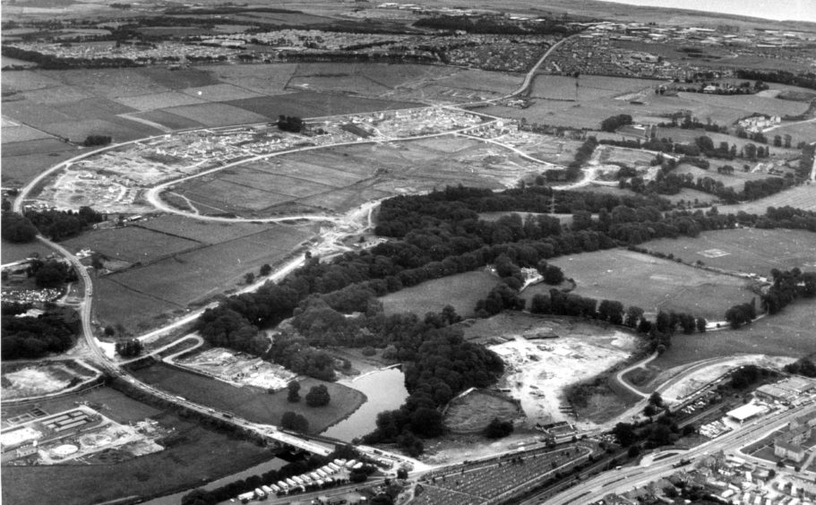
Northfield
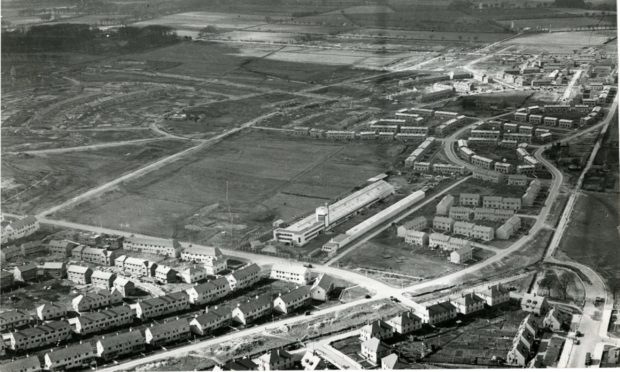
But by the late 1940s there was demand for much more, and a large estate was proposed for land at Northfield, mostly occupied by farm land.
The bottom left of this photo below shows housing under construction on Granitehill Road in 1949.
Homes had already gone up around Marchburn Drive, with streets laid out for the next phase around what is now Byron Avenue.
A pastoral view, the fields beyond look towards the parish of Newhills above Bucksburn.
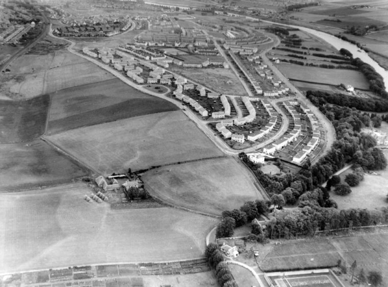
Garthdee and Kaimhill
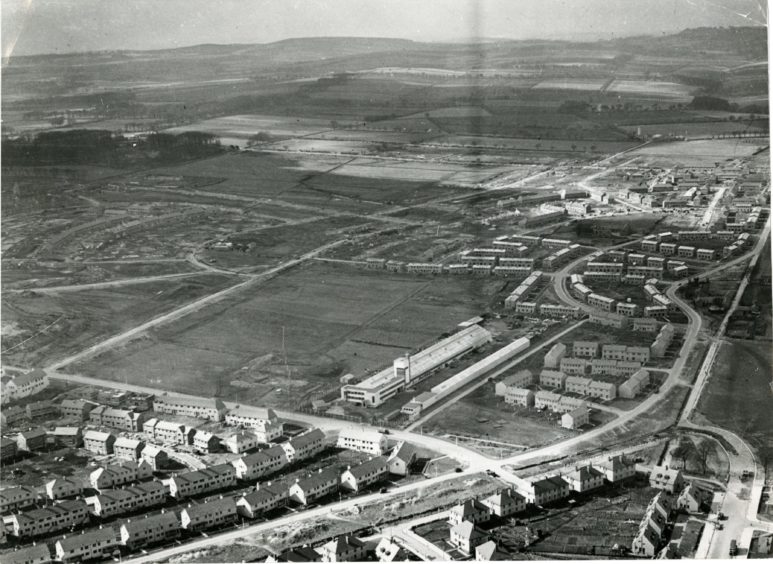
On the other side of the city, the communities of Garthdee and Kaimhill were taking shape as this photo below from 1955 shows.
Overlooking the River Dee, the estate had a rural feel to it, but it was bookended by Garthdee Road snaking around the houses on the right, and Auchinyell Road on the left.
The open fields on the left look towards the Deeside railway line just visible at the top corner, before Morrison Drive was built.
Meanwhile, the fields sloping down to the river on the right are now occupied by the Robert Gordon University campus.
One thing that hasn’t changed is the allotments at the bottom, which still exist next to Pitfodels Station Road.
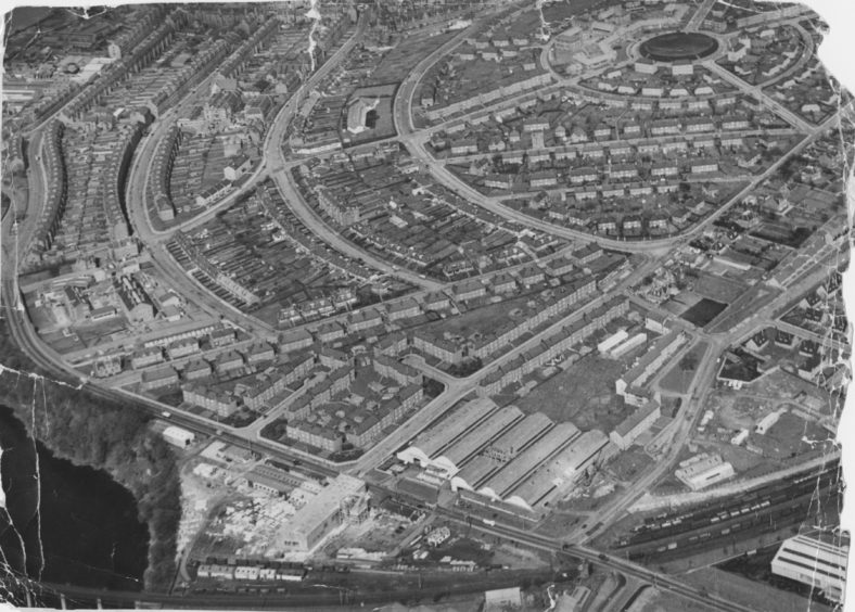
Torry
The interesting layout of Aberdeen’s south-side community of Torry makes a striking bird’s eye view in this photo below from 1964.
You can see Torry nestled in the bend of the River Dee with Wellington Road sweeping alongside on the left, and the railway bridge just visible at the bottom.
Once a Royal Burgh in its own right, the historic fishing community of Torry became part of Aberdeen after Victoria Bridge was completed in the late 19th Century.
The photo shows Aberdeen’s first council houses, which were built in Torry around 1919.
The earth excavated from the vast construction project was piled up to make the green, circular centre-piece on the right, known locally as “The Moundie”.
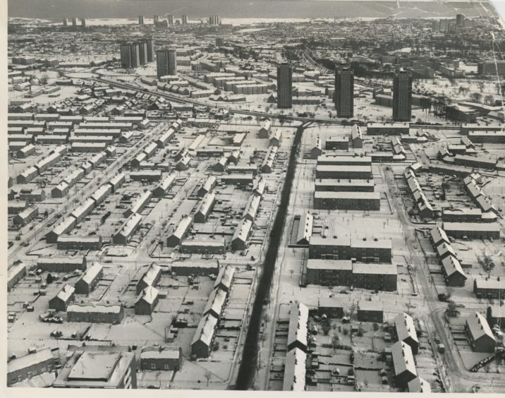
Mastrick
The houses look like models in this scenic photo below showing Mastrick under a blanket of snow in January 1979.
But little has changed in the last 42 years, the streets and maybe even some of the residents are the same.
Mastrick Road is running up the centre of the image looking towards Anderson Drive, the Stockethill high-rise flats and Aberdeen Royal Infirmary beyond.
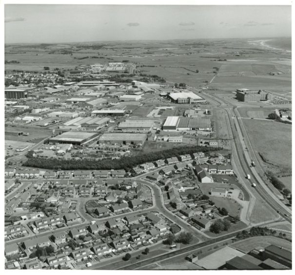
Bridge of Don
The aerial photo below from 1983 shows the suburb of Bridge of Don and its industrial estates looking towards the dunes at Murcar beyond.
The roundabout near the top right shows Ellon Road meeting the Parkway, two years before the AECC was build.
These days the land by the roundabout is occupied by Aberdeen Energy Park.
Danestone
Construction had started on a new community called Danestone on farmland near Bridge of Don in this shot from above in 1984.
Fairview Street is visible, but Wallacebrae Drive was yet to be built, while the Tesco superstore is still fields in this semi-rural peek into the past.
The leafy trees skirting the River Don at the bottom of this photo still remain today, while the uniform graves of the Grove Cemetery are just visible at the bottom.
The ups and downs of Aberdeen’s housing estate pubs that brought new communities together