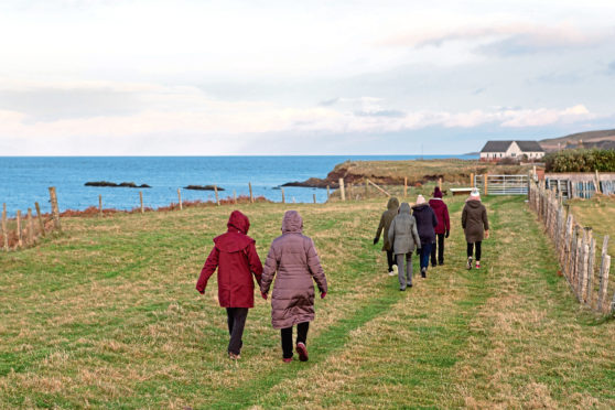
Many folk will be staying off the bigger hills during winter, but shorter walks at lower levels can be managed by most all year round.
Personally, even though I like bigger physical challenges, I also really enjoy short walks, especially with the dogs and the kids, and even more if there is a cup of tea and cake at the end of it.
This route takes in the completed first section of the Point and Sandwick Coastal Community Path, starting from the Point end of the Braighe.
It passes St Columba’s Church (Eaglais na h-Aoidhe) and follows the coastline before carrying on through the village of Aignish and returning along the main road.
The Old Knock School is an alternative start and finish point.
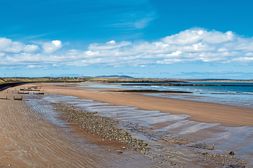
The quality of the new path is so good that the walking is really enjoyable and I discovered a wee beach that I had not known about and was treated to the sight of more seals than I have ever seen in one place before, apart from at Dunvegan.
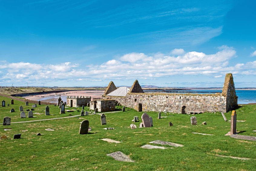
The highlight for many people on this walk, though, would likely be St Columba’s Church. This is such an impressive and important building dating back to the 14th Century, and was one of the most important medieval churches in the Outer Hebrides.
It was once the parish church of Stornoway and has a fascinating history.
It has been linked to the Knights Templar, due to the presence of the Sword Stone – a coffin-shaped stone with a faintly visible sword on top – but the most recent theory about that is that it marks the final resting place of the clan chiefs of the Macleods of Lewis.
The location itself is incredibly exposed – so exposed, in fact, that waves have been known to come right over the church in the winter. Starfish have even been found in the church afterwards.
Thankfully, the site has now been well protected after conservation work was carried out on the church in 2012 and 2015.
For those unfamiliar with the area, the route which has been made accessible by completion of the first phase of the coastal path is on OS Explorer Map 459, Central Lewis and Stornoway.
It begins at Grid Reference 483 321 (the parking area at the Point end of the Braighe, near the Aignish Farm Raiders Monument) or from GR 492 320 (the Old Knock School).
If starting from the Old Knock School, walk westwards down the A866 main road towards the Braighe, until you come to the parking area that is the alternative start point, just over half a mile away.
Next, take the path northwards across the Braighe isthmus, passing the raiders monument. St Columba’s Church and the coastal path will be obvious on your right-hand side.
Follow the path round as it skirts the outside of the church and its graveyard, following the very edge of the coastline and then crossing grazings. Conditions are excellent underfoot.
About 800 feet past the church, there will be a road off to your right. Ignore it and keep on the path. Shortly afterwards, you will pass a small beach to your left – there are often many seals to be seen here – and very soon the path will end and become a road. Follow this road uphill for about 650 feet until you see another road off to the right. Turn right here and follow it all the way along until you meet the main A866 road again.
Turn right downhill and you will arrive back at the Old Knock School after about 650 feet.
The walk described is 1.8 miles, but can be extended slightly by continuing on the road uphill after the path has finished, instead of turning right after 650 feet.
This would take you all the way uphill and out on to the main road near the houses at Seaview.
To complete the walk, as before, turn right downhill and return to the Old Knock School.
The walk
- Route: Aignish circular
- Distance: 1.8 miles
- Time: 30 minutes
- Difficulty: Easy
- Map used: Ordnance Survey 459, Central Lewis and Stornoway