Mortlich and Aboyne Loch, Deeside
It’s always wise to have a back-up plan in your pocket when setting off on a walk just in case your first choice doesn’t work out, and after reading some reports about the ascent of Mortlich I had come prepared.
This forested hill of modest height oversees the Deeside village of Aboyne and offers commanding views to bigger neighbours like Clachnaben and Mount Battock to the south.
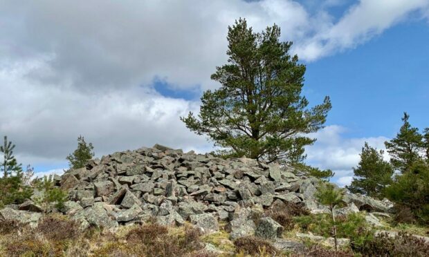
It’s also the location of a hill fort, likely Pictish, although much of its stonework has been dismantled over the years to be used as boundary walls and any remains are now buried beneath the massed granite boulders of a more modern cairn, built to commemorate the 10th Marquis of Huntly.
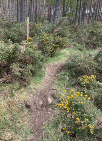
A few reports over the last couple of years had suggested that a machete might be needed to reach the top of this hill due to overgrown gorse and bracken obscuring the path and blocking the way ahead. So despite Mortlich being the main objective of the day, I was prepared to give it a miss and just enjoy a longer loop around the area.
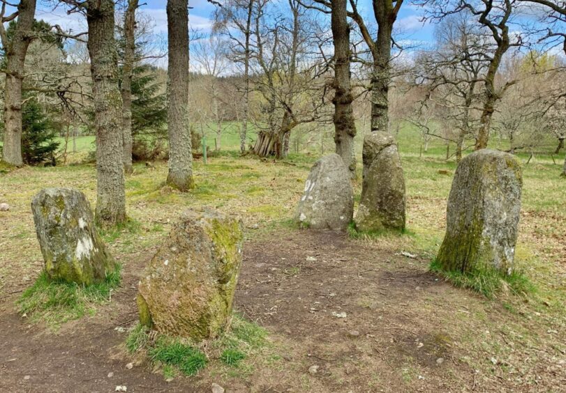
I set off from the centre of the village, heading up the tree-lined drive towards Aboyne Castle before making a short diversion into woodland to see the Aboyne Stone Circle.
There is some doubt as to the age and purpose of these five standing stones, one theory being that it is simply ornamental.
Once out of the castle grounds, I joined the Tarland Way, a signed track heading north and then across the B9094 and into the woodland which surrounds Queen’s Hill. A series of twists and turns eventually reaches a wooden gate and just beyond that on the left, the hill path for Mortlich.
The gorse barrier was easily breached and there had been widespread clearance of the old bracken. I was soon at a broken-down gate with the steeper, wooded section rising above, and although there were fallen trees ahead the path always adjusted and I was soon at the summit boulder pile.
Lying to the front of the cairn was an inscribed slab which read:
Charles 10th Marquis of Huntly
Died 18th September 1863
Erected by Mary Antoinetta his widow and the tenantry of Aboyne.
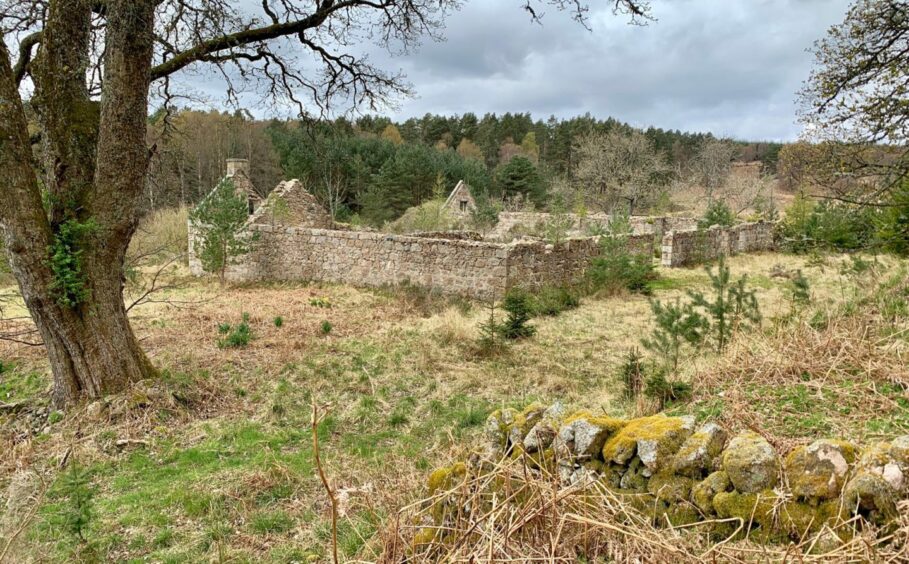
The local advice had been to retrace my steps back down the hill as most other descent routes were now overgrown or tortuous. Once at the foot, I turned left and followed a path of various quality down to a gate, through a field and then turned right down another field in front of the farm ruins.
The next section followed a path through woodland with some boggy sections and it could be easy to go off path in places. There were more fallen trees, all easily turned, before the path started dropping faster and there were glimpses of the waters of the Loch of Aboyne.
The loch is a site of special scientific interest due to its flora and fauna, and it is also important in the life cycle of butterflies and waterfowl.
I followed the muddy path along the shoreline for a bit, then crossed a wooden stile over a fence to walk along the edge of the golf course.
Once past the clubhouse, it’s only a matter of walking through a few residential streets to the A93 and a right turn to reach the starting point.
ROUTE
1. From car park, cross A93 and head right along road to reach Aboyne Castle gates.
2. Head up tree-lined drive and at first junction turn left. Shortly after, turn first left again for short detour to see Aboyne Stone Circle a short distance into woods via path on right.
3. Return to main track and turn left, heading for exit. Cross B9094 and go straight ahead, turning right at signpost for Tarland Way and following track north.
4. Ignore first turn-off left, but take next one (arrow marker) down to B9094. Cross to join path heading downhill into trees to wooden bridge over Tarland Burn.
5. Cross bridge and continue on main track. After about 1km, leave it on forest track going uphill on right. Ignore any branches, and when it turns north-west you should leave it for a narrow path (arrow post) going sharply right to reach a wooden gate.
6. After going through gate, head uphill to left on path. This goes through gorse at first to reach a metal gate, then winds its way steeply through the trees to reach the huge pile of boulders that mark the summit of Mortlich.
7. Return the way you came, turn left and follow path to metal gate then over field to Bonnyside (ruin). Turn right down the field to another gate giving access to path through woods which leads down to loch.
8. Follow shoreline path at first to cross stile to walk along edge of golf course, then across it past clubhouse and through residential streets to reach A93. Turn right for short walk back to parking.
INFORMATION
Distance: 10km/6miles
Ascent: 305m/1005ft
Time: 3-4 hours
Grading: Satisfying circuit on forest tracks and paths, including the Tarland Way, with short but steep
climb to old fort on summit of wooded hill which will suit walkers with moderate degree of fitness. Muddy
at times, plus fallen trees in places (avoidable). Take care and be considerate when crossing the golf
course. Dogs under close control around farm livestock and on course.
Start/finish: Car park in centre of Aboyne (Grid ref: NO 528986).
Map: Ordnance Survey 1:50,000 Landranger Map 37 (Strathdon & Alford); Ordnance Survey 1:25,000
Explorer sheet OL59.
Tourist Information: VisitScotland, Ballater iCentre, Station Square, Ballater, AB35 5QB (Tel 01339
755306).
Public transport: Regular bus service to Aboyne.