It was the shortest day, and to be honest, I wasn’t in the best of moods. A broken night’s sleep, a dark morning and a little too long reading the news headlines had left me lacking in seasonal cheer.
So, when my long-suffering wife Carole said: “Why don’t you get out for a walk”, she was probably doing us both a favour.
I’d had a notion to revisit Geal Charn for a wee while now, and this seemed like a good day. Bitterly cold out, but a warm spell had removed most of the snow cover from the hills. I decided to travel light without some of the usual winter hardware. It helps if you can see the hills from your bedroom window!
I parked carefully at the end of the minor road to Dorback Lodge. There’s a No Parking sign, but it seems OK if you can squeeze your vehicle right off the road surface. Geal Charn lay to the south, and I could see the vehicle tracks for my outward and return journey ahead across the Dorback Burn. Don’t be fooled by the name. It’s more like a river, and the bridge shown on some maps is long gone. I crossed with care, emerging dry without too much difficulty. It could be more of a problem in spate though.
Aiming for the abandoned buildings at Upper Dell, I picked up a vehicle track, which meanders pleasantly southwards towards the northern ridges of Geal Charn. Before long I passed the splendidly named Loch an t-sidhean dhuibh, the Loch of the Black Fairy. In reality, a small glacial kettle-hole, nestling in a fold in the moorland. Great name though, and surely once the subject of a local legend.
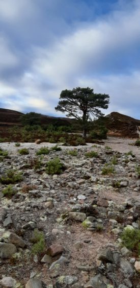
Descending slightly, the track fords another burn, where several granny Scots Pines are clustered in a cleft. I was pleased to see them surrounded by dozens of their offspring, perhaps a precursor of the regeneration of an upland woodland here.
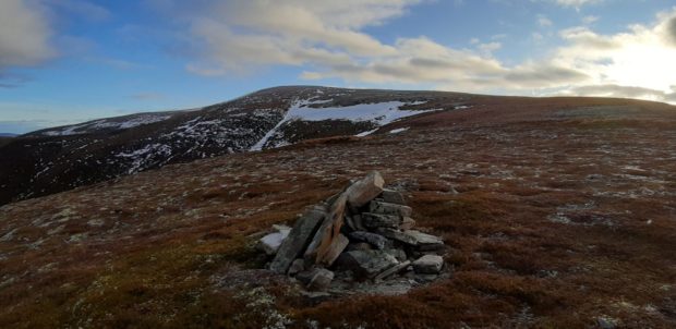
At the high point of the track I struck right uphill, where a very small pile of stones marked the start of a sketchy path. The path proved intermittent, but the going remained easy on the frozen ground. I imagine this would be pretty boggy in “normal” conditions. A steady pull uphill brought me to a small cairn, clearly visible from below. From here, the ridge curved left ahead of me, climbing steadily towards the summit.
A few more minutes and I reached a line of fence posts that I followed for the last few hundred metres to the summit. The summit ridge is a broad whaleback, littered with shattered white quartzite (which presumably give Geal Charn its name – “The White Hill”).
Geal Charn is very much an outlier and in character is far closer to the rolling moorlands of the Cromdale and Ladder Hills to the east than to the main Cairngorm massif. However, what it lacks in character it gains in its situation, providing a fine 360 panorama. In particular, the northern Cairngorms look spectacular, with fine views over Glen Avon towards the remote northern corries of Ben Avon and Beinn a Bhuird. Far to the north-west, Ben Wyvis was clearly visible, the distance seemingly foreshortened by the conditions.
Rummaging in my rucksack I was a little put out to find that my sandwiches seemed to have disappeared (later located in the hat box in my den. No idea how!). Undeterred, I lunched on a selection of confectionery from my emergency supplies (well, it was Christmas), before setting off on my return.
I followed the ridge for another few hundred metres, then turned to descend north-east towards the high point of the vehicle track leading down to Dorback Lodge. This wide straight track is a bit of a scar on the landscape, but I enjoyed the surroundings as I descended through these bleak brown moors, mottled by patches of silvered muirburn. The sun was getting low now, finally dropping behind the hills as I reached the car. It might have been a short day, but it felt like I’d made good use of it.
THE ROUTE
- Location: Geal Charn, Dorback – the start point is a few miles up the minor road from Nethy Bridge. The OS grid reference is NJ 07743 16827 and the closest postcode is PH25 3EE
- Distance: 8 miles
- Ascent: 1,719 feet
- Duration: 4 hours
- Difficulty: Moderate hill walk