Learning basic navigation skills is a great way to reduce risk and boost your confidence in the hills, as Gayle discovers.
Anyone heading into the hills needs to have their wits about them.
Sure, you might set out in glorious sunshine, with a fair idea of where you’re going, “safe” in the knowledge you’re got a navigation app on your fully-charged mobile.
But the weather in Scotland can change in the blink of an eye – one minute it might be sunny and warm and the next it’s snowing – and phone batteries run out and signal can be lost.
When that happens, a map and compass can get you home – if you know how to use them.
Embarrassingly, I’m one of those people (or was, until last weekend) who thought they knew how to use these essential and in some eyes “old school” tools fairly competently but actually, I was just winging it.
I always go armed with a map, but there have been times when I’ve consulted it, turned it upside down, scratched my head, and been none the wiser. I know – it’s downright irresponsible behaviour.
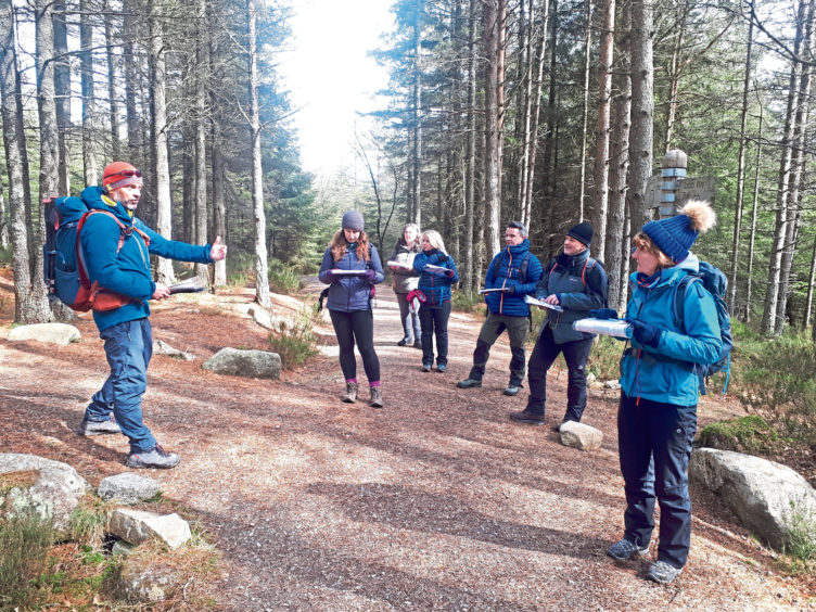
Keen to become more savvy, I signed up for a “hill skills” course around Bennachie in Aberdeenshire run by Hillgoers founder Garry Cormack.
Bennachie has several tops, the highest of which, Oxen Craig, is 528m, although the most prominent peak is 518m Mither Tap.
Today’s course, which is aimed at beginners or folk needing to update their hill skills, starts from the visitor centre car park near Pitcaple.
There are seven of us in the group and Garry, who launched Hillgoers in 2016, kicks off with a discussion about responsible outdoors access, planning routes, preparing your kit, the importance of checking weather forecasts and telling someone where you’re going.
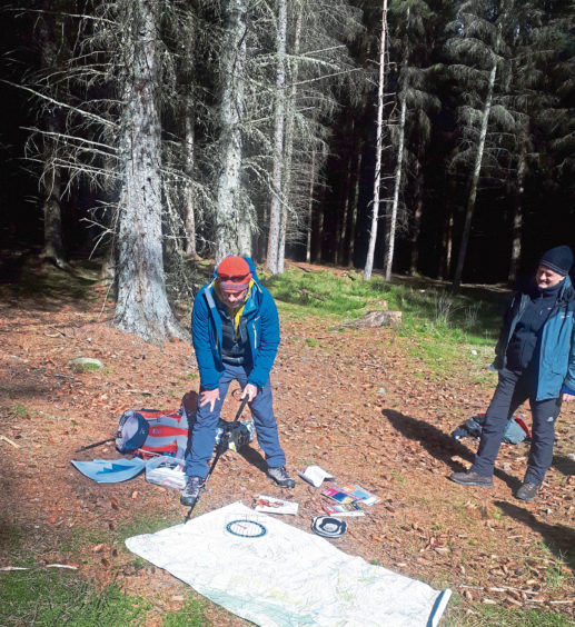
He then spreads a giant map on the ground and teaches us about scale, contour lines, grids, symbols and features such as burns, footbridges and trig points.
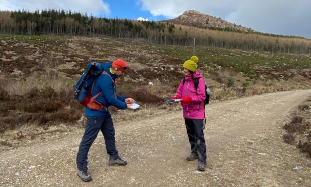
Next up is learning how to use the compass which a few of us admit we find a bit daunting.
I dig out my ancient one, hold it level, and watch as the magnetic needle wavers and wobbles in a desperate bid to find north.
“Maybe chuck that in the recycling bin!” laughs Garry, handing me a spare one.
It seems my compass has bitten the dust – it may be a case of wear and tear, or the fact it’s become demagnetised over time. Could its wonkiness be the reason I’ve been getting lost?!
Once we’ve all found north, Garry runs through some basic navigation strategies, talks about what to do if you lose your way, does a “show and tell” of his hiking equipment and has a debate about technology versus good old paper maps.
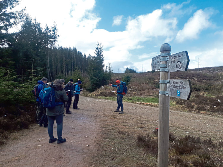
The plan is to head into the wilderness and while anyone who’s been up Bennachie might be thinking – “that diddy wee hill?” – Garry reckons it’s a fantastic training ground.
“Bennachie has everything you need to teach navigation – a mix of woodland and upland paths, open moorland and stream junctions,” he explains.
“It has lots of interesting contour features, with many tops to explore!”
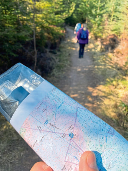
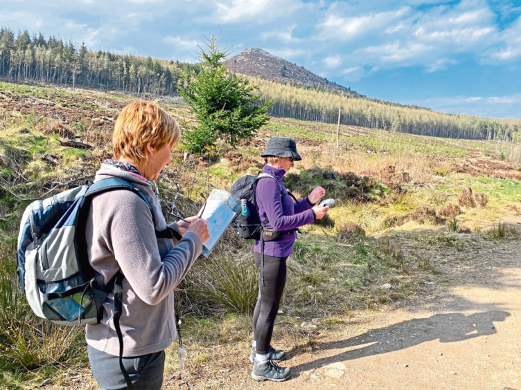
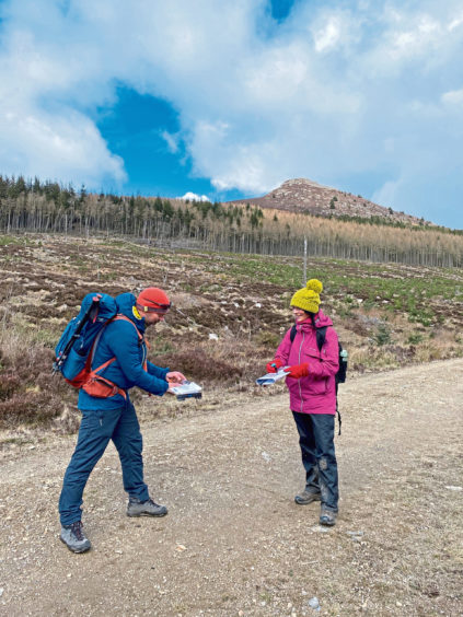
Using our maps and compasses, we navigate through woods to points of interest, with the ambition of heading towards 409m Millstone Hill, a southern outlier of Bennachie.
It’s useful to work out our individual pace per 100m; this can give an indication of how long it will take to reach a certain point.
Looking at ground features and using grid references, Garry then sets us wee tests to find things like walls, burns and gravel pits.
It’s great fun, if a little bamboozling at times, but before long, everyone in the group is brimming with confidence.
After passing the remains of some old crofts, we enjoy a picnic beside a burn. It’s a stunning wee spot and a chance to catch up with fellow walkers.
Just round the corner, the views of Mither Tap are absolutely cracking, and we pause to gaze up at the prominent granite tor.
The rest of the session sees us honing our skills while exploring the slopes of Millstone Hill.
It’s a fantastic learning curve and I can’t wait to show off my navigation skills next time I’m out hiking. I feel a heck of a lot less daunted by the prospect and (hopefully) less likely to perish in the wilderness.
The hill skills workshop is one of many offered by Hillgoers.
They run all over Aberdeenshire, Perthshire and the Highlands and include winter skills, trail running, mountain biking, national navigation awards, Duke of Edinburgh awards, guided wildlife walks, multi-day treks and more.
Garry, a qualified mountain leader, is an enthusiastic instructor with a huge passion for the outdoors, as are all his employees.
His main ambition is to keep people safe, build confidence so they can plan their own routes safely and responsibly, and connect with the outdoors in a positive way.
“It’s really important to spend time planning, researching the weather, and to have a Plan B, and even a Plan C if the car park is full!” he says,
“Always remember to tell someone where you’re going and when you expect to be back, especially if you’re going solo.”
Respect for the hills is hugely important. Nobody wants to be the idiot who’s forced Mountain Rescue volunteers out of their beds at 3am in the morning.
And no-one wants to end up injured, or dead, because they’ve not taken navigation skills seriously.
Possessing the ability to read the lay of the land, and having the confidence to explore, safe in the knowledge that should your electronic devices fail you would be able to navigate your way back with nothing more than a map and compass, is a liberating feeling.
- Courses have just started running from Dunkeld. The venue is similar to Bennachie in that it has woodland and upland paths and plenty of features to explore.
- For details of courses across Scotland, see www.hillgoers.com