Burn o’ Vat and Loch Kinord, Deeside
The Muir of Dinnet National Nature Reserve is an area of exceptional beauty, an ancient landscape shaped by powerful forces that contains two of Scotland’s jewels – the dramatic cauldron of Burn o’ Vat and the wildlife haven Loch Kinord.
Either make for a fine short excursion but combining them into one longer circuit provides the best of best worlds without being too taxing. The whole circuit is well signed, and there numerous information boards at regular points.
It’s probably better to begin with Burn o’ Vat before it gets too crowded. There’s a neat yet spacious car park at the visitor centre just a couple of miles up the B9119, reached from the A93 Ballater to Aboyne road.
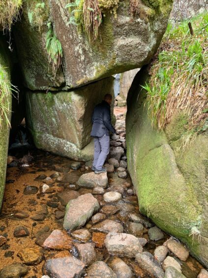
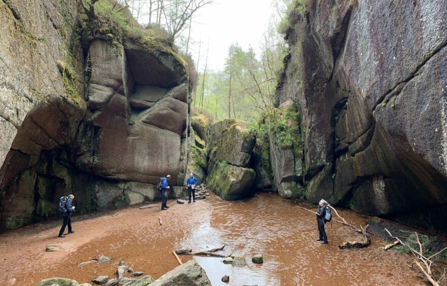
The initial walk to the jumbled rocks at the mouth of the Vat doesn’t take long, although the wait to take your turn to squeeze through the narrow crack into the stunning natural amphitheatre may take longer.
This giant pothole was gouged out by rocks being driven along in the roaring stream beneath a glacier more than 10,000 years ago. The main sound today is of voices echoing round the enclosing walls. It’s simple enough to scramble up to a higher vantage point with care.
We retraced our steps to the wooden bridge passed earlier, crossing and heading uphill, leaving the crowds behind. The short way back to the car park goes right: we went left, gaining height on a good path through the trees before emerging into more open terrain and reaching a signed crossroads.
We turned right, walking north-east on a grassy forest track slicing through the vegetation. En route, we encountered a few small blockades of fallen trees, but there was always a way under or around. It’s worth checking in advance if there are any closures or diversions planned for forestry work.
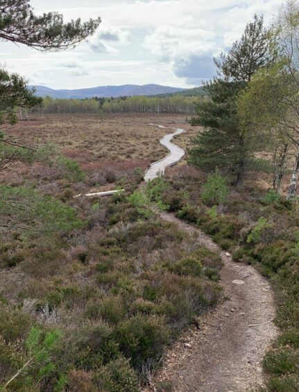
The track came out on the B9119, but a gap in the wall opposite gave access to a grassy path running parallel with the road, eventually joining another woodland track heading towards Loch Kinord.
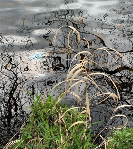
There were signs warning of adder activity as we followed a drystone dyke down to an open grassy area – this is said to be a hotspot for the snakes, especially among the tumbled stones of the wall.
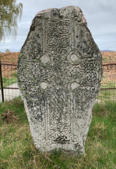
Lord Kinord was home to a Christian community in the ninth century, and the ancient stone cross displayed just above the shoreline is thought to have been cut locally and had pride of place in the chapel. It was dug up near this site in the 1820s and displayed at Aboyne Castle until its return in the 1950s.
The islands on the loch also contain the remains of an iron-age crannog, built around 2,500 years ago. Another island was the site of a castle. This fortress attracted kings and queens during hunting expeditions in the north. It was burned down in the 1600s but its causeway was still used by locals for many years after.
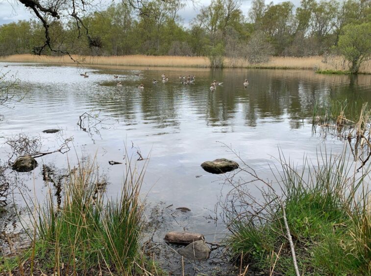
The main attraction, however, is the extensive variety of bird, insect and plant life around the water. Waterfowl are particularly prevalent. We spotted geese, swans, several varieties of duck, as well as a heron and we lucky enough to see two cormorants, wings outstretched, sunning themselves on a handy protruding rock.
The clockwise circuit is easy to follow: the path drifts away from the shore into woodland at times, clinging to it at others. It’s like a gigantic game of hide and seek – you never know just what’s going to be around the next corner.
Eventually, we arrived at a split in the path near the finish. The left-hand branch took a lazy loop across a boardwalk through wetlands before rejoining the other branch for the last push back to the road and the car park to bring the curtain down on a day of seeing nature in all its glory, something for everyone.
ROUTE
1. From parking, take signed path in front of visitor centre, cross wooden bridge and when second bridge is reached, don’t cross but keep left on path to jumbled rocks at Vat entrance and squeeze through gap.
2. Return to bridge, cross and head uphill. Turn left at first path junction and left again at next and continue through woods until out of treeline.
3. Turn right on grassy track heading north-east for 2km to emerge from woods on to wider track and walk down to B9119.
4. Cross road, go through gap in wall and follow grass path which runs parallel with B9119 before becoming wider track through woodland with Loch Davan to your left.
5. Follow line of old wall across more open grassy area where there are some wooden benches, heading down towards shore of Loch Kinord.
6. Path takes left turn at Celtic cross to begin well-signed clockwise circuit around shoreline.
7. Shortly after passing beneath old building at Meikle Kinord, there is option of two paths. The left one does a short boardwalk loop through wetlands before rejoining the right-hand one to lead back to car park.
INFORMATION
Distance: 10km/6miles
Ascent: 205m/675ft
Time: 3-4 hours
Grading: Well-signed woodland paths and tracks combined circuit suitable for all ages and abilities. Care needed on stepping stones to gain entrance to Burn o’ Vat. Some muddy sections, sturdy footwear advised. Diversions may be encountered due to fallen trees. Dogs under close control in nature reserve, with added risk of birds affected by avian flu. Also, watch out for adders.
Start/finish: Burn o’ Vat visitor centre (Grid ref: NO 429996) on B9119. Toilet facilities.
Map: Ordnance Survey 1:50,000 Landranger Map 37 (Strathdon & Alford); Ordnance Survey 1:25,000 Explorer sheet 59.
Tourist Information: VisitScotland, Ballater iCentre, Station Square, Ballater, AB35 5QB (Tel 01339 755306).
Public transport: Bus services to Dinnet (No 201), a one-hour walk from Burn o’ Vat car park.