Meikle Kilrannoch, Angus Glens
I had arrived in the home territory of Glen Doll as so often before, without a plan or a specific route in mind, a wait-and-see approach to the day’s walk.
The Angus glens were badly affected by the November storms of 2021 and there is still a great deal of repair and restoration work going on. A chat with one of the rangers gave me an update on the state of play: most routes now open, albeit with diversions, but the riverside path from the car park will remain closed for some time to come.
She asked where I was walking today and I told her I genuinely didn’t know. Broad Cairn had been the favourite, but then my feet started leading me up the track towards Jock’s Road. A good choice. The next decision could be made at the high point of this historic trail.
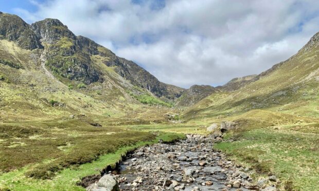
The early part of the route is still closed off, but a signed diversion leads round and out of the forest into the corrie at the top of the treeline. My last excursion here was last December when we were forced to retreat, the fresh fall of snow making upward progress impossible.
No such problem this time, the way up the steep incline passing quickly on a bright day, the high crags on either side sparkling in the sunlight.
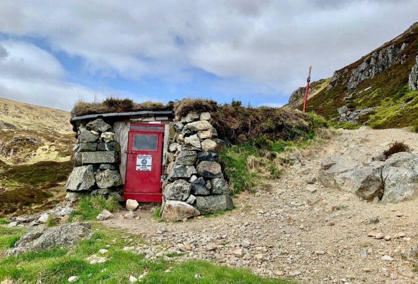
After a short lunch stop at Davy’s Bourach, I decided on the next stage of this stravaig, leaving the path to head over rough ground for the rounded hill of Meikle Kilrannoch.
Along with its neighbour Little Kilrannoch, it is an important site for vegetation and rare plants, boasting some of the rarest alpines in the country.
For example, these unassuming rounded hills are the only place in Britain where you can find purple coltsfoot (Homogyne alpina), and the only Scottish site of the alpine catchfly (Lychnis alpina). I was too early for the latter but did catch a splendid carpet display of mountain scurvygrass (cochlearia micacea) illuminating the boggy plateau.
I did wander further afield from the mapped route shown, dropping to the lonely crags at the head of Canness Glen for the long view down Glen Isla where the river snaked off to the horizon, and popping over to the Munro of Tom Buidhe but these were optional extras. The rest of the route is satisfying enough for the curious walker without these add-ons.
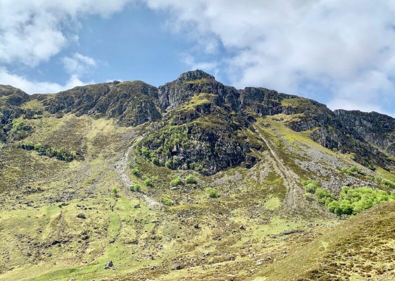
From Meikle Kilrannoch, I dropped to a boggy col and then rose again to Craig Maud, the first summit along the craggy line known as The Dounalt which provides vertiginous views down on Jock’s Road, now reduced to a pale snail trail on the opposite side of the glen.
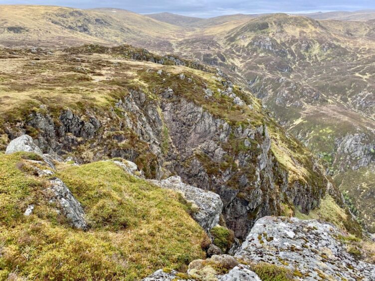
The going was rough at times – it had been pathless and undulating since leaving the emergency shelter – but rewarding, a pleasant surprise at every twist and turn. The end corner of the line was Craig Rennet, worth a visit with its wonderful line of sight over Glen Doll, but my route continued with a twist to the right, along the mainly grassy top of the plunging Erne Craigs.
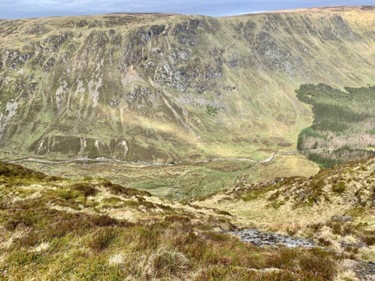
This led over the top of the waterfall to the head of Fee Water where I joined a solid path once again, a favourite of Munro-baggers heading up Corrie Fee for Mayar.
This gave a fast run down the corrie and through the forest where it joined the inward route at the earlier diversion signpost, and from there it was simply a case of retracing my steps back to the car park.
Despite knowing this area so well, it felt like I’d reached new territory, the unplanned providing a magical mystery tour of my own backyard.
ROUTE
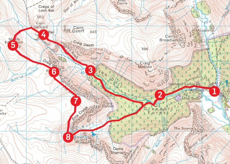
1. Head back out of car park and turn right, taking rough track past Acharn. Keep straight ahead above White Water to reach turn-off for Jock’s Road (signed).
2. This section is currently closed due to fallen trees, so continue on track and follow diversion signs which lead to bridge at top of forest.
3. Cross bridge and pick up hill path which heads steeply north-west to reach emergency shelter (Davy’s Bourach) at top of the pass.
4. Leave path just beyond shelter going left over open ground. Cross water and make short pathless ascent to top of Meikle Kilrannoch.
5. Descend south-east to boggy col and make short pull-up to Craig Maud and the start of the line of crags, an area known as The Dounalt.
6. Follow the undulating ridge with spectacular bird’s eye views down to Jock’s Road.
7. As you approach the end of the ridge at Craig Rennet, swing right to walk above the Erne Craigs and then drop easily to reach the path beside the Fee Burn.
8. Follow the excellent path down through Corrie Fee and back into the forest to link with the track at the earlier diversion and retrace steps to car park.
INFORMATION
Distance: 15.5km/9.7miles
Ascent: 790m/2590ft
Time: 5-7 hours
Grading: Fine high-level circuit linking two glens on good paths with some rough pathless ground in between. More suited for walkers with good level of hill fitness and relevant skills, although can be shortened by sticking to just one there and back ascent. Dogs under close control due to ground nesting birds and around farm livestock.
Start/finish: Glen Doll pay and display parking (Grid ref: NN 913610).
Map: Ordnance Survey 1:50,000 Landranger Maps 44 (Ballater & Glen Clova); Ordnance Survey 1:25,000 Explorer sheet OL 53.
Tourist Information: VisitScotland, Dundee iCentre, V&A Dundee, 1 Riverside Esplanade, Dundee DD1 4EZ (Tel 01382 527527).
Public transport: None.
Tourist Information: VisitScotland, Ballater iCentre, Station Square, Ballater, AB35 5QB (Tel 01339 755306).
Conversation