Specialist satellite imagery will be used to help protect Scotland’s most precious environments in a new partnership between tech companies and Nature Scot.
Musselburgh satellite imagery company Astrosat, along with fellow tech organisations Intelligent Reality and Informed Solutions have been selected by Nature Scot to work on a £1.25 million project to improve the management of the nation’s protected areas.
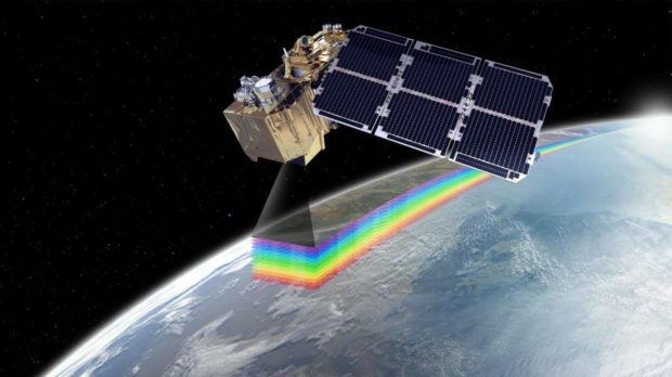
Using data from the EU’s Copernicus Programme’s twin Sentinel-2 satellites, the initiative seeks to make vital information about Scotland’s protected areas, like Sites of Special Scientific Interest (SSSI), freely and quickly available to anyone that needs it.
Anyone, be they land managers wanting to build a new path, developers seeking to build new homes or the general public will be able to access the online service and find out almost any information they need about making changes to protected areas.
It is hoped the new service, which will also utilise artificial intelligence to deal with huge amounts of data, will cut down on unnecessary bureaucracy and speed up all manner of projects, while at the same time protecting Scotland’s special environments like peatlands and dune systems.
A “coloured fingerprint” taken from space
Steve Lee, the chief executive officer of Astrosat, said he’s excited about the potential applications Nature Scot could use satellite data for.
Use your mouse or touch the screen to reveal an infrared image of burned vegetation, created using modified satellite data from the Copernicus Sentinel project in 2019. The imagery can help conservationists identify hotspots in the burned area.
Not only do the Sentinel-2 satellites capture regular photographic images on the visible spectrum, they can also provide Astrosat with specialist short-wave infrared and near infrared data, allowing Nature Scot to see Scotland beyond the capacity of the human eye.
Mr Lee, 41, said: “I set up Astrosat because I have this concept that every problem has a space solution.
“A lot of Nature Scot’s protected sites are all vastly spread all over the place, and for them to have humans surveying it all is nearly impossible.
“But with satellites, we can take a picture and given them the information they need really quickly.
“Obviously Scotland’s a bit cloudy, so we’ll get as many optical images as we can, which is just like a normal camera picture, but we can also use the non-visible spectrum.
“Once you go beyond the visible spectrum, you can give nature a health check on a vast scale.
“The near infrared and hyperspectral bands can create a kind of coloured fingerprint.
“This allows you to almost test the health of things like crops, grasslands, woodlands and areas like that.
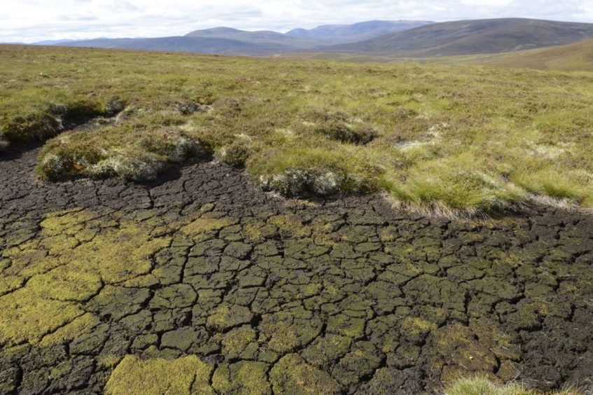
“With peatland, you can look at soil moisture.
“We can also use radar to see through clouds, and that can be used for land erosion. Let’s say there’s an old lighthouse on a coast, you can catch the coast eroding way before a human being could and protect it.”
“It’s like writing a song”
He continued: “One subject I’m really keen to look at is peatland management. Because peat is a really good carbon sink, and Nature Scot has a lot of peatland in their remit, that’s one I’m really keen to keep an eye on.
“We can look at what Nature Scot are doing to protect such areas, and be able to give a quick report to ensure those conservation metrics are being followed, be it looking at environmental damage, industrial damage, over-commercialisation, or over-use by tourists.
“It’s really an open book, it’s up to Nature Scot to tell us what they want and we’ll figure out if it’s possible.
“I love it, for me looking at an issue on paper and figuring out satellite data is great fun, it’s like writing a song.”
A £20m fund to help solve public problems with technology
The £1.25m Nature Scot project is funded through the UK-wide GovTech Catalyst Challenge, a £20m fund designed to help solve public sector problems with innovative digital technology.
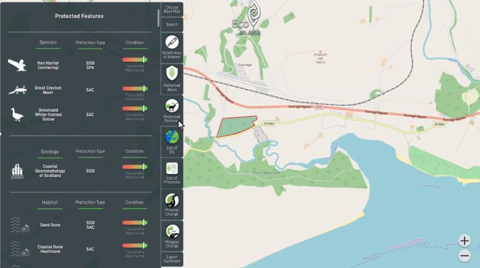
Once complete, it is hoped the new online service would be able to help people seeking to change Scotland’s protected landscapes find answers faster for their aims.
Brian Eardley, protected areas manager with Nature Scot, said: “Scotland’s protected areas safeguard our most special places for nature and provide many benefits to individuals, communities and society as a whole.
“It’s vital that any proposals for change on protected areas don’t compromise, and indeed preferably enhance, these sites.
“However one of the biggest problems land managers, developers or interested members of the public often encounter is getting hold of the relevant information they need and getting it quickly.
“This project aims to revolutionise that process with a platform that can predict potential impacts on protected areas and provide immediate tailored information and advice for any specific site.
“It has the potential to benefit a wide range of users from the developer unsure of whether to progress a proposal to members of the public interested in their local protected area.”