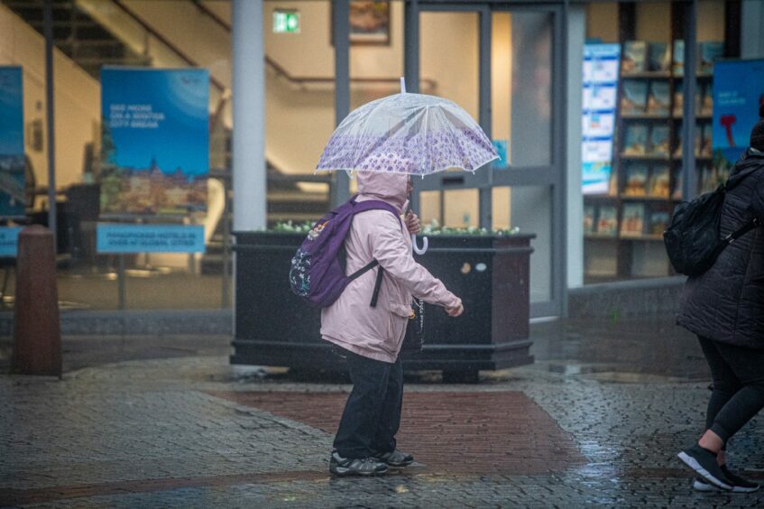
Heavy and persistent rain has caused significant disruption across the north-east today.
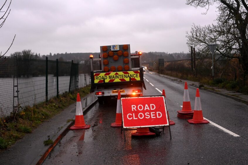
A number of roads across Aberdeenshire have been hit with flooding which has led to closures and a build-up of traffic.
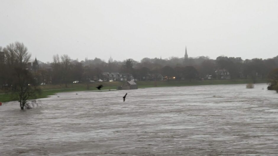
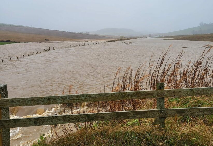
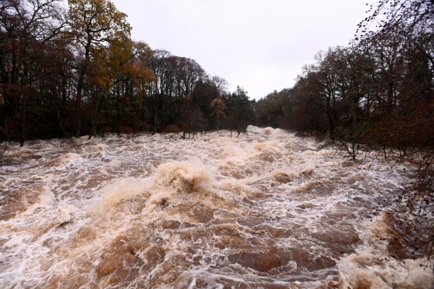
Sepa has now issued severe flood warnings for Kintore, Kemnay, Inverurie, Ballater and Aberdeen (Dee). Flooding is expected to match that of Storm Frank in the winter of 2015 and 2016.
Many train services have been cancelled due to line closures between Perth and Aberdeen and Perth and Inverness.
The Met Office has put an amber weather warning in place across much of the east of Scotland which has now been extended to 9pm.
A yellow weather warning also remains in place across a wider patch of the north-east until midnight.
⚠️⚠️ Amber weather warning UPDATED ⚠️⚠️
Rain across eastern Scotland
Extended from NOW until 2100 FridayLatest info 👉 https://t.co/QwDLMfRBfs
Stay #WeatherAware ⚠️ pic.twitter.com/VJ3HYvOnGX
— Met Office (@metoffice) November 18, 2022
Meanwhile, many residents in Aberdeen and Aberdeenshire are experiencing power cuts and internet outages due to the severe weather.
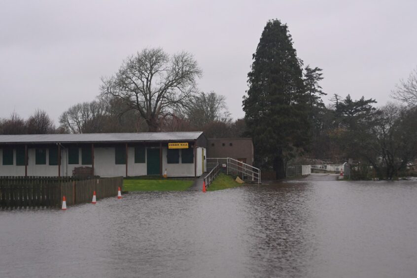
It has also halted Aberdeen’s festive celebrations with the first day of Curated in the Quad officially cancelled and the Christmas Village to remain closed today.
It was announced in the early afternoon on Friday that the Garthdee campus of Robert Gordon University would be closed with immediate effect.
It is understood that janitors are doing sweeps of all buildings asking everyone to leave.
Warnings to motorists
Drivers are being advised to take care, particularly in the amber warning zone, and to only travel if necessary.
Traffic Scotland has said there is surface water on the A93 between Crathes and Drumoak, the A92 at Muchalls and the A90 between Stonehaven and Laurencekirk.
These roads are described as “just passable”.
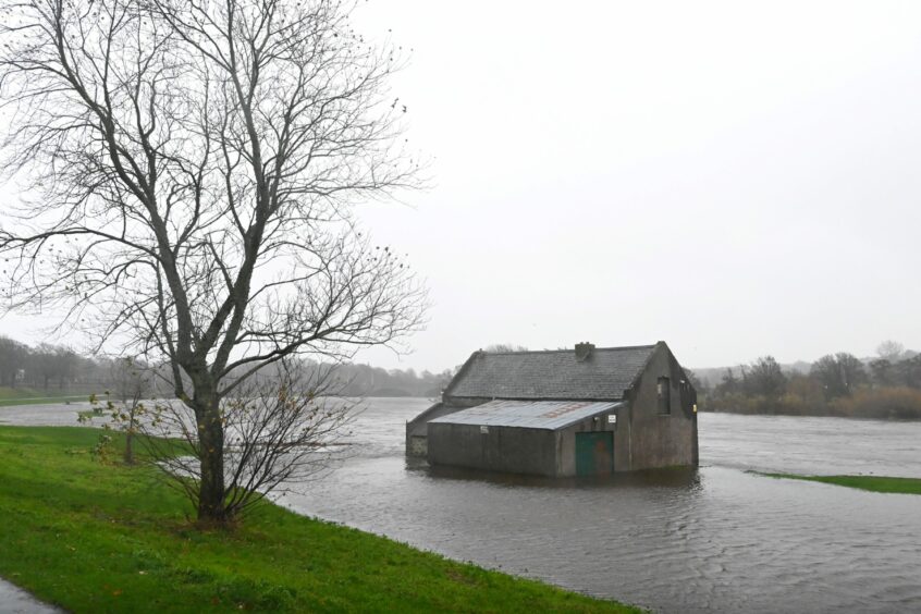
A severe flood warning remains in place for the Garthdee and Riverside Drive areas of Aberdeen with River Dee levels expected to rise this evening. Please stay safe. @HSCAberdeen pic.twitter.com/kJDS76lNWj
— Aberdeen City Council (@AberdeenCC) November 18, 2022
Where has flooding been reported?
- The A937 is closed between Marykirk and the Aberdeenshire boundary
- B9005 Methlick to Ythanbank
- A920 Colpy Road
- A96 near Huntly is closed near the railway bridge
- The B977 between Dunecht and Echt
- The B9170 between Oldmeldrum and Inverurie
- A92 closed between the Parbroath Crossroads and Melville Lodges
- B979 is closed between Blackburn and Hatton of Fintray
- In Westhill, there is deep water on the A944 Straik Road heading to Sauchen
- The B993 Keithall Road in Inverurie will be closed from 9am due to rising levels on the River Don
- Drain covers have come up on South Deeside Road between Maryculter and Durris
- C36K Bridge of Feugh is closed to traffic
- The B9001 is blocked between Inverurie and Rothienorman
- The A96 near Kinellar and at Huntly
- The A947 between Turriff and Fyvie
- The A97 between Huntly and Gartly
- The A90 around the Angus Council border
- Blacktop Road between Silverburn and Bishopdams Road
- A980 Alford to Banchory road at Torphins
- Montgarrie Road between Montgarrie and Alford
- In the Highlands, the Strath Oykel Road connecting Rosehall and Leadmore has been closed due to flooding.
Further risk of flooding
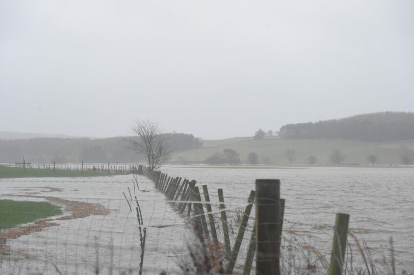
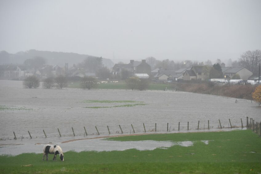
Sepa has also put flood alerts and warnings in place across much of the north and north-east, including the area around the River Don.
Flood alerts are issued for regional areas to help prepare for severe weather, while flood warnings mean immediate action is required.
Severe flood warnings have been issued in:
- Kintore
- Kemnay
- Inverurie
- Ballater
- Aberdeen (Dee)
Flood alerts have been issued in:
- Aberdeen City and Aberdeenshire
- Findhorn, Nairn, Moray and Speyside
- Caithness and Sutherland
Flood warnings have been issued in:
- Marykirk
- Maryculter
- Banchory
- Aboyne
- Spey Viaduct to Spey Bay
- Boat O’Brig to Spey Viaduct
- Aberlour, Craigellachie and Dandaleith
- Orkney Churchill Barriers
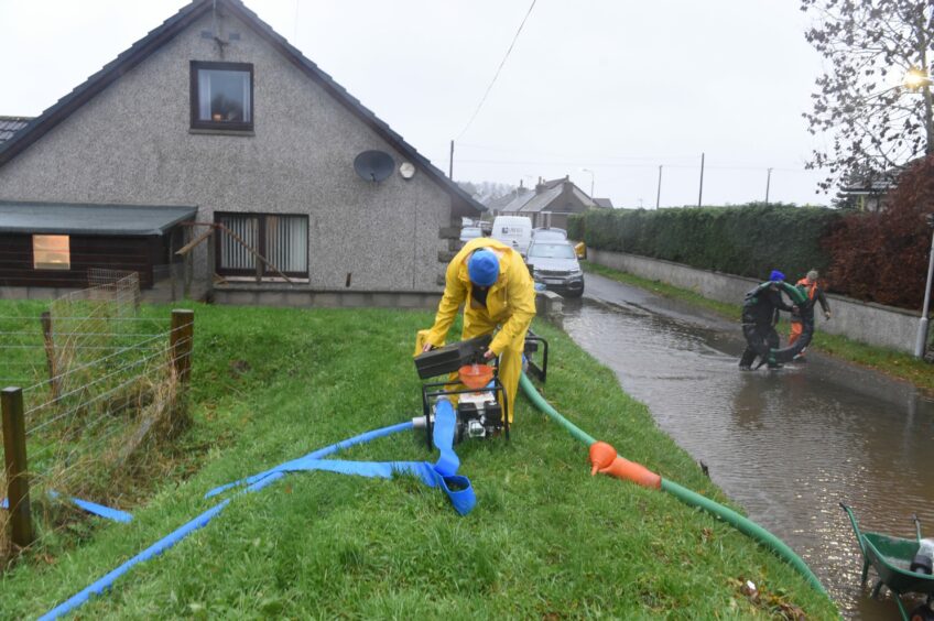
Residents in these areas have been told to remain vigilant to protect themselves and their properties throughout the day and into Saturday, with sandbags available at a number of locations via Aberdeenshire Council.
West Aberdeenshire and Kincardine MP Andrew Bowie commented: “This is a very anxious time for people in communities across Aberdeenshire. As the rain continues, it is testing the old infrastructure and ineffective protections in some areas.
“This week I asked Scottish Water to investigate the ageing sewer network in the older part of Stonehaven, which was linked to recent flooding. Homes and businesses in the likes of Kemnay and Inverurie will also have a weather eye on the updates today.”
A month’s worth of rain
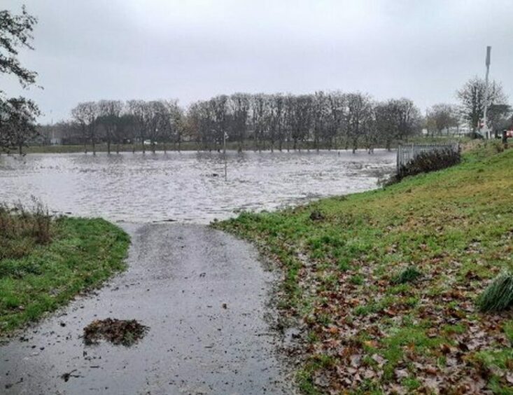
In Aberdeen, the council shut Pets’ Corner in Hazlehead Park due to flooding while levels at the River Dee and River Don have risen significantly.
Maryculter Bridge has also been closed due to the rising river levels on that section of the River Dee.
It is understood the River Deveron has burst its banks resulting in closures along the A96.
Forecasters have said that some areas of higher ground in the amber warning area could see a month’s worth of rain within a couple of days.
More than 3.9ins of rain, and even 5.9ins, is possible in parts of the Grampians and Cairngorms.
Average rainfall for November in Aberdeenshire is 4.4ins meaning that if the area does see 5.9ins of rain, more than a month’s worth of rain will fall in the space of just a couple of days.
Disruption to public transport
ScotRail has announced disruption to train journeys is expected until around 3pm this afternoon.
Reduced speed limits have been put in place on some lines due to the severe weather which will cause delays.
- The line between Dundee and Aberdeen has been closed due to flooding at multiple sites
- There are no trains running between Aberdeen and Inverness
- Journeys from Edinburgh and Glasgow up to Aberdeen and Inverness have been delayed or suspended
- The Highland Mainline is closed between Dunkeld and Pitlochry, affecting services to and from Inverness
- There are no trains between Inverness and Wick
Train tickets will be accepted on the Stagecoach number 73 service between Dundee and Arbroath, while three replacement buses will run between Dundee and Aberdeen.
/1 Good morning. As forecast, the country has seen a massive amount of rainfall overnight, and it’s causing some disruption across the railway, particularly in the east. Here is the current rainfall radar for Scotland. pic.twitter.com/mowN39sMn1
— Network Rail Scotland (@NetworkRailSCOT) November 18, 2022
Stagecoach Bluebird cancelled multiple services, and throughout the day journeys were running between 10 and 25 minutes late.
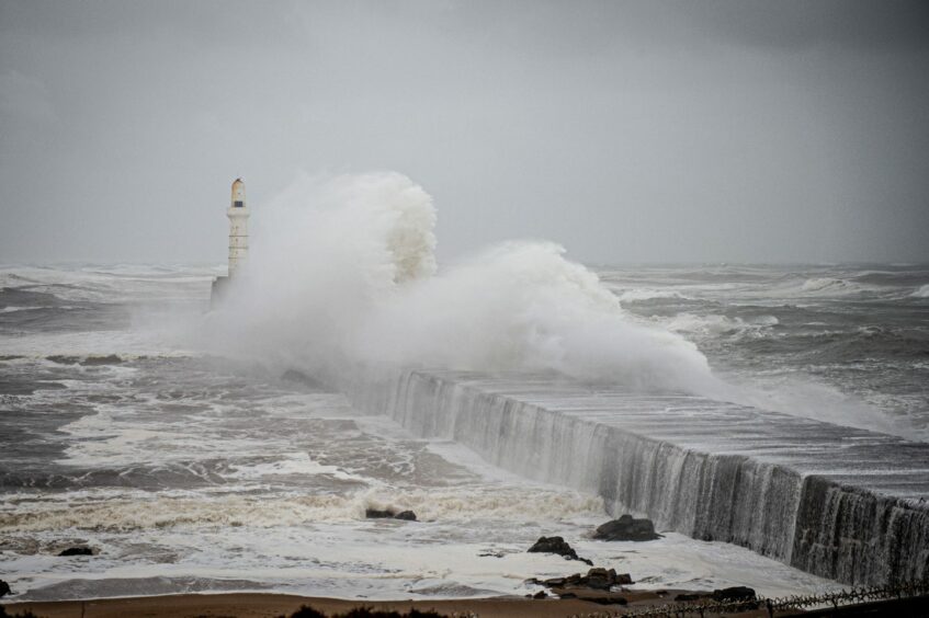
NorthLink ferries to Orkney and Shetland have suffered cancellations since Tuesday due to stormy sea conditions.
All of Friday evening’s services were cancelled, with passengers warned cancellations could continue into Saturday.
Over on the Western Isles, though the forecast isn’t as bad, a number of CalMac ferries are subject to cancellations.
These include:
- Uig – Lochmaddy
- Uig – Tarbert
- Oban – Colonsay
- Oban – Lochboisdale
- Tayinloan – Gigha
- Fionnphort – Iona
The latest information can be found on CalMac’s Twitter page.
Photos show the impact of the weather across the north-east


We will update this article throughout the day with the latest disruption.
Conversation