Calendar An icon of a desk calendar. Cancel An icon of a circle with a diagonal line across. Caret An icon of a block arrow pointing to the right. Email An icon of a paper envelope. Facebook An icon of the Facebook "f" mark. Google An icon of the Google "G" mark. Linked In An icon of the Linked In "in" mark. Logout An icon representing logout. Profile An icon that resembles human head and shoulders. Telephone An icon of a traditional telephone receiver. Tick An icon of a tick mark. Is Public An icon of a human eye and eyelashes. Is Not Public An icon of a human eye and eyelashes with a diagonal line through it. Pause Icon A two-lined pause icon for stopping interactions. Quote Mark A opening quote mark. Quote Mark A closing quote mark. Arrow An icon of an arrow. Folder An icon of a paper folder. Breaking An icon of an exclamation mark on a circular background. Camera An icon of a digital camera. Caret An icon of a caret arrow. Clock An icon of a clock face. Close An icon of the an X shape. Close Icon An icon used to represent where to interact to collapse or dismiss a component Comment An icon of a speech bubble. Comments An icon of a speech bubble, denoting user comments. Comments An icon of a speech bubble, denoting user comments. Ellipsis An icon of 3 horizontal dots. Envelope An icon of a paper envelope. Facebook An icon of a facebook f logo. Camera An icon of a digital camera. Home An icon of a house. Instagram An icon of the Instagram logo. LinkedIn An icon of the LinkedIn logo. Magnifying Glass An icon of a magnifying glass. Search Icon A magnifying glass icon that is used to represent the function of searching. Menu An icon of 3 horizontal lines. Hamburger Menu Icon An icon used to represent a collapsed menu. Next An icon of an arrow pointing to the right. Notice An explanation mark centred inside a circle. Previous An icon of an arrow pointing to the left. Rating An icon of a star. Tag An icon of a tag. Twitter An icon of the Twitter logo. Video Camera An icon of a video camera shape. Speech Bubble Icon A icon displaying a speech bubble WhatsApp An icon of the WhatsApp logo. Information An icon of an information logo. Plus A mathematical 'plus' symbol. Duration An icon indicating Time. Success Tick An icon of a green tick. Success Tick Timeout An icon of a greyed out success tick. Loading Spinner An icon of a loading spinner. Facebook Messenger An icon of the facebook messenger app logo. Facebook An icon of a facebook f logo. Facebook Messenger An icon of the Twitter app logo. LinkedIn An icon of the LinkedIn logo. WhatsApp Messenger An icon of the Whatsapp messenger app logo. Email An icon of an mail envelope. Copy link A decentered black square over a white square.

Fears Moray village could become an ‘island’ despite coastal erosion works

Kingston's defences will be bolstered, but there are worries they will not stretch far enough along the coast.

Collage of Jim Mackie on right and Kingston coastline from drone footage.
Innes Community Council member Jim Mackie has significant concerns about coastal erosion in Kingston. Image: Jim Mackie/DC Thomson

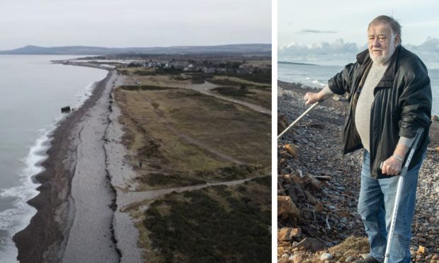
Fears have been raised that Kingston at the mouth of the River Spey could become an “island” – despite new flood prevention work planned.

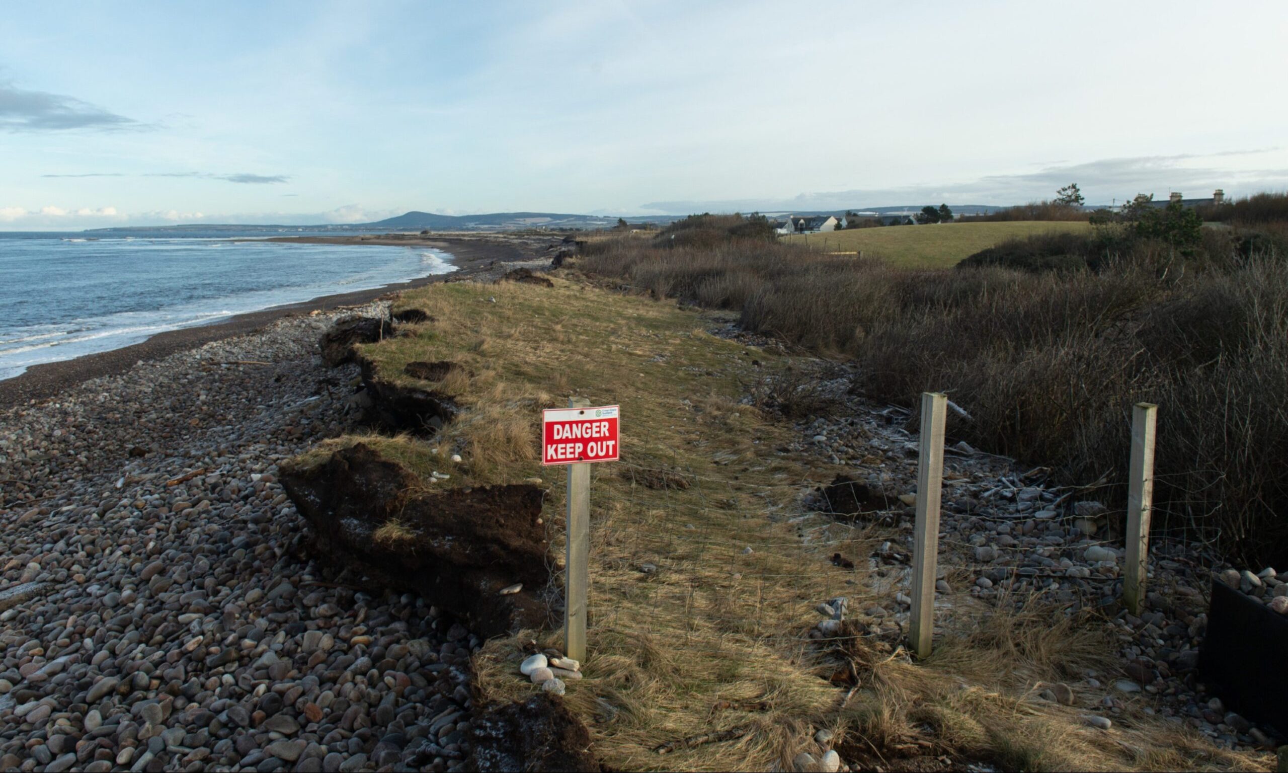
The Moray village is repeatedly issued with flood warnings throughout the year by Sepa due to risks from high tides and river levels.

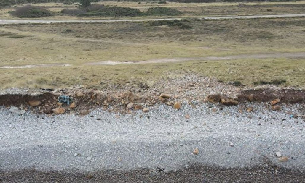
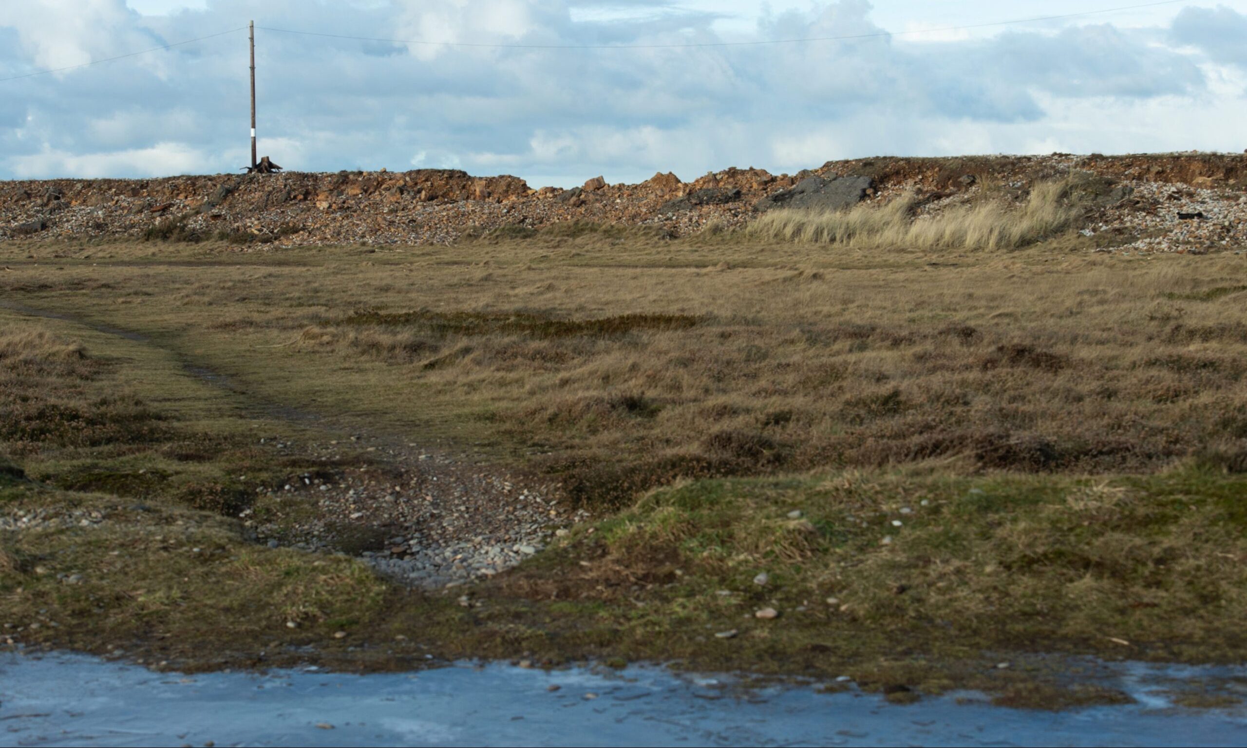
Erosion from repeated storms now threatens the council’s beach car park with the remains of a now-demolished concrete works now exposed.

A new shingle bank nearly 2ft high has been commissioned by Moray Council to protect the area.

However, concerns have been raised the new Kingston defences do not stretch far enough and water could merely pour round the end of it instead. This could potentially turn the village into an “island” isolated by flooding.

Shingle barrier viewed from drone.
Jim Mackie is concerned about a hole developing in the shingle barrier at Kingston. Image: Jim Mackie

Could Kingston be made an island in high tides?

The main road access to Kingston is already repeatedly closed when the River Spey pours across the golf course, fields and through streets in Garmouth.

When that happens, access to the village is maintained through the narrow single-track Cadgers Road to the west.

Innes Community Council member Jim Mackie has been tracking the changes on the coastline using a drone for nearly two years.

Jim Mackie on Kingston coastline.
Jim Mackie regularly inspects changes to the Kingston coastline. Image: Jason Hedges/DC Thomson

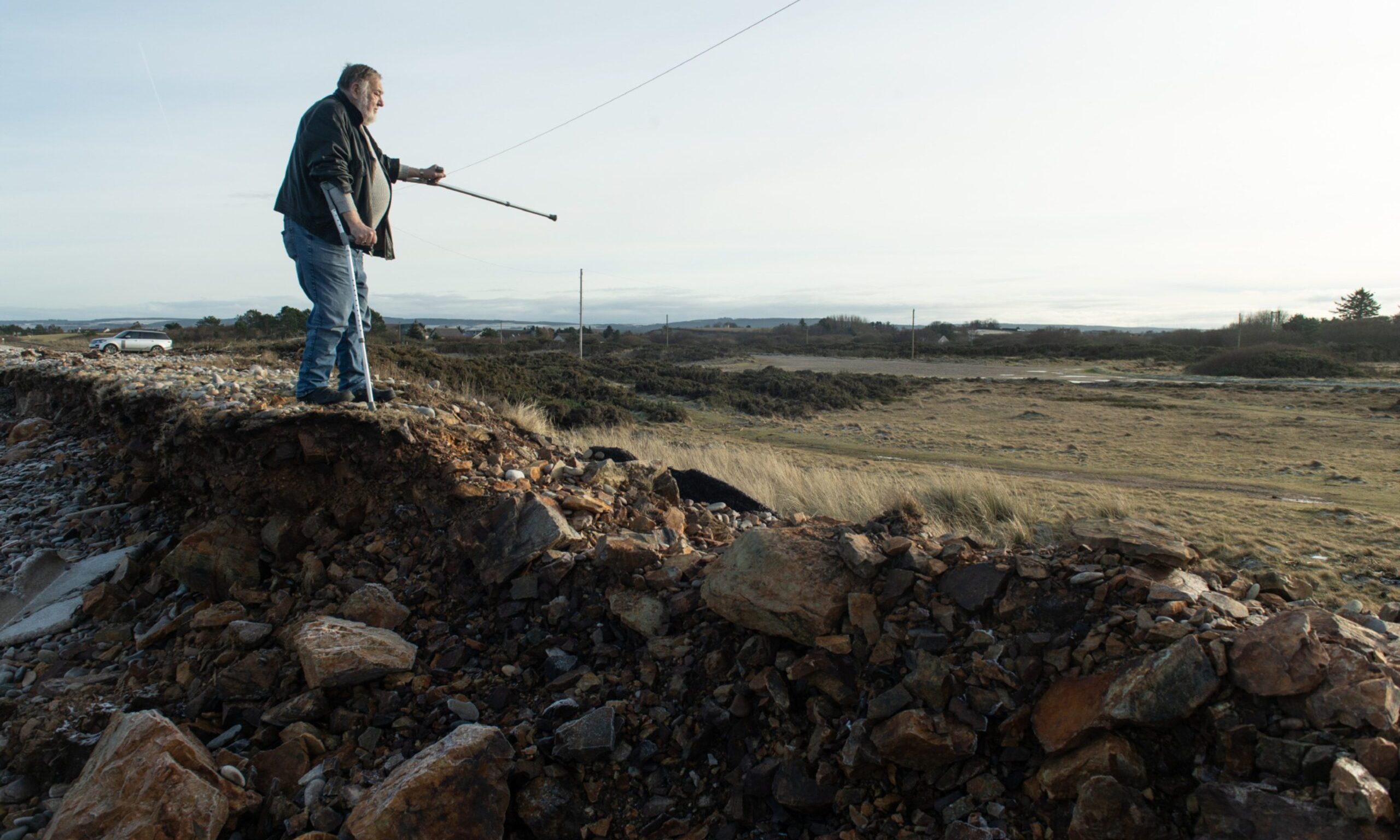
He believes a hole is developing less than 200 yards west of the car park, which could be breached in a major storm, resulting in water merely bypassing the planned new shingle defence.

Mr Mackie said: “Kingston beach has taken a pounding recently. The area to the west of the car park is now under serious danger.

“When a storm hits the water will come over the top and into the burn. It would cut off the only other access to the village.

“Kingston would then be an island. The village would be isolated completely.

“Over past five to six years it’s calculated that coastal erosion has removed approximately 350,000 cubic metres of gravel in the mile stretch of beach west of the car park at Kingston and along the front of the eroded beach head.

“The gravel has not been properly monitored but it’s assumed that most has gone offshore, drifting towards Lossiemouth and possibly responsible for filling up Portgordon harbour.”

What flooding works Moray Council is planning

Moray Council has warned the coastal erosion and exposed debris near the car park is risking the site of special scientific interest (SSSI) and special area of conservation (SAC) designation for the Kingston shingle bank.

Police have issued warnings about taking away stone from it in the past and this week walkers were told not to take away driftwood.

Kingston coastline with "danger keep out" sign visible.
The stretch of coastline where the Moray Council works are planned. Image: Jason Hedges/DC Thomson

The local authority says taking action at that specific site complies with its erosion policy, which is applicable when its own property is at risk, which includes the car park.

The council is also at risk of prosecution if debris from the car park is damaging the SSSI status.

Officials say they intend to use the Kingston project as a case study for how to better protect other shingle beaches.

Meanwhile, a blueprint to better protect other parts of the coastline, which will include 11 separate local plans, remains in development and is due to be debated in April.

Kingston shingle barrier viewed from inland.
The area of shingle barrier Jim Mackie is concerned about. Image: Jason Hedges/DC Thomson

Marc Macrae, chairman of Moray Council’s economic development and infrastructure committee, said: “Completion of the Moray-wide coastal adaptation plan will be a welcome opportunity to highlight those areas where there is risk and the trigger points at which action may be taken.

I’m pleased the committee has approved the recommendation for the Kingston works in the meantime and I look forward to meeting with the community soon at engagement sessions.”

Conversation