Temperatures are set to plunge across the UK with snow showers expected as Storm Jake sweeps in.
The Met Office has issued yellow warnings of snow, ice and wind, with forecasters saying icy roads could lead to travel disruption during rush hour on Wednesday.
After what is expected to be the warmest winter on record, the arrival of meteorological spring is being marked by this wintry spell which is set to see as much as 10cm of snow on high ground and severe gales in some places.
Met Eireann has issued a national warning for strong winds in Ireland from Tuesday night to Wednesday morning, and this meets the criteria for naming a storm – so Storm Jake has been born.
In the UK, blustery weather is expected during Wednesday morning across south-west Wales and south-west England where isolated gusts of 70mph are possible around exposed coasts, with gusts of 50mph inland.
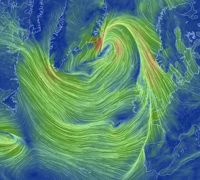
But while Storm Jake will make its way to the UK, the strongest winds will hit Ireland, and the impact on the UK will not be as great as what people have experienced with previously named storms.
#StormJake has been officially named by @MetEireann. Strongest gusts for Ireland with lower impacts for the UKhttps://t.co/G1ywuDBzUr
— Met Office (@metoffice) March 1, 2016
Areas including Manchester, Newcastle, Scarborough and Leeds can expect to see a marked drop of around 5C (41F) or 6C (42.8F) on Wednesday after balmier temperatures of 10C (50F) or 11C (33.8) the previous day.
Showers will turn wintry on Tuesday evening, with the risk of a more prolonged spell of snowfall late in the night and early on Wednesday morning, especially in the south, according to the Met Office warning.
This will give a covering of snow with 2cm to 5cm possible in many places, and locally 5cm to 10cm mainly on ground above 100m.
But Met Office forecaster Alex Burkill said that even within the warning areas, some people may not see snow due to the nature of showers.
Places likely to be hit include Lancashire, the Manchester area and the Peak District, and Mr Burkill said: “With the timing of these wintry showers coming across, you’d imagine there could be some disruption mainly to morning rush hour around those areas.
#Rain turning to #snow for parts of the UK tonight. Warnings have been issued https://t.co/CLJj9SperUhttps://t.co/y0Vlhubp8H
— Met Office (@metoffice) March 1, 2016
“Even if the snowfall’s not that great, we could see icy surfaces if surfaces are left untreated, so drivers should be aware that there could be some disruption to travel.”
Mr Burkill said it would be “noticeably colder” on Wednesday.
The Met Office is due to process the final set of winter temperature readings from weather stations around the UK this week, with 2015/16 expected to be the warmest in some parts since the 17th century.
Preliminary data for the central England temperature series showed an average temperature of 7C (44.6F) this winter, beating a previous high of 6.8C (44.2F) set in 1659.
Early figures also indicate this winter has been the second wettest on record and the warmest for the whole of England and Wales in records dating back to 1910.
The average total rainfall across the country over the winter was 515mm (20.2 inches), coming second only to 2013/2014, which saw widespread storms and flooding.