Pitmedden Forest, Abernethy, Perth & Kinross
The network of trails and paths in Pitmedden Forest are neatly shared by the counties of Perth and Kinross and Fife with the boundary running right through the middle.
Auchtermuchty is the main access point for the southern approaches, while Abernethy is a good starting point if you prefer to come in from the north.
With our weather window open for just a few hours on a stormy Sunday, we decided the latter was the better bet, a shorter journey with the rain and wind scheduled for a dramatic return.
Abernethy sits on the Nethy Burn and its tranquil setting and compact streets make it an instant attraction for tourists. In ancient times the settlement was a stronghold of the Pictish king Nechtan, and was a major religious and political centre.
Our route began at the Round Tower, one of only two of this type remaining in Scotland (the other is in Brechin). It is thought to have been built in the 11th Century, primarily for defence, and it is suggested it may have been the site of the meeting of King Malcolm Canmore and William the Conqueror in the village in 1072.
After a brief look around the tower and adjoining churchyard, we crossed the street and made our way up Kirk Wynd, following signs for Glen Road and passing Williamson Hall on our right, before the road became a rougher lane, marked as Witches Road path.
On reaching a small, disused quarry, a left turn on a path into the trees led us round the edge of fields, through a metal pedestrian gate and then up to another gate and a junction of tracks and signs. After a short navigational discussion we continued straight on, the track becoming grassy and curving right along the field edge until reaching Turflundie.
Signs on the wooden gate pointed the way round the buildings to a track into the forest. We were now on shared cycle trails, although so far we hadn’t seen anyone on a bike.
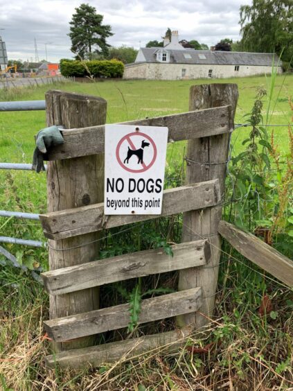
We also started meeting a few dog walkers. Please be aware that although dogs are welcome on the forest trails, there are some restrictions on access through the farmland sections, so the route in its entirety may not be suitable with your four-legged friend.
We made one diversion from the track loop to investigate the mapped blotch of blue tucked away in the trees, but found no water, only mud and reeds.
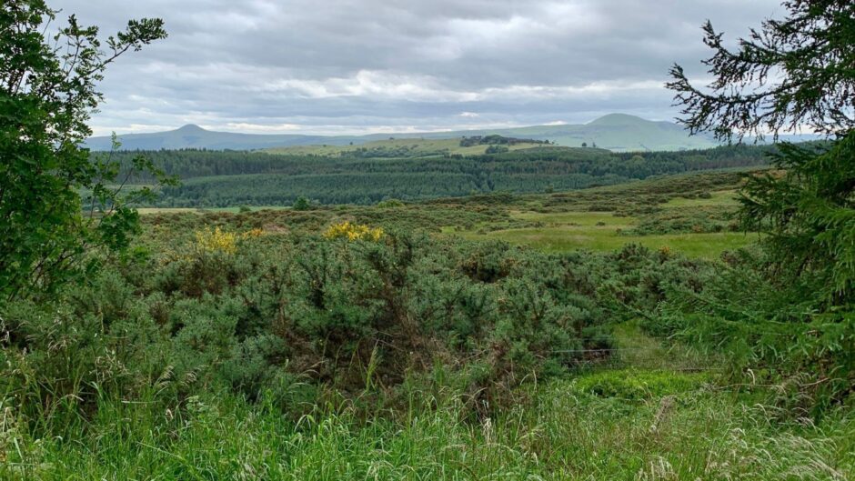
The pines gave way to more mixed tree cover as track continued north-east along the boundary line and gaps opened up to give some fine views to the Lomond hills.
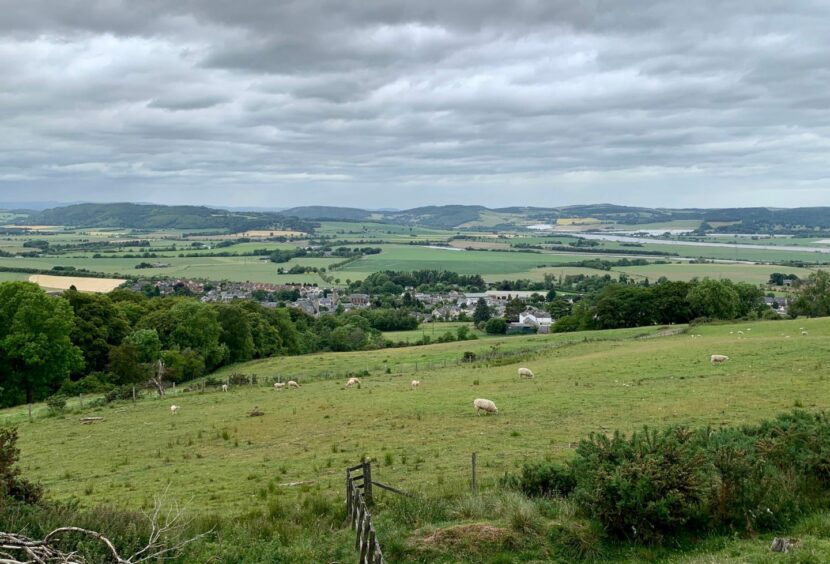
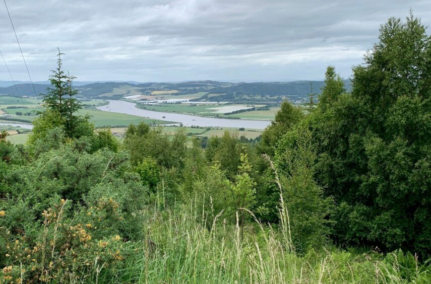
There was a three-way track split beyond a vehicle barrier, the centre option leading up and around Pitcairlie Hill before returning to this point. If this part seems a bit superfluous, rest assured that there is bench and a view over the Tay at the top of the circuit.
The way back to Abernethy was simple, a signed right turn just beyond the barrier leading down a silent, dark tree corridor. When the track curved to the right, we left it for a path which led to a field gate.
With the treeline, wall and fence to the left, and an unbroken wall of nettles to the right, the way forward is obvious even if you do miss the regular signage. Another gate opened on to a muddy farm track which twisted its way downhill, before heading along a series of lanes to reach the main road.
And not only had we beaten the incoming rain, there was even time for an al fresco coffee stop in the shadow of the tower.
ROUTE
1. From Abernethy Tower, cross main street and turn right up Kirk Wynd (signed: Path to Glen Road). Continue on Witches Road (signed) path south to old quarry.
2. Take woodland path on left and follow as it climbs alongside fenced fields and through couple of gates to another signed junction. Go straight ahead, following path for Abernethy Glen, as it curves to right along field edge to Turflundie.
3. Go through wooden gate and head left past buildings as signed, then straight ahead on woodland track. At signed junction, go left (Pitmedden Forest paths) and follow loop round to next junction where you turn left again.
4. Keep heading north-east along county boundary until reaching vehicle barrier and meeting of tracks. Take middle one heading straight uphill.
5. Take next left to loop round Pitcairlie Hill and arrive back at vehicle barrier.
6. Pass through and take track on right through dark tree corridor (signed for Abernethy). When track curves right at edge of trees, leave it and take woodland path on left until reaching gate.
7. Turn left on grass path through field with wall and fence to your left to reach another gate.
8. Continue on rough track as it works its way downhill through fields to Gattaway farm. Go to right around farm buildings, walk down lane to A913, then turn left to head back to start.
INFORMATION
Distance: 12.6km/8miles
Ascent: 390m/1280ft
Time: 3.5-4.5 hours
Grading: Well-signed forest circuit suitable for all ages and abilities on good tracks and paths, farm lanes, some pavement walking. Shared cycle trails – watch out for bikes. Dogs are welcome on forest trails but route also passes through sheep fields and there are access restrictions posted. NB: Please remember to close all gates.
Start/finish: Abernethy village centre (Grid ref: NO 189163), small car park off Main Street. If full, there is on-street parking with consideration.
Map: Ordnance Survey 1:50,000 Landranger Map 58 (Perth & Alloa); Ordnance Survey 1:25,000 Explorer sheet 370.
Tourist Information: VisitScotland, Perth iCentre, 45 High Street, Perth, PH1 5TJ (Tel 01738 450600).
Public transport: Buses service between Perth and Glenrothes (No.36).
Conversation