Tom’s Cairn, Finzean, Deeside
There’s far more to the small Aberdeenshire community of Finzean than first meets the eye. Despite a population numbering less than 300, it is scattered over a surprisingly wide area and outsiders could be excused for being momentarily confused by the spread of its constituent parts.
There’s no doubt, however, of its charm. Lying immediately to the north of the Water of Feugh and the old county boundary between Aberdeenshire and Kincardineshire, it is perfectly placed at the centre of green fields and verdant woodland.
Little wonder that the surrounding landscape was a favourite subject for the celebrated 19th Century Scottish artist Joseph Farquharson – the Painting Laird – whose family have owned Finzean Estate since the 1600s.
A network of tracks and paths allows a fine clockwise circuit to be enjoyed, and although you will climb to a height of 310 metres there’s never any great effort, just wonderful views all the way round.
There’s no public transport to the start point, but visitors are welcome to park in the grounds of the Birse and Feughside Parish Church. From there, I crossed the road and headed downhill past a few cottages, then turned right and into the estate grounds.
I took the rough tree-lined drive towards Finzean House, but turned off left on another track heading deeper into the wood. A sharp turn not long after led uphill and eventually to twin paths splitting off – take the left-hand branch – and into muddier territory. Hidden in the trees to the right is the Long Cairn, evidence of Neolithic settlement.
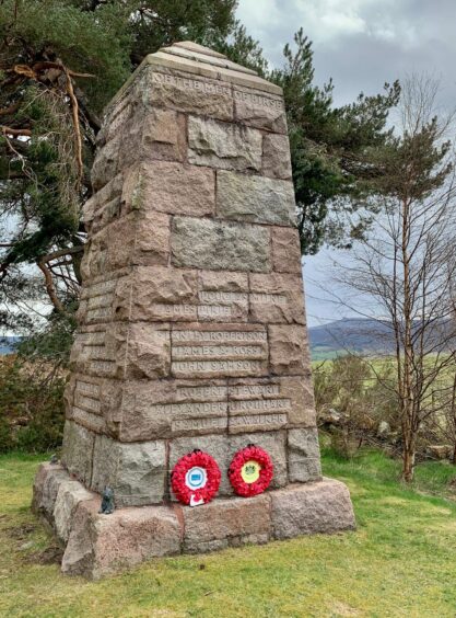
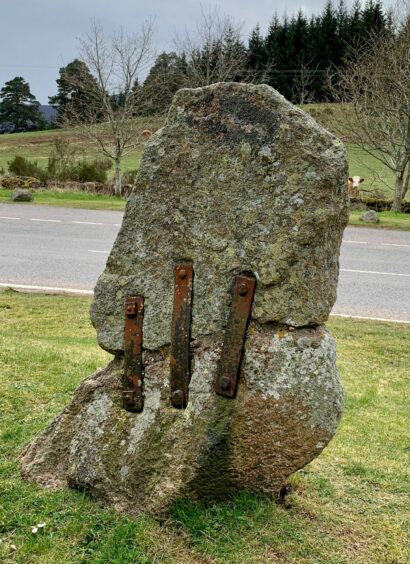
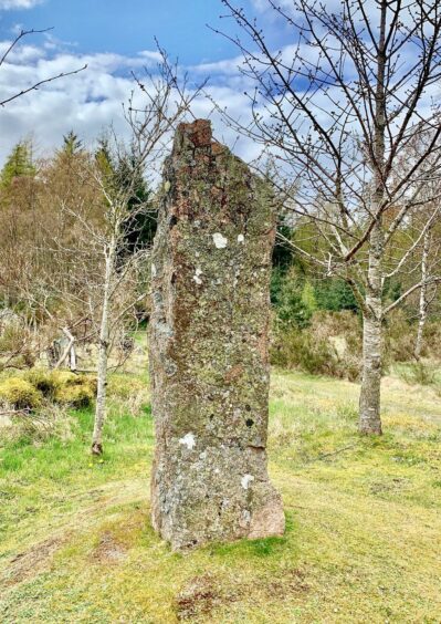
The path led out on to the B976 where there are three stone monuments of varying ages: the Birse Millennium Stone (2000), the Birse Parish War Memorial (1921) and, across the road at the foot of Corsedardar Hill, the ancient Dardanus Standing Stone.
Local legend says that this is the spot where the Pictish king Dardanus was executed after being defeated in battle by the Lords of Scotland in AD76, but it is more likely that it is a Bronze Age slab. It is held together by metal bands, the result of an accident where it was broken in half by workmen.
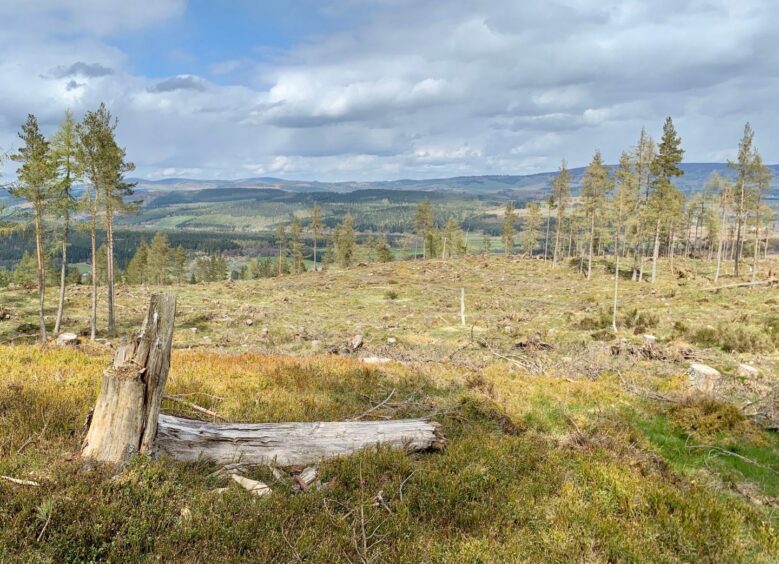
The path headed directly up and over the top of Corsedardar Hill where tree clearance had opened out the views, before dropping to a farm gate.
I went through, following the path round the side of a grassy mound and walked among some spectacularly unbothered sheep who didn’t seem to mind my presence one little bit.
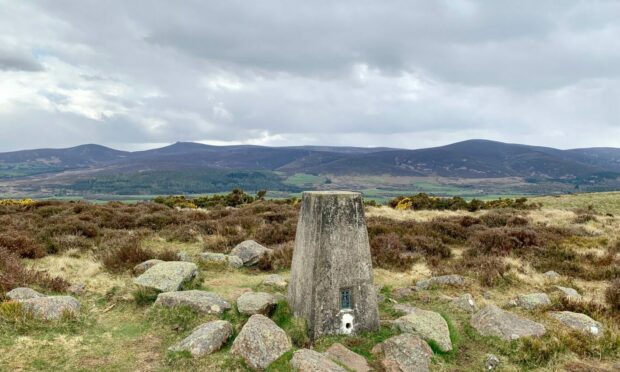
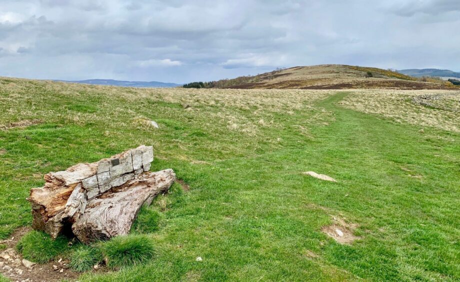
After passing a carved wooden seat which was conveniently positioned for a widescreen view of Clachnaben and its big pals stretched along the horizon, I passed through another gate for the final short rise to the summit of Tom’s Cairn, which had equally breathtaking views.
I retraced my steps for a short distance, then dropped to a high gate and followed a field path on its twists and turns before emerging back on the B976. A sign for Finzean took me left, and just past the school there was access to a path running parallel to the road.
The only obstacle was the excellent farm and coffee shop a few metres from the finish.
One last tip: the ‘z’ in Finzean seems to have been an error lost in time, the correct pronunciation is said to sound more like Fingin’. It may help if you do get lost somewhere along the line.
ROUTE
1. Cross road from church and take minor road opposite which bends left downhill past cottages to join another road.
2. Turn right and then almost immediately head right through gates of Finzean Estate. Stay on rough drive for 2km then, as it starts to curve right towards Finzean House, go left on forest road into woods heading south.
3. At next junction go sharp right and stay on main track, ignoring any turns, until it eventually heads right then left to reach entrance to two paths on right.
4. Take left branch through trees, muddy underfoot in places, until it reaches B976 at war memorial where there are also two standing stones.
5. Cross road and head uphill on signed path for Tom’s Cairn. This passes over top of Corsedardar Hill then drops to farm gate.
6. Go through and follow grassy path over sheep fields to another gate, then continue to cairn and trig pillar that mark summit of Tom’s Cairn.
7. Retrace your steps for short distance and when path splits, go right, then left at signpost (for Tillcroy) and follow path down to high metal gate.
8. Go through and head downhill with fence to left. Path turns right along another fence to reach pedestrian gate. Go through and keep following path along field edges until it reaches gate and B976.
9. Turn right and walk up road, then left for Finzean. Just past school on right is access to path which runs parallel with road back to starting point.
INFORMATION
Distance: 10.5km/6.5miles
Ascent: 263m/865ft
Time: 2.5-4 hours
Grading: Easy circuit with gentle ascents on estate roads and tracks, woodland and hill paths plus field edges. Muddy in places, good footwear advised. Section of walking on minor roads on inward leg, plus one road crossing. Dogs under close control in Finzean Estate and around farm livestock – sheep will be encountered on open hill.
Start/finish: Birse and Feughside Parish Church (NO 605925) near Finzean off B976 South Deeside Road.
Map: Ordnance Survey 1:50,000 Landranger Maps 44 (Ballater & Glen Clova) and 45 (Stonehaven & Banchory); Ordnance Survey 1:25,000 Explorer sheet 406.
Tourist Information: VisitScotland, Ballater iCentre, Station Square, Ballater, AB35 5QB (Tel 01339 755306).
Public transport: None to start, nearest buses Aboyne or Banchory
Conversation