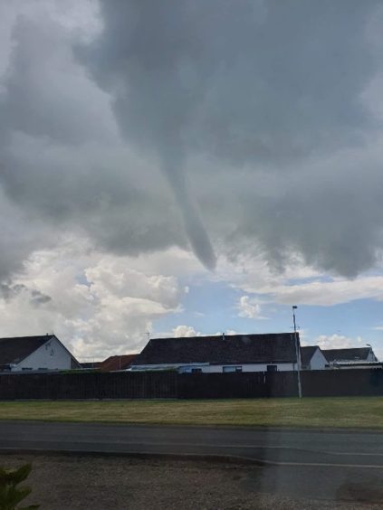
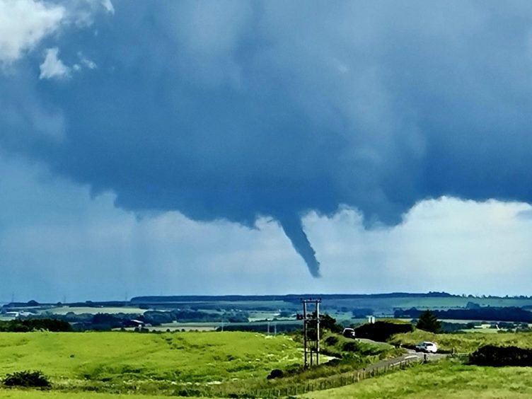
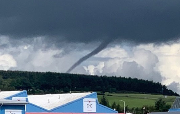
Weather watchers in the north-east were left surprised with the appearance of a rare sighting in the skies.
While the region contended with thunder and lightning – and a series of torrential downpours – it was an unfamiliar sight hovering above Dyce in Aberdeen that grabbed the most attention.
Thought to be a funnel cloud, the weather pattern is the first step towards the development of a tornado.
It is only when the cloud makes contact with the ground that it can be described as a tornado or, if it lands at sea, what is known as a waterspout.
When that does happen, the pressure of the clouds forms a “vortex”, suddenly generating high-powered and extremely destructive winds to swirl around it.
It is thought a funnel cloud appeared over Dyce, rather than it connecting with the earth’s surface to form a tornado.
A Met Office spokesman said it was difficult to provide a conclusive answer.
He said: “Because of the horizon being obstructed by the hill, it is hard to say, but it looks like a funnel cloud.
“If you could see the full horizon you would be able to see if it was a tornado or not.”
In the UK, funnel clouds generally look more like “thin, dangling” ropes rather than the thicker and more intense systems more commonly seen in the US – and the movies and television shows set there.
However, tornadoes are not nearly as rare in the UK as you may think.
The Met Office says between 30 to 35 typically form in the skies over the UK every year, but added it is “very rare” they are strong enough to cause any severe damage to people or property.
And Florin Nedelea captured this amazing image in Cruden Bay.

Marion Rotherham captured the below image while out for a walk. It is looking over to Cruden Bay direction from Strichen.

And the below video was captured by Lesley Jones in Cruden Bay
There were also reports of sightings in Inverurie and Methlick.
