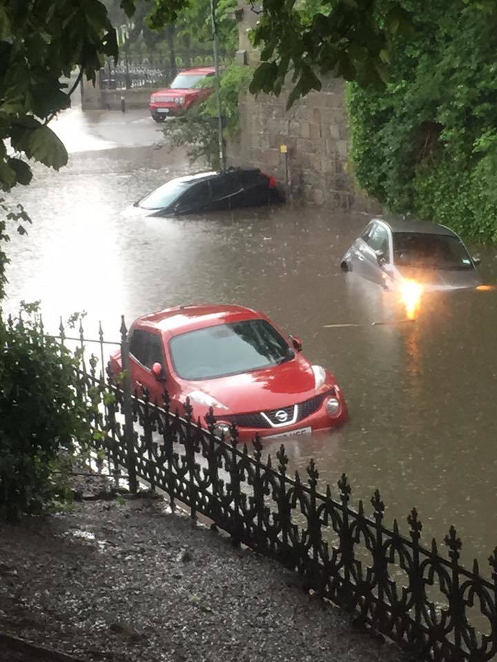
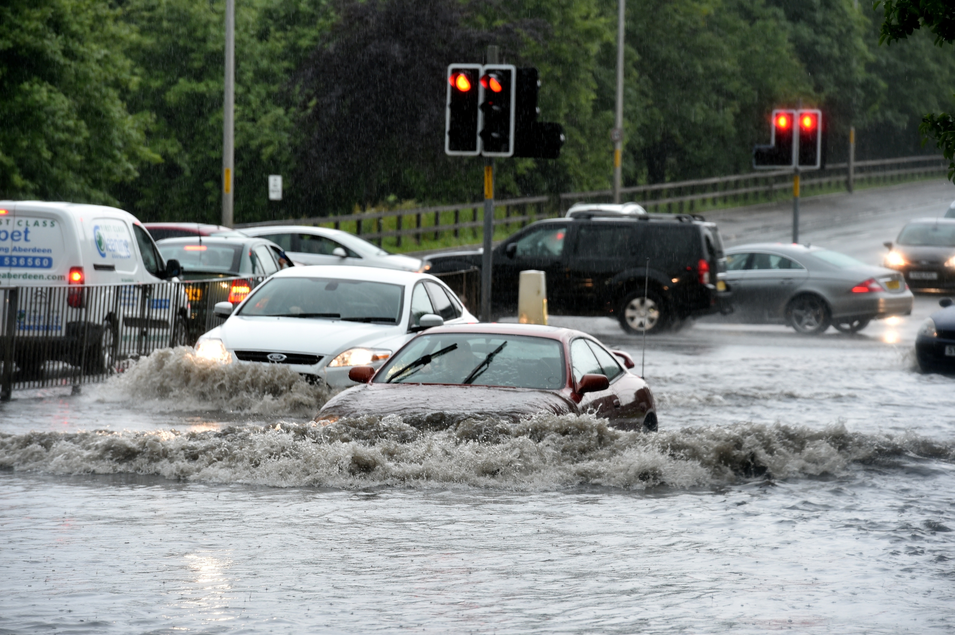
A number of roads across Aberdeen have been flooded as a result of the heavy downpour which continues to batter the city.
Drivers have experienced nightmare conditions on roads across Aberdeen, while buses and trains have been delayed and cancelled and people flying to and from Aberdeen Airport have been hit with a number of problems as the airport terminal has flooded.
Resident have been warned not to drive unless essential, while Aberdeen City Council have also warned that problems on the roads could continue through until tomorrow morning as the rain continues to fall.
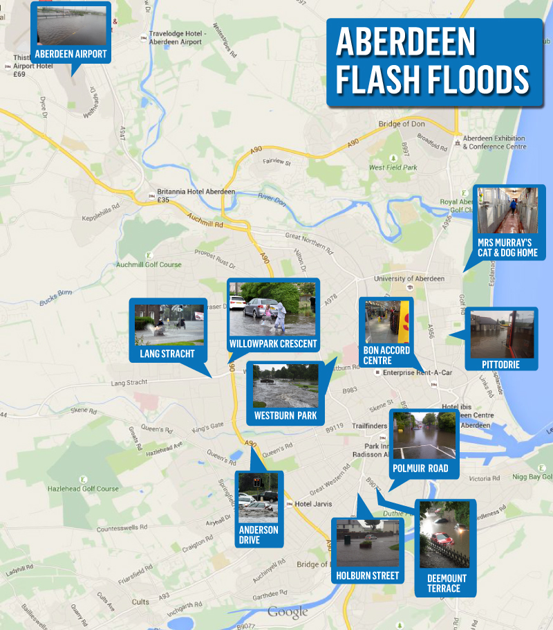
Some of the worst affected roads are Polmuir Road, Holburn Street, Deemount Terrace, Anderson Drive, Market Street, Westburn Park, Willowpark Crescent, the Lang Stracht, Portree Avenue, Froghall Road and Golf Road.
An Aberdeen City Council spokesman said: “Aberdeen City Council has mobilised teams and will be running operations through the night to check the safety of the main roads. Teams will not be able to check for damage until the flooding has subsided.
“As the rain is more persistent than forecast, motorists on their way to work in the morning are advised to be aware there might still be problems with flooding and roads.
“Motorists are asked to be extremely cautious driving through floods if they cannot see the road surface as several man-hole covers and gully covers are known to have lifted. This situation is likely to continue for the next few hours and overnight.
Flooding and traffic causing delays to most services at the moment. Thank you for your understanding – try to stay dry!
— First Aberdeen (@FirstAberdeen) July 7, 2015
“Roads across the city have been affected, particularly in the city centre and beach area, along with Ferryhill and near the River Dee.
“Streets known to be affected by flooding include Polmuir Gardens, Jack’s Brae, Holburn Street, Anderson Drive, Market Street (south-bound between Virginia Street junction and Union Square turn-off), Hardgate, Portree Avenue, Froghall Road and Golf Road.
“The Maritime Museum and The Winter Gardens in Duthie Park have both been closed.
“Roads are likely to be affected for several hours, with the water levels predicted to rise and fall during this time.
“The Tullos Road Depot has extra vehicles out just now, including gully cleaners.
“Traffic lights have been reported as having failed at the Victoria Road/South Esplanade junction and the City Council is working to resolve the problem.”
Aberdeen City Council is delivering sandbags to homes and businesses in the affected areas, while resudents can also collect sandbags from the councils Tullos Road Depot, which will be open until 8pm, while there will also be a night watch staff member on all night.
UPDATE: Trains services between Edinburgh/Inverness & Aberdeen/Inverness/Inverurie may be cancelled/delayed/revised till 20.00
— ScotRail (@ScotRail) July 7, 2015