Peter Ranscombe looks at eight examples of transport, tourism and communications infrastructure across the north that are under threat from climate change, along with some of the steps being taken to protect them.
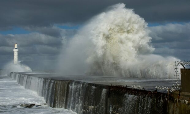
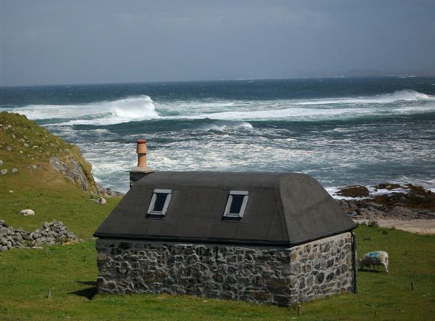
A836 near Dunnet Bay
Lying between Thurso and John o’ Groats, Dunnet Bay is one of the many attractions on the North Coast 500 driving route, which leads tourists in a loop north from Inverness to explore the Highlands.
The A836 near Dunnet Bay is one of the examples of roads at risk of coastal erosion highlighted by Dynamic Coast, a research project run by Glasgow University and funded by the Centre of Expertise for Waters, NatureScot, the Scottish Government, and the St Andrews Links Trust.
A report published in 2000 by Scottish Natural Heritage, the forerunner of the present NatureScot, highlighted the risk to cultural heritage sites along the Caithness coastline from climate change, including at Dunnet Bay, with wind and waves identified as potential threats.
A9 near Helmsdale
The Dynamic Coast project identified the A9 between Inverness and Wick as another road under threat from coastal erosion, including near Brora and Helmsdale.
Bear Scotland, which maintains trunk roads for Scottish Government agency Transport Scotland, said: “Currently, there are no concerns from our team or Transport Scotland regarding coastal erosion affecting the A9 at Brora and Helmsdale and no improvement measures are proposed at this time.
“Our teams continue to complete regular inspections on our trunk roads to identify and address any emerging issues.
“This ensures the network remains in a safe and reliable condition for road users.
“We are aware of the impacts that climate change can have on the environment and resulting challenges on the trunk roads we manage and maintain.”
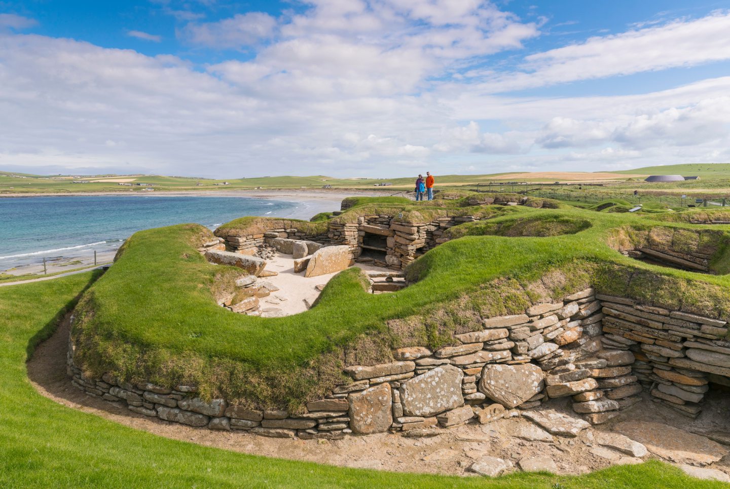
Skara Brae on Orkney
In 2018 Historic Environment Scotland (HES), the public body that manages 336 properties around the country, identified 28 of its sites that were at “very high risk” from flooding or erosion, and a further 160 at “high risk”.
It triggered a 10-year repair and maintenance programme costing £65 million.
The work has included looking at the seabed around Skara Brae, a neolithic village in Orkney, to see if natural solutions can help to protect the United Nations’ world heritage site from erosion.
Ironically, Skara Brae was only discovered following coastal erosion caused by a storm in 1850.
A sea wall was erected in the late 1920s after one of the village’s houses had been destroyed by a storm earlier in the decade.
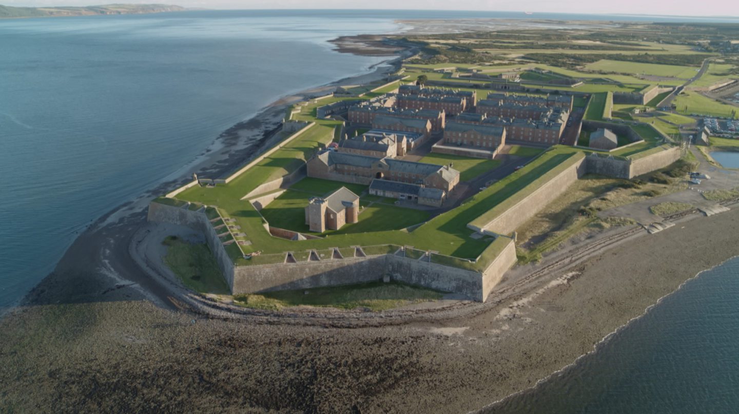
Fort George
Standing on the shore of the Moray Firth at Ardersier, between Nairn and Inverness, Fort George was built in the aftermath of Culloden to house Highland regiments.
The base remains home to the Black Watch, the third battalion of the Royal Regiment of Scotland, but is also managed by HES as a tourist attraction.
As part of its £65m of repairs and maintenance to its properties, HES has installed rock armour to protect the fort from coastal erosion and marine flooding.
The project – along with the work at Skara Brae – was used as a case study last year (2020) by the Institution of Civil Engineers in its “state of the nation” report into the need to protect Scotland’s infrastructure from climate change.
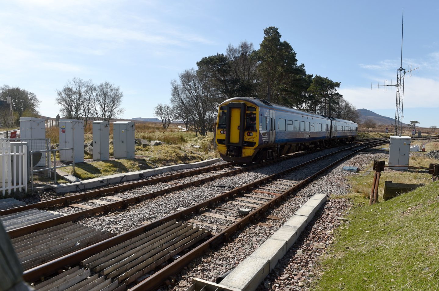
Far north railway line near Brora
The far north railway line links Inverness with Thurso and Wick in Caithness, snaking through Ross & Cromarty and Sutherland along the way.
As well as the A9, the Dynamic Coast project also pointed to the far north line as being at risk from coastal erosion, including near Brora and Helmsdale.
The Highlands and Islands Transport Partnership has been running trials on the line to move timber by rail instead of road, underlining the route’s importance as a potential freight corridor, as well as for commuter and tourist passenger services.
Last year’s trials focused on services from Georgemass junction, where the line splits to Thurso and Wick, while next year’s plans feature Altnabreac in Caithness.
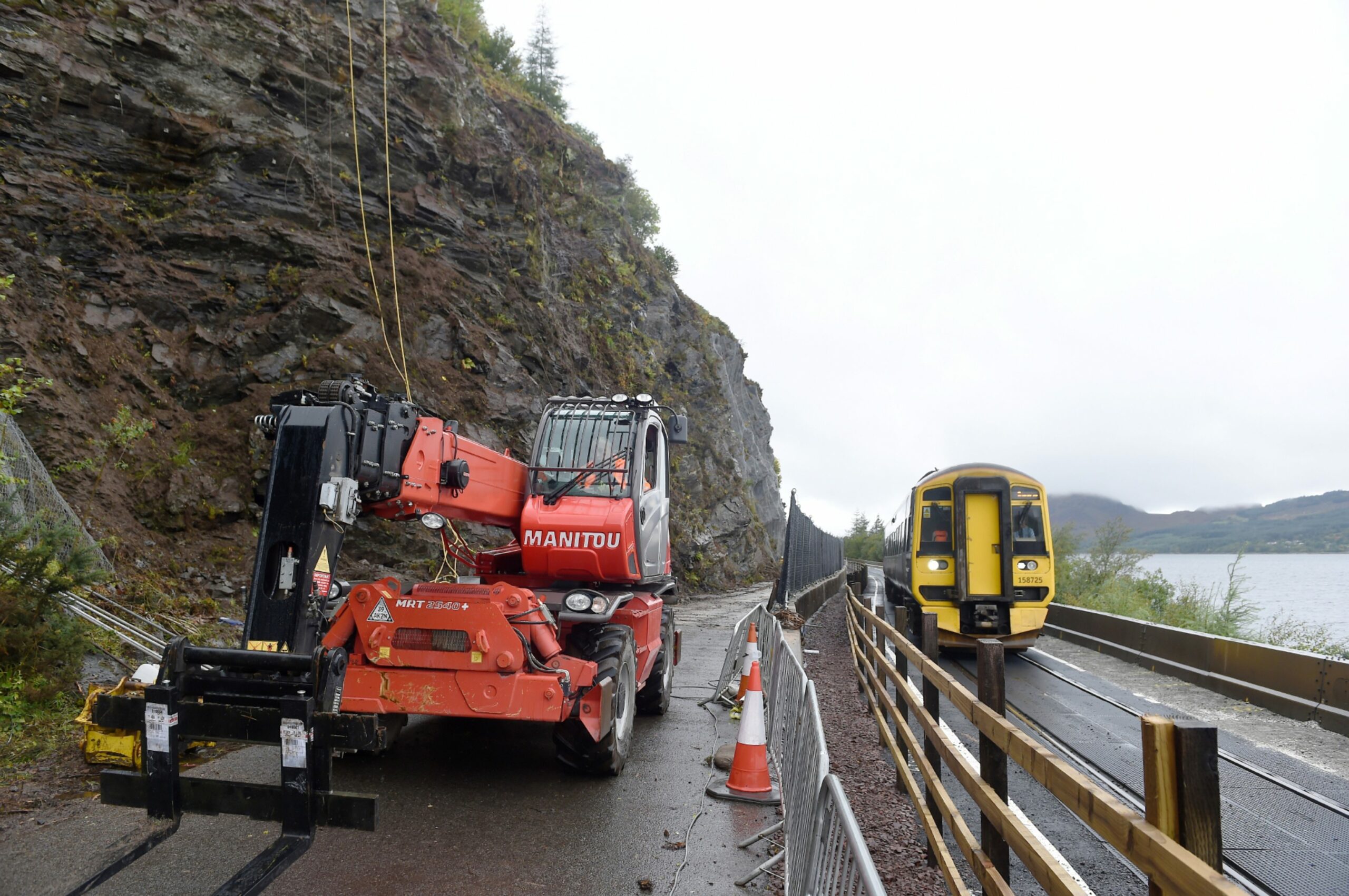
The Kyle line
Once the far north line reaches Dingwall, north-west of Inverness, the Kyle line then branches off to the west, carrying trains to Kyle of Lochalsh – the gateway for travellers crossing to Skye.
In Scotland’s national coastal change assessment, the Dynamic Coast project highlighted the threat from the movement of Loch Carron’s coastline near Attadale.
The report noted: “The land behind is mainly agricultural grazing land, but crucially the main rail line from Inverness to Kyle of Lochalsh runs parallel to the shoreface and only a few metres inland of it.
“Given the rate of past erosion and projecting this into the future, there is concern for the future viability of the rail line.”
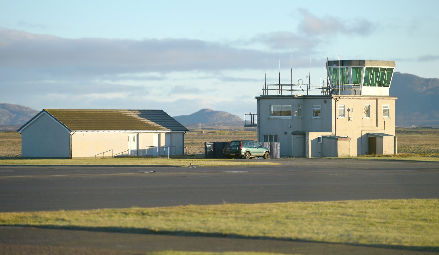
Benbecula airport
The Dynamic Coast project said coastal airports that are affected at present will see more erosion in the future, citing Benbecula Airport in the Outer Hebrides as an example.
In its draft flood risk management plans for 2022 to 2028, the Scottish Environment Protection Agency also noted the threat to the airport from coastal erosion and flooding.
Highlands & Islands Airports (HIA), which operates the site, has made major efforts to secure Benbecula, including £1m of protection work that was completed in 2018 using around 10,000 tonnes from Druim Reallasger quarry on North Uist.
Earlier this year, HIA announced it was to spend £4m to shore up coastal defences at Stornoway Airport, alongside ongoing monitoring at Barra, Benbecula, Islay, Sumburgh and Tiree airports.
Roads on Tiree
Lying west of Mull, the low-lying island of Tiree was identified as being at risk of coastal flooding by the Dynamic Coast project.
In its report, Adaptation and Resilience Options for Central Tiree, the project team said: “There is a need to develop a dynamic adaptive policy pathway for central Tiree to enable existing assets, such as roads, to be relocated if or when their present location become exposed to erosion/flood risks.
“Space on land needs to be identified and safeguarded now to keep open future options, avoid future risks, and reduce the need for some ‘erosion resist’ options.
“Any future erosion of the dune ridge poses a risk of flooding and wave overtopping that will enhance existing road infrastructure damage.”
Climate change and Scotland’s crumbling infrastructure
Islanders warned of ‘unavoidable’ impact of rising sea levels