Glen Ey is worth saving for a fine day when you will see the Ey Burn shimmer as it meanders across its wide, flat floor.
Everywhere is evidence of glaciation; mounds of moraine, kettle holes and huge boulders dropped in jumbled piles as the ice decayed and melted. Look for the perched block, a massive boulder precariously balanced on its small pedestal.
In spring and summer, the sad, eerie call of curlews on the river’s shallows break the silence of the glen. They are more likely to be heard than seen, for they are shy birds. If you are patient though, you will get close enough to see them probe the mud and pebbles with their long, curved beaks for worms and other creatures.
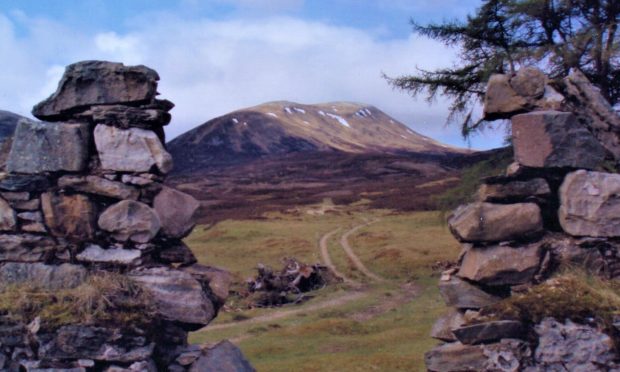
Beyond the third wooden bridge, a stone gable can be seen, this is Altanour. The old building is surrounded by a sward of grass and is watched over by its ring of dark fir trees. Underneath its floor is believed to be a large cellar, the only shelter left in the ruin.
A grand walk begins a little past Altanour, following the Altan Odhar up to the Munro of Carn Bhac. As you climb you will see that the head of Glen Ey is a large basin, once full of the ice that fed the glacier, surrounded by steep-sided hills. Beinn Iutharn Mhor, a second Munro, stands as a grey, scree-aproned wall.
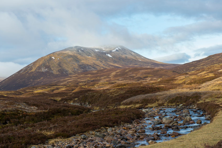
The vegetation here is a carpet of short yellow grass with much dry moss and blaeberry, studded with the pink and purple flowers of tiny Alpines. The schist rock of these hills seems to produce a more fertile soil than the acidic granite to the north.
Carn Bhac is a long ridge running north-east to south-west with three tops. The eastern-most is the highest and has a cap of hard quartzite, which means that the final section up to the cairn is over angular white blocks. The prospect from the top is of an empty mountain land, with no trace of house, road, radio mast or wind turbine.
Follow the ridge to the central top and then the line of the old boundary between Aberdeenshire and Perthshire (unmarked on the ground) south across a big tract of moorland and peat bog. This is a great area to spot mountain hares, much easier when they have the white of their winter coats. They will sit bolt upright and perfectly still to avoid your attentions until you cross their line of tolerance when they will lose their nerve and bound off.
Once the northern wall of the second Munro is reached there is a choice of either scaling the rather daunting screes or walking east to find a less difficult ascent.
On the crest of the ridge, a path will take you to the summit cairn. It is a spectacular walk, following the edge of a deep corrie with precipitous crags. A lochan occupies its base and, for much of the year, a flowing, brilliant-white snow cornice defines the top edge of its cradling walls.
The most direct route back is to follow the path north-east along the mountain’s curved backbone. This continues down the steep nose at the end. Down again on the floor of the glen, the river bank is a good place to rest. The water is crystal clear and has polished the rocks of its bed to show off their coloured bands of minerals.
In spring there is the joyous song of the skylark, rising up to tell all around that this is his territory.
I understand perfectly, for this is a place about which one could sing one’s heart out.
This walk is included in Jack Harland’s new book, Highland Journal 2, In My Stride, available from all local bookshops.
The walk
- Directions: Take the minor road west from Braemar and park at Inverey. Follow the track south into Glen Ey and walk or cycle to the ruins of Altanour.
- Distance: 18.6 miles (30 kilometres), of which 10 miles (16 kilometres) can be cycled.
- Time: 8 hours using a mountain bike.
- Difficulty: A straightforward but long cycle/walk for the hill fit.
- Map used: Ordnance Survey Landranger 43.