Tarbat Ness, Portmahomack, Highland
The striking lighthouse which sits at Tarbat Ness is the third highest in the country and the centrepiece of a fine walk around wild shores.
It was commissioned after the 1826 Moray Firth disaster when 16 ships were lost during a storm, and came into service just four years later having been engineered by Robert Stevenson.
It was automated in 1985 and nowadays is in private hands, but it is still a towering presence on the tip of this headland which retains a real feeling of wildness.

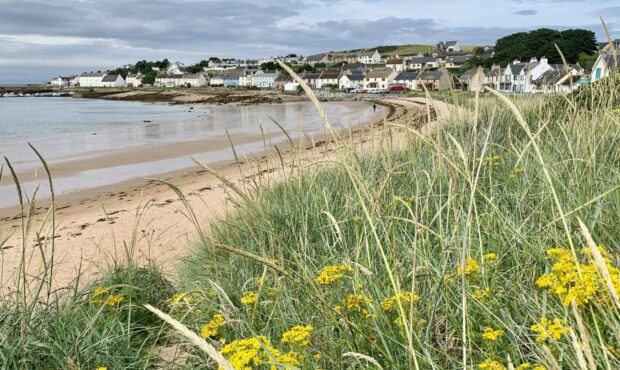
The walk starts from the fishing village of Portmahomack in Easter Ross, reached by a series of minor roads to the north-east of Tain. The settlement dates from 800 AD, named Port ma Cholmag, for Colman, an early Christian saint. It was also held for a time by the Norsemen of Orkney after a sea battle off the coast in 1029.
The scene is somewhat more serene these days as you stroll along the curve of the bay past the row of white-washed houses to the harbour and then out along the western shoreline on a good path. The way ahead is between the emptiness and the endless water to the left, the arable land and cattle fields rising to the right.
There are lots of gates to go through and a few stiles to climb, and there’s always muddy sections to contend with, but the route is obvious with markers and signposts every so often to keep you right.
One smaller stile that could be easy to miss at first glance is below an old fishing bothy, and just beyond that the path splits. It’s better to turn uphill to the top of the gorse wall to head off any tidal problems on the lower line.
As the lighthouse begins to loom in the distance, keep left nearer the shore after passing a little loch and then work your way up to a metal gate in a finely-built wall.
Once through, you have the option of a short detour out to the far tip, a rugged spot to sit and stare at the endless meeting of sea and sky with the possibility of seabird sightings. My visit was also enlivened by the spectacular show of pink and purple heather framing the landscape – and the lighthouse.
Tarbat Ness was once the site of a Roman fort, and legend has it that it was also a meeting place for witches covens. Today it is an important landfall for migrating birds.
The inland leg of the walk down the eastern shore has an even wilder feel: once you turn away from the small jetty, the path becomes more overgrown, the sandy inlets more isolated, and the noise of the gulls on the cliffs more raucous.
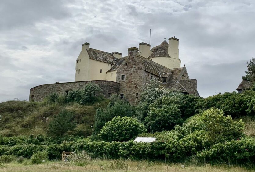
The path takes one short diversion uphill (signed) to outflank a cliff but soon returns to shore. Further on, you pass beneath the imposing Ballone Castle. Built in the 16th Century, it lay in ruins for many years before being restored as a private dwelling in 1990.

The final stop is the dramatically sited village of Rockfield, where a sharp turn uphill follows a series of twists and turns along quiet minor roads back to Portmahomack.
ROUTE
From beach car parks, walk along shore front to harbour at far end of village. When road ends at houses, keep left on path and go through gate to follow grassy track along coast.
Pass through gate, then soon cross fence by stile. Continue to another fence which runs parallel to shore and follow it on seaward side. Use stile to cross just before fence runs down to shore rocks then pass old fishing bothy.
Take grassy track round shore and when it forks head right to top of gorse banks. Go through farm gate and follow above sea. Further on, small gate leads through another fence almost hidden in gorse and continue on path soon coming close to grassy shore once more.
Keep left of fence, passing small loch and go through gate. Cross next fence by stile near old wall then head for huge wall which runs close to the sea. Keep left to go through metal pedestrian gate, following path with lighthouse on right.
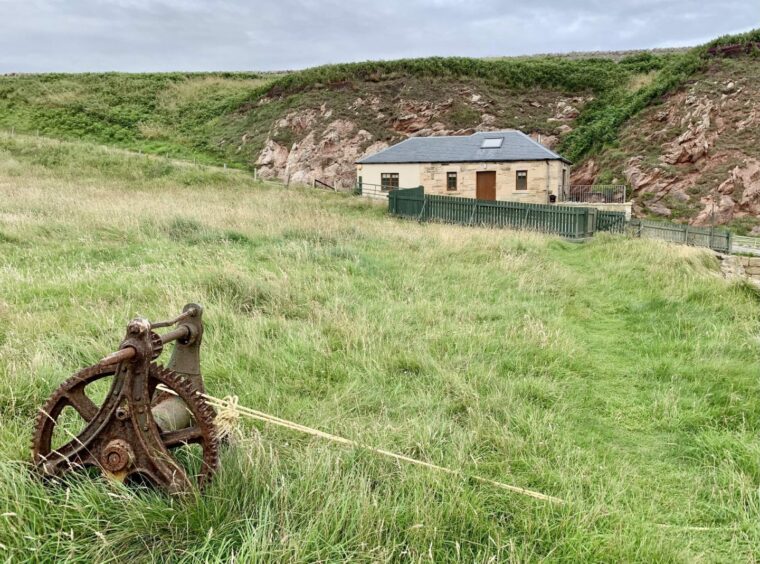
Detour left at path t-junction visits far tip of peninsula. Return and follow path to right, joining track to lighthouse to reach end of public road (car park on left). Continue to next junction and turn left. Pass cottage (Old Salmon Bothy) and before jetty turn right through gate.
Grassy path, overgrown at times, runs along shore above beaches, at one point turning right up to cliff tops (marker posts) before it passes through gate and drops back to shore.
Cross stile with cliff and nesting seabirds to right and keep going along shore, ignoring any tracks climbing away. Pass beneath restored Ballone Castle, staying on shore to cross stile and aiming for village of Rockfield.
Go through gate to Rockfield, then turn right climbing out of village and follow minor road back to Portmahomack.
INFORMATION
Distance: 14km/9miles
Ascent: 135m/443ft
Time: 3.5-5 hours
Grading: Well-signed beautiful coastal circuit from former fishing village to lighthouse at tip of headland, minor ascents, suitable for all ages and abilities on tracks, paths and quiet minor roads. Muddy and damp in places, can be overgrown on eastern shore section. Route passes through cattle fields and sheep also encountered – dogs under close control. Please remember to close all gates.
Start/finish: Beachfront car parks at Portmahomack (Grid ref: NH 914842). No charge but donations welcome.
Map: Ordnance Survey 1:50,000 Landranger Map 21 (Dornoch & Alness); Ordnance Survey 1:25,000 Explorer sheet 438.
Tourist Information: VisitScotland, Inverness iCentre, 36 High Street, Inverness, IV1 1JQ (Tel 01463 252401).
Public transport: Bus service from Tain to Portmahomack (No 5).
Conversation