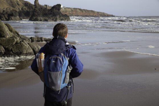
There’s so much to know about the Aberdeen coast and its surrounding areas. Find out more when you acquire East Grampian Coastal Partnership’s Discover Maps.
-
Some Press and Journal online content is funded by outside parties. The revenue from this helps to sustain our independent news gathering. You will always know if you are reading paid-for material as it will be clearly labelled as “Partnership” on the site and on social media channels.
This can take two different forms.
“Presented by”
This means the content has been paid for and produced by the named advertiser.
“In partnership with”
This means the content has been paid for and approved by the named advertiser but written and edited by our own commercial content team.
Maps are an excellent way to find out more about a specific area. They can reveal what a place was like in the past and what it can be in the future.
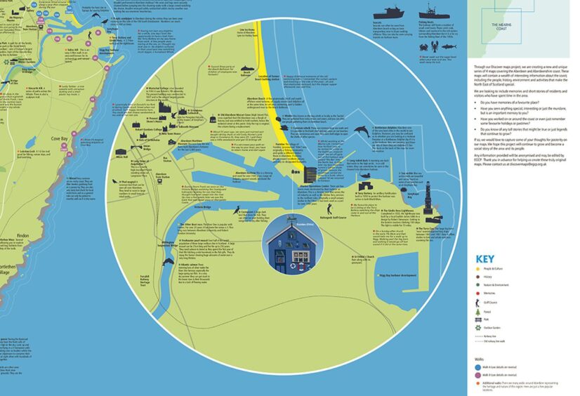
This is why John Watson, a director of the East Grampian Coastal Partnership (EGCP), came up with the Discover Maps project. EGCP created four novel maps of the Aberdeen and Aberdeenshire coastline. Each contains a wealth of information about the coast, including its residents, the local history, environment and activities that make the north-east of Scotland special.
Watch: Learn more about the Discover Maps project
As a former editor-in-chief of The Cartographic Journal, David R. Green, who is now chair and director of EGCP, knows the impact a map can make.
He says: “Maps are great for raising awareness and learning about things. People can use them on a table at home or online. They’re easy to digest visually. You can take a map out on a coastal walk and find things that you wouldn’t normally do.
“With our maps, you’ll discover more about the coastal landscape and features from past events that you wouldn’t find anywhere else. They are unique.
“Our maps also share all sorts of interesting historical information. For example, did you know that Lawrence of Arabia was once stationed at RAF Boddam and lived at Collieston?”
Discover Maps: a record of the region
EGCP started with three illustrated and annotated maps covering the Aberdeenshire coastline between Fraserburgh and St Cyrus. Then it added a fourth map of the Aberdeen coast to the map series.
John explains they were keen to create an archival record of the region.
He says: “We employed a local historian to help us gather information about all the different things that have gone on over time in Aberdeen and Aberdeenshire. So, the maps have become a record of little bytes of information that were maybe hidden away before. These are now all recorded on the maps for each of the different areas.”
EGCP’s folding map of the Aberdeen coast was displayed at last year’s International Cartographic Conference Exhibition in South Africa.
A copy of the folding map will also be held in the British Cartographic Society collection in the Bodleian Library in Oxford.
Discover Maps: also ideal as gifts or wall hangings
Aside from being informative, the folding maps are also visually appealing and very collectible. That makes them an ideal gift to give to someone. Or you can hang them on your wall at home or in your office as a decorative piece and a great conversation starter.
David points out: “Maps are a visual form of communication, one that’s very attractive to lots of people.
John observes: “Each map cover features the artwork of a local artist, Ian Thomson. They’re very nice, a bit retro, almost like 1920s-30s postcard-style.”
Discover Maps: where to get them
PDF copies of the maps can be downloaded for free on the EGCP website and VisitAberdeenshire’s website.
They’ve also been donated to libraries, schools and other public places for feedback and further information gathering for the second issue of the maps.
The printed folding maps are on sale at several local outlets. Visit EGCP’s website for the locations.
They can also be ordered from EGCP’s e-shop and are available on the Ordnance Survey website and from Stanfords Maps in London.
EGCP would like to express its sincere thanks to the following organisations for funding and supporting the Discover Maps Project:
Aberdeen City Council, Aberdeenshire Council, NESFLAG (EMFF Scheme), Shell, University of Aberdeen, VisitAberdeenshire, Visit Scotland, OEUK, Serica Energy, Rockrose Energy, Peterhead Port Authority (PPA), Dennis Maps Ltd., Foyer Graphics, and Avcimmedia.