Calendar An icon of a desk calendar. Cancel An icon of a circle with a diagonal line across. Caret An icon of a block arrow pointing to the right. Email An icon of a paper envelope. Facebook An icon of the Facebook "f" mark. Google An icon of the Google "G" mark. Linked In An icon of the Linked In "in" mark. Logout An icon representing logout. Profile An icon that resembles human head and shoulders. Telephone An icon of a traditional telephone receiver. Tick An icon of a tick mark. Is Public An icon of a human eye and eyelashes. Is Not Public An icon of a human eye and eyelashes with a diagonal line through it. Pause Icon A two-lined pause icon for stopping interactions. Quote Mark A opening quote mark. Quote Mark A closing quote mark. Arrow An icon of an arrow. Folder An icon of a paper folder. Breaking An icon of an exclamation mark on a circular background. Camera An icon of a digital camera. Caret An icon of a caret arrow. Clock An icon of a clock face. Close An icon of the an X shape. Close Icon An icon used to represent where to interact to collapse or dismiss a component Comment An icon of a speech bubble. Comments An icon of a speech bubble, denoting user comments. Comments An icon of a speech bubble, denoting user comments. Ellipsis An icon of 3 horizontal dots. Envelope An icon of a paper envelope. Facebook An icon of a facebook f logo. Camera An icon of a digital camera. Home An icon of a house. Instagram An icon of the Instagram logo. LinkedIn An icon of the LinkedIn logo. Magnifying Glass An icon of a magnifying glass. Search Icon A magnifying glass icon that is used to represent the function of searching. Menu An icon of 3 horizontal lines. Hamburger Menu Icon An icon used to represent a collapsed menu. Next An icon of an arrow pointing to the right. Notice An explanation mark centred inside a circle. Previous An icon of an arrow pointing to the left. Rating An icon of a star. Tag An icon of a tag. Twitter An icon of the Twitter logo. Video Camera An icon of a video camera shape. Speech Bubble Icon A icon displaying a speech bubble WhatsApp An icon of the WhatsApp logo. Information An icon of an information logo. Plus A mathematical 'plus' symbol. Duration An icon indicating Time. Success Tick An icon of a green tick. Success Tick Timeout An icon of a greyed out success tick. Loading Spinner An icon of a loading spinner. Facebook Messenger An icon of the facebook messenger app logo. Facebook An icon of a facebook f logo. Facebook Messenger An icon of the Twitter app logo. LinkedIn An icon of the LinkedIn logo. WhatsApp Messenger An icon of the Whatsapp messenger app logo. Email An icon of an mail envelope. Copy link A decentered black square over a white square.

Lost map sparks Ben Nevis run for GPS units

Post Thumbnail

A member of Lochaber Mountain Rescue Team will take part in the Ben Nevis Race at the weekend to raise money for new navigation equipment for his colleagues.

The team’s decision to buy eight new GPS units followed a particularly difficult rescue during the avalanche season last winter in which members lost their only map of the area.

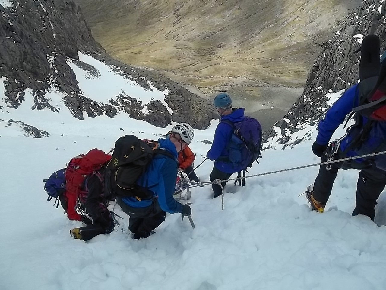
The incident in February of this year involved a solo climber, who escaped injury after falling around 130ft through a cornice at Beinn Eibhinn beside Aonach Beag.

In an online appeal for sponsorship, Martin McDermott said: “After a couple of decades looking after the runners, I decided to enter the race as a runner.”

He added: “Last winter, I was involved in a rescue looking for a climber who went through a cornice.

“I was lucky enough to be with some of the greats on the team and, despite falling through cornices and avalanches, we rescued the climber.

“The weather was awful and we lost the only map of the area.

“Luckily one of us had a mapping GPS, which got us all down the hill. Because of this, the team has bought eight GPS units at a considerable cost.”

Mr McDermott explained that the reason they only had one map between them was because they were sent out of their normal area and the map was lost because it was “jettisoned in favour of a ice axe arrest”.

He added that he had been training “on and off” for a year for the event, which takes place on Saturday.

Following the rescue on Beinn Eibhinn, team leader John Stevenson said: “The conditions were very bad. It was a total whiteout with a lot of deep, heavy snow.

“The team was having real problems. A couple went through the cornice and one guy was avalanched. They were fine because they were roped up.

“You get a wee scare when it happens, but they just kept going until they eventually located the man.

“They pulled him up to the top and it took a while to navigate off the hill.”

Mountain rescue team secretary Miller Harris today said only having one map between them had been “a mistake”.

He said: “The lesson has been learnt. They were doing everything correctly, but they really should have each had their own map.”

Mr Harris added that GPS was a useful tool, but should never be used as the sole form of navigation in the mountains. Each walker or climber should also carry a map and compass and know how to use them.

Anyone wishing to make a donation can do so on the team’s website at www.lochabermrt.co.uk