I did this walk in October with two friends, so it was important to make an early start – we were going to need all of the daylight.
Five minutes from the car park, we heard the first stag roar, and the roaring continued all day.
There were seven miles to be cycled along the rough track, interrupted by two swollen streams, one of which involved some precarious balancing on boulders while pushing our half-submerged bikes over the slippery bed.
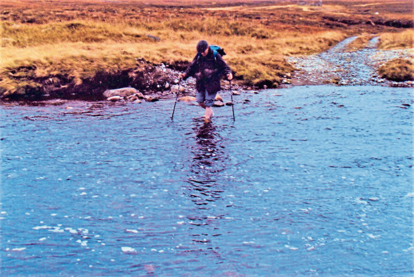
Faced with a wide and deep crossing at the Geldie Burn, we decided to leave the bikes and wade across, our boots tied around our necks. It did not seem too cold at first – but there was no feeling at all in my feet as I emerged on the south bank.
Warm boots back on, we walked at a fast pace along a good track that led west, high above the Geldie Burn. Looking down to the meanders on the river flats, I spotted a large group of hinds in the centre of a bright-green meadow. They all stood still, looking in the same direction. Following their gaze, I saw a mature stag running to meet another who was heading quickly towards the hinds.
They met, then abruptly began a rapid parallel walk, heads up and antlers back. At the end of this, the intruder ran back the way he had come and the champion stag threw back his head and roared. Throughout it all, the hinds barely moved. Not one lowered her head to feed and all eyes were on the stags.
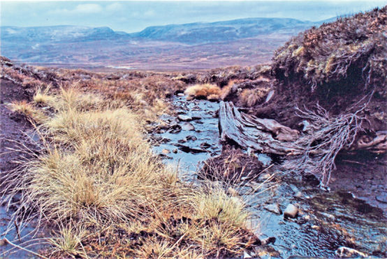
The track ends at the Allt a’ Chaorainn, and the climb up on to Carn an Fhidhleir is hard and relentless over rough heather and bog. The streams on the lower ground have cut into the black peat, revealing the bleached fossils of roots and stumps of the great trees that used to clothe the slopes of this mountain.
The summit cairn is an interesting feature, being the meeting place of Inverness-shire, Aberdeenshire and Perthshire. Streams running down the east side of this mountain run into the Dee, on the south side into the Tay, and on the west side into the Spey.
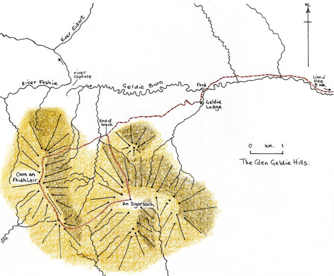
Walk south-east from the cairn, heading for the bealach between the two Munros. The higher starting point makes a difference and it is less of a challenge to climb up to the stony plateau, which is the summit of An Sgarsoch, the place of the sharp rocks.
We sat on the stone benches of the large and well-built shelter cairn. It was a lovely spot for afternoon tea, with the sun warming the rock of the mountain top and the glowing, golden Cairngorms a scenic marvel before us.
After another icy crossing of the Geldie, we cycled back in the gloaming.
In the last of the light, I freewheeled down to the public road with bats, stoking up on late insects, flitting alongside.
This walk is included in Jack Harland’s new book, Highland Journal 2, In My Stride, available from all local bookshops.
The route
- Directions: Take the minor road west from Braemar to Inverey, then continue to the Linn o’ Dee car park. Cycle along the track that goes west from there, and cross the White Bridge. Continue for a further four miles to the ford over the Geldie Burn and leave your bikes to wade across.
- Distance: 25 miles, of which 14 miles can be cycled.
- Time: 10 hours using a mountain bike.
- Difficulty: A long cycle/walk that is only for the hill fit. Beware crossing tributaries of the Geldie with your bike, especially after heavy rain. The crossing of the Geldie itself should not be attempted when in spate.
- Map used: Ordnance Survey Landranger 43.