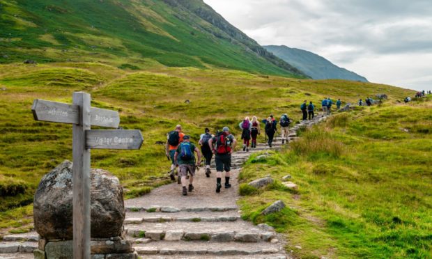
Officials at Ben Nevis are becoming increasingly concerned by the number of people being led astray by online maps while climbing the mountain.
It may seem perfectly logical to check Google Maps for routes or paths when out and about.
But on Britain’s highest mountain, one supposed route has been leading walkers up “potentially fatal” terrain.
The John Muir Trust looks after the highest parts of Ben Nevis.
They have seen increasing numbers of walkers using Google Maps to guide them up the mountain but, depending on how they search for the route, it can take them up a dangerous path.
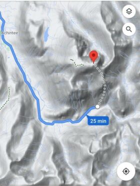
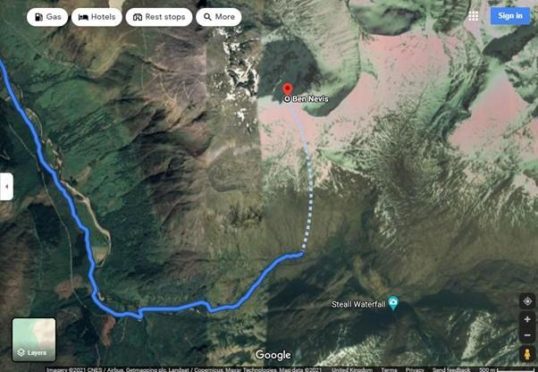
The route appears to be directing walkers to the Upper Falls carpark as the crow flies, away from recommended routes.
This specific area would be difficult for even experienced climbers to navigate.
Nathan Berrie is a conservation officer at The John Muir Trust. He said: “The problem is that Google Maps directs some visitors to the Upper Falls carpark, presumably because it is the closest carpark to the summit.
“But this is NOT the correct route and we often come across groups of inexperienced walkers heading towards Steall Falls or up the south slopes of Ben Nevis believing it is the route to the summit.”
Mountaineering Scotland’s mountain safety adviser Heather Morning spoke of just how dangerous this alternate route could be to follow.
She said: “Even the most experienced mountaineer would have difficulty following this route. The line goes through very steep, rocky, and pathless terrain where even in good visibility it would be challenging to find a safe line.
“Add in low cloud and rain and the suggested Google line is potentially fatal.”
Officials on the mountain have seen many injuries and accidents occur as a result of people following routes downloaded from the internet.
Both Mountaineering Scotland and The John Muir Trust are currently appealing to Google to ensure that the route is removed from their system.
In the meantime, Ms Morning emphasised the importance of getting information from a more reliable source, especially if you are a less experienced climber.
She said: “Modern navigation technology brings some amazing advantages for hill walkers, but this example is clearly not one of them.
“Walkers and climbers with even a little experience will know to read information from a map, whether digital or paper, and if they are looking for downloadable routes know to use reputable sources and check several sources to ensure the information they are accessing is the right route for their level of experience and ability.”
This advice stretches beyond Ben Nevis, as walkers in many other popular destinations have also been victim to dangerous online routes.
If walkers on An Teallach in the north-west followed a certain route provided by Google Maps, they would have found themselves walking off a cliff.
Google response
Google have since responded to reports of the dangerous walking route.
A spokesman from Google said: ”We’ve investigated the issue at Ben Nevis, and have confirmed that our walking directions do not lead people through dangerous routes.
“Our driving directions currently route people to the Nevis Gorge trailhead car park – the lot closest to the summit – which has prominent signs indicating that the trail is highly dangerous and for advanced hikers only.
“To help both novice and experienced hikers more easily find trails that suit their level of expertise, we’re now updating our driving routes to take people directly to the visitor centre, where they’ll be able to speak with staff about the best trail to take.”