Calendar An icon of a desk calendar. Cancel An icon of a circle with a diagonal line across. Caret An icon of a block arrow pointing to the right. Email An icon of a paper envelope. Facebook An icon of the Facebook "f" mark. Google An icon of the Google "G" mark. Linked In An icon of the Linked In "in" mark. Logout An icon representing logout. Profile An icon that resembles human head and shoulders. Telephone An icon of a traditional telephone receiver. Tick An icon of a tick mark. Is Public An icon of a human eye and eyelashes. Is Not Public An icon of a human eye and eyelashes with a diagonal line through it. Pause Icon A two-lined pause icon for stopping interactions. Quote Mark A opening quote mark. Quote Mark A closing quote mark. Arrow An icon of an arrow. Folder An icon of a paper folder. Breaking An icon of an exclamation mark on a circular background. Camera An icon of a digital camera. Caret An icon of a caret arrow. Clock An icon of a clock face. Close An icon of the an X shape. Close Icon An icon used to represent where to interact to collapse or dismiss a component Comment An icon of a speech bubble. Comments An icon of a speech bubble, denoting user comments. Comments An icon of a speech bubble, denoting user comments. Ellipsis An icon of 3 horizontal dots. Envelope An icon of a paper envelope. Facebook An icon of a facebook f logo. Camera An icon of a digital camera. Home An icon of a house. Instagram An icon of the Instagram logo. LinkedIn An icon of the LinkedIn logo. Magnifying Glass An icon of a magnifying glass. Search Icon A magnifying glass icon that is used to represent the function of searching. Menu An icon of 3 horizontal lines. Hamburger Menu Icon An icon used to represent a collapsed menu. Next An icon of an arrow pointing to the right. Notice An explanation mark centred inside a circle. Previous An icon of an arrow pointing to the left. Rating An icon of a star. Tag An icon of a tag. Twitter An icon of the Twitter logo. Video Camera An icon of a video camera shape. Speech Bubble Icon A icon displaying a speech bubble WhatsApp An icon of the WhatsApp logo. Information An icon of an information logo. Plus A mathematical 'plus' symbol. Duration An icon indicating Time. Success Tick An icon of a green tick. Success Tick Timeout An icon of a greyed out success tick. Loading Spinner An icon of a loading spinner. Facebook Messenger An icon of the facebook messenger app logo. Facebook An icon of a facebook f logo. Facebook Messenger An icon of the Twitter app logo. LinkedIn An icon of the LinkedIn logo. WhatsApp Messenger An icon of the Whatsapp messenger app logo. Email An icon of an mail envelope. Copy link A decentered black square over a white square.

North of Scotland prepares to for snow as temperatures of plummet

Forecasters predict many parts of the UK could get snow showers

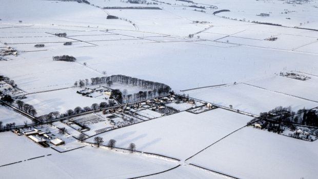
The north of Scotland is preparing for blizzard conditions this morning as a northerly wind brings in arctic air.

The Met Office last night issued a yellow warning for snow for Grampian and the Highlands which is in place until 11am today.

Temperatures will drop dramatically to mid-winter levels as the arctic air sweeps in.

Yesterday in parts of eastern Aberdeenshire it was 13C, while further north in Moray, Inverness and the Highlands it was slightly cooler.

However today a maximum of only 6C is expected in the north and north-east, with temperatures dropping as low as 2C during snow showers.

During the morning clusters of snow showers will form above Caithness and Sutherland.

This area will expand and push down towards Inverness, Moray and Aberdeenshire.

There will be some rain and sleet, which will develop into snow.

At higher levels the showers will be more intense and about 2ins of snow is expected to fall – with inland Aberdeenshire, Moray and the Highlands most likely to see the heaviest snowfall.

The Met Office have warned that this will cause disruption to travel routes, particularly at higher levels, and people have been advised to allow extra time for their journey.

In the afternoon it is expected the wintry showers will ease off as some of the arctic air drifts over the North Sea.

Tomorrow will once again be bitterly cold with a maximum of just 5C predicted.

Some snow is expected in upland areas but lower down rain or sleet is more likely and these showers will be pushed away quite quickly due to strong winds.

Milder conditions are expected to return on Wednesday and Thursday.

Peter Sloss, meteorologist with the Met Office in Aberdeen, explained the cause of the wintry conditions.

He said: “It’s ultimately to do with the jet stream in the atmosphere which has moved further south and the wind direction has changed and we are getting this cold air down from the arctic.

“As we go through Wednesday and Thursday the wind direction will be back towards a westerly and we will start to draw in milder conditions from the Atlantic.

“It will be a fairly short lived cold spell.”