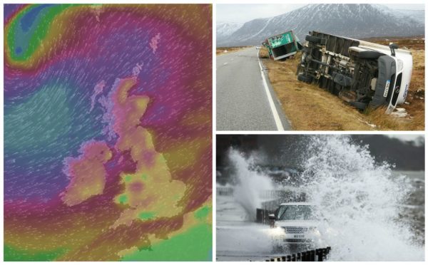
Three lorries were blown from the north’s busiest roads yesterday as storm force winds battered the Highlands and Islands.
Storm Henry brought relentless gale force winds and torrential rain to the region, causing widespread travel problems throughout the day.
Ferry travel was cancelled, rail services were disrupted and roads were closed as Traffic Scotland warned that only essential journeys should be attempted.
Meanwhile, at a weather buoy in the North Sea to the north-west of the mainland, waves reaching heights of 48ft (14.6m) were recorded.
The most severe weather was expected to hit the north overnight – but as of 5pm yesterday the Western Isles had already recorded a gust of wind measuring 89mph on South Uist.
The Met Office issued an amber “be alert” weather warning for wind which remains in place until this morning, as well as a yellow warning for heavy rain which stays in force until 9pm tonight.
Forecasters said winds of 70-80mph are expected, with 90mph gusts possible in exposed areas, especially in the west.
Storm Henry followed hot on the heels of Storm Gertrude, which also wreaked havoc over the weekend with hurricane force winds and heavy snow.
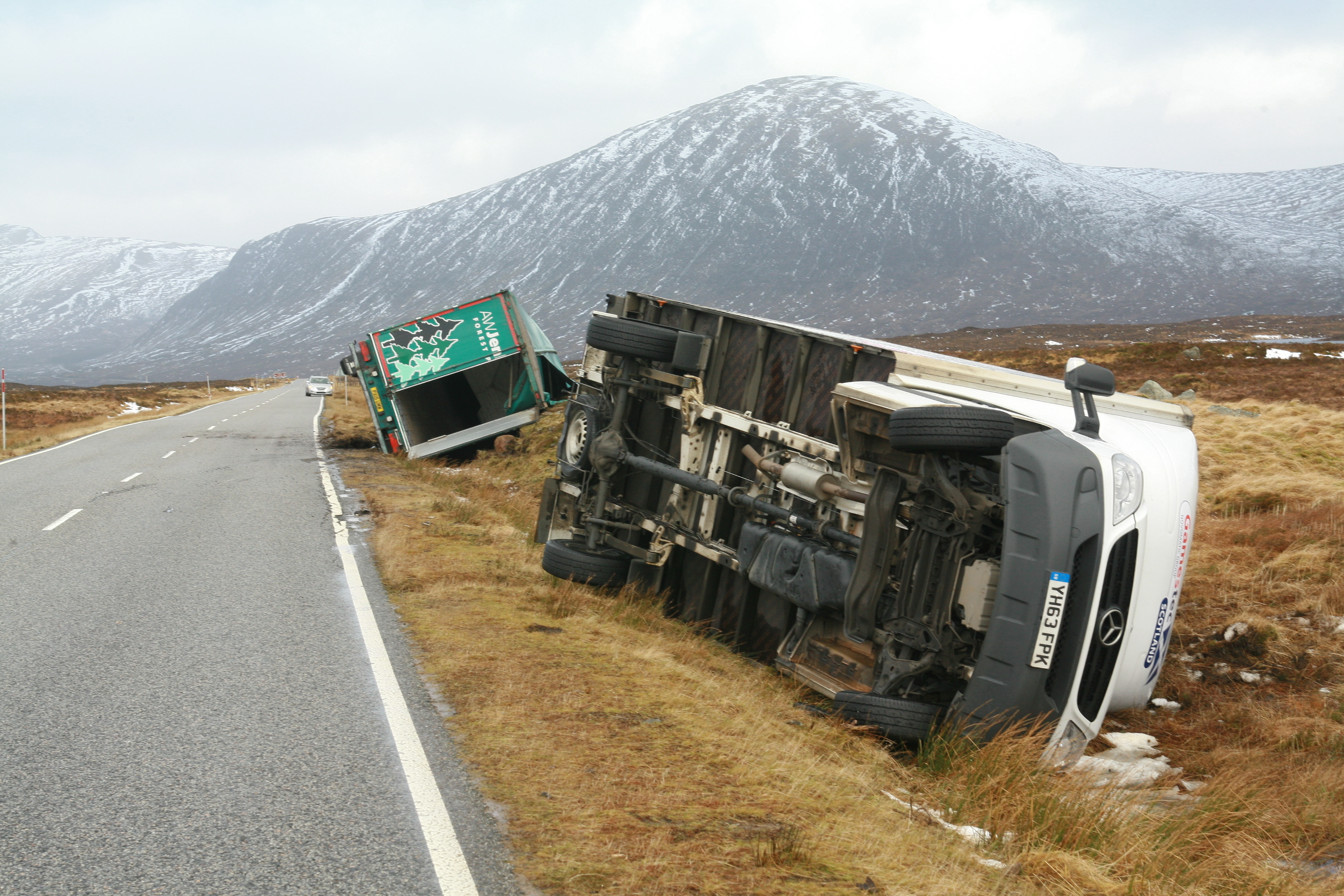
By noon yesterday, three lorries had already overturned on opposite sides of the country.
Fire crews from Lochaber were called to reports of an HGV on its side on the A82 Inverness to Glasgow road near Glencoe Ski Centre at 8.46am.
An appliance from Kinlochleven and two from Fort William had to remove the windscreen of the lorry to free the driver trapped inside.
A heavy rescue unit from Inverness was also called for but was not required.
However the crew were soon sent south to rescue another trapped driver whose lorry had overturned at Rannoch Moor.
The same three fire crews were sent to the scene, where they used cutting gear to free the man.
Police later ruled that only cars were allowed on the route after a van also overturned. Larger vehicles were forced to divert via Oban.
Meanwhile on the east coast, a lorry overturned while crossing the Cromarty Bridge on the A9 Inverness to Thurso road.
The driver managed to escape and did not suffer any injuries.
However it took several hours to recover the vehicle, which had come to rest against one of the parapets of the crossing.
Police closed the bridge to high sided vehicles for most of the day because of concern about the strong cross winds.
Restrictions were also placed on the Kessock, Dornoch and Skye Bridges.
Eddie Ross, Bear Scotland’s north west unit representative, said: “We are doing everything possible to keep roads open however high winds and heavy rain is continuing to affect trunk roads and for safety a number of vehicle restrictions have been implemented by Police Scotland on some routes.”
Schools in the Western Isles also remained closed all day yesterday, although they were expected to re-open this morning subject to a review at 9pm last night.
Many schools in the north-west Highlands also closed early because of the bad weather forecasted.
Police in the Western Isles confirmed that all public transport was cancelled during the period of the amber warning – and also took the time to warn residents not to put their bins out until the wind had died down.
Scottish Transport Minister Derek Mackay said the Scottish government Resilience Room has been activated and was closely monitoring events.
“This latest period of unsettled weather is likely to cause familiar problems for travellers across the country with disruption to ferry and rail services likely,” he said.
“The gale force winds that are forecast are also likely to make travelling conditions particularly difficult for high-sided vehicles and we have already seen restrictions and evens some full closures of bridges today, with further disruption probable.”
Pascal Lardet, SEPA’s hydrology Duty Manager, added that there was a coastal flood risk for the Western Isles “due to storm force winds generating a large surge and waves”.
“Flooding impacts could include disruption to travel, particularly causeways, from spray and wave overtopping,” he said.
“Elsewhere tides are currently low, however minimal impacts from wave overtopping and spray is possible along exposed northern and western coastlines until Tuesday.”
Scottish Hydro Electric Power Distribution said it was operating on “red alert” last night, with extra engineers being drafted into the areas most likely to be affected by power cuts.