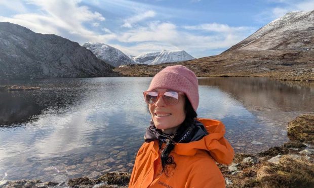
As I planned the final day of a trip spent in and around Torridon, I decided I wanted to give my weary, over-walked legs a bit of a rest.
I’d spent four days hiking up and down hills and glens, covering a fair distance in the process.
So when I spotted a four mile circuit around Beinn Eighe’s stunning national nature reserve, I reckoned it sounded absolutely perfect.
Billed as Britain’s only waymarked mountain trail, I assumed it might be fairly easy. How wrong I was!
Beinn Eighe – a mountain with many peaks and arms – is at the heart of the reserve.
Where did I park?
I parked at the Coille na Glas-Leitir car park, which is two miles from the village of Kinlochewe on the banks of Loch Maree.
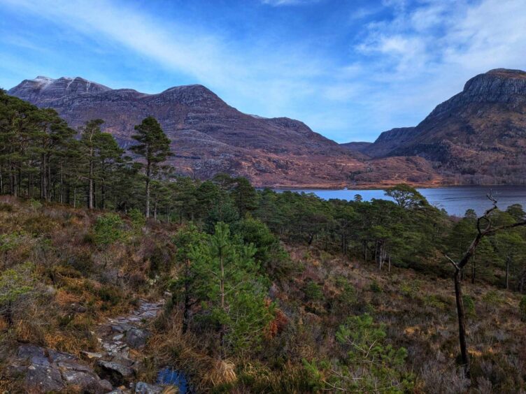
The trail path starts roughly at sea level and begins climbing gently through birch and pine forest.
The Scots pine that dominate on the so-called ‘Wood of the Grey Slope’, have existed here for at least 9,000 years.
Preservation of this forest was one of the main reasons this special site was chosen as Britain’s very first National Nature Reserve – in 1951.
The trail steepens as height is gained, and I strip off layers and pull on my shades when the sun starts to blaze.
Sensational scenery
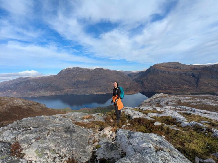
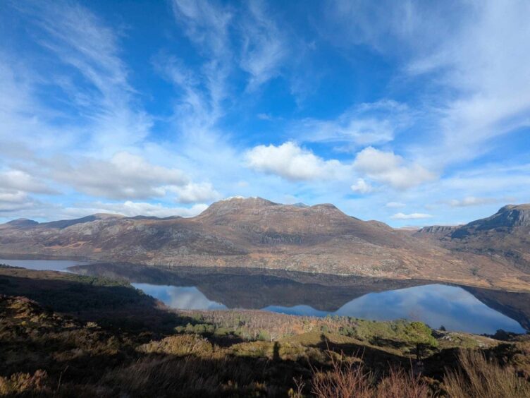
A bridge over the rushing Allt na h-Airighe burn is a great place to pause and take stock of views down through the trees to sparkling Loch Maree, and across to the spectacular 981m peak of Slioch.
The ascent is surprisingly tough on the old calves and thighs, but the waymarked route has been designed to make things a bit easier, with steps carved out of the bare rock in some sections.
Emerging from the pines, (in my case, perspiring profusely), the landscape becomes dizzyingly steep, with precipitous drops to one side, and quartzite crags shimmering in the light.
Look out for the waymarker cairns
Large waymarker cairns – some of which indicate the altitude you’ve reached so far, are there to guide you – but it’s easy to miss a few, so keep your eyes peeled.
One that catches my eye, on a sharp bend, is curiously titled ‘Trumpet Rock’.
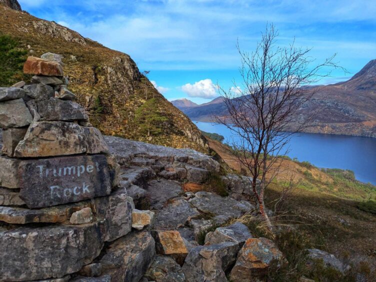
A glance at a booklet I’d picked up at the car park tells me: “Whatever organic sounds last issued from what are now quartzite rocks here fell silent around 540 million years ago.”
Essentially, lumpy surfaces in the rocks were made by “tube-dwelling, worm-like creatures” burrowing into the white sands of a tropical ocean about 500 million years ago.
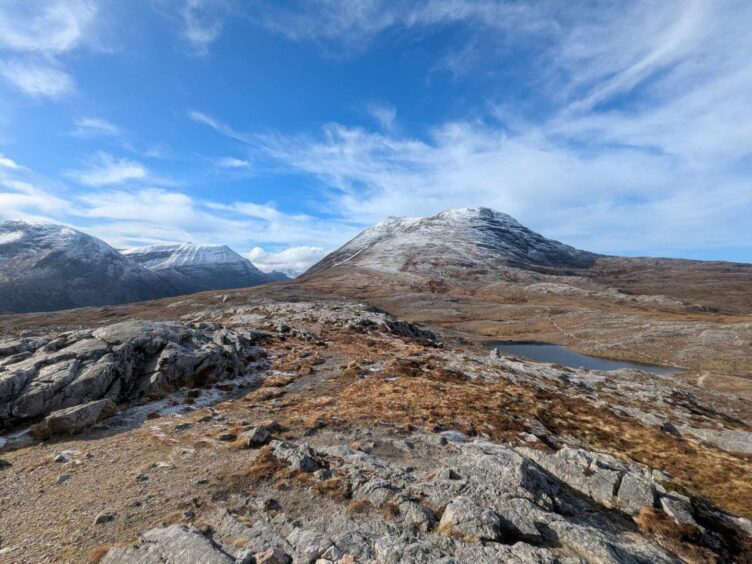
When the gradient finally eases, I stop for a breather on a flattish plateau of quartz that’s been scraped bare by glaciers.
A tragic tale in the glen
Looking down, I spot a delta – an area of low, flat land – where the meandering river meets the loch.
Another peek at the booklet, which encourages you to look back, and then “turn away… perhaps with relief”, reveals a shocking and tragic tale.
PIC
It states: “In the 1300s, followers of the Leod MacGilleandreis (part of the Macleod clan) did battle around Kinlochewe with members of Clan MacKenzie.
“The MacKenzies won, and on the order of Black Murdo of the Cave (the fourth Lord of Kintail), they decapitated the losers and threw their heads in the river.
“Those heads washed ashore at Ath nan Ceann, upstream of what later became known as a good fishing pool.”
Best place to enjoy a picnic?
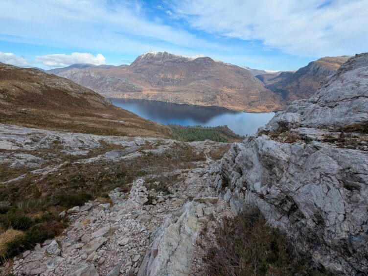
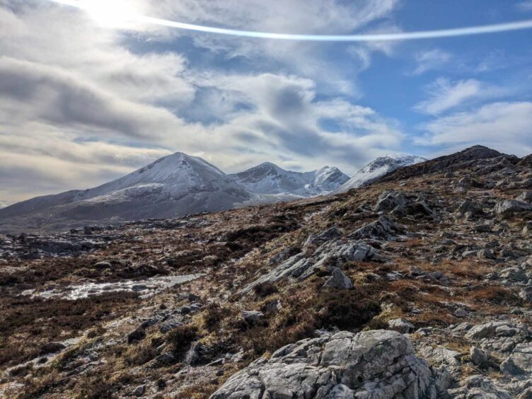
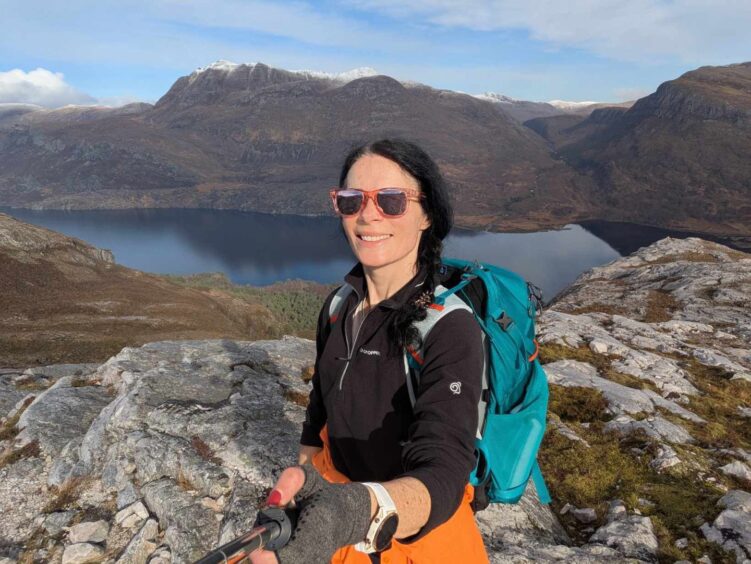
Shuddering at this gory imagery, I continued my uphill slog, and soon reached the highest point of the trail, the large ‘Conservation Cairn’, at 563m.
It was here that I enjoyed my picnic, while drinking in jaw-dropping views of the majestic ridges of Beinn Eighe, Slioch, Loch Maree and the snow-covered Corbett of Meall a’ Ghiubhais.
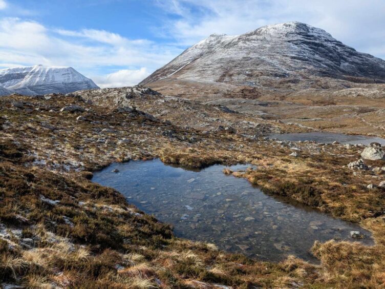
The path descends, passing a series of picture-perfect lochans, some still frozen over, with stones reflected in their shallow waters.
The last is named ‘Lunar Loch’ and no wonder: it’s like a moonscape. It’s the stuff of full-on sci-fi.
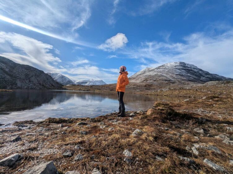
Actually, the loch was named to commemorate the first moon landing on July 21, 1969, but it does look very other-worldly.
Into the cold zone
This much colder ‘arctic-alpine’ zone hosts ground-hugging species, usually confined to Arctic tundra – including plants such as dwarf willow, bearberry and alpine clubmoss.
Named cairns continue to lead the way down, each with a story to tell, including one which points out fossils , and another titled ‘Ice Age’, where a passing glacier has scratched its mark into the quartzite.
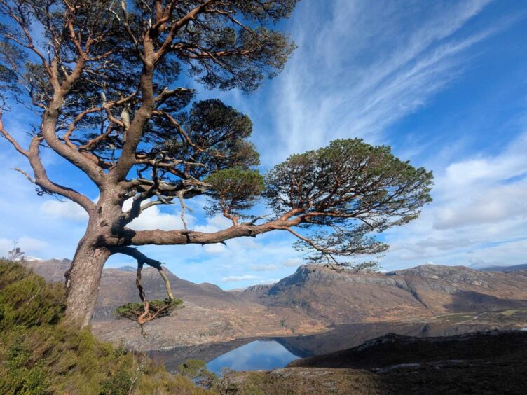
The descent into the forest is pretty steep, but there’s plenty to spark the imagination – tinkling waterfalls, an impressive lone pine tree, and a huge gorge.
The pine is a beauty, and is apparently more than 300 years old – which is only middle-aged in Scots pine terms.
Onto Woodland Trail – and into the loch!
Back down in the pine and birch woods, I soon reached a marker for the ‘Woodland Trail’, which makes an interesting contrast to the scenes enjoyed at higher altitude.
Gone are the barren, scree-and snow-covered mountains, shattered rocks, and scrubby low-level plants and shrubs.
Now, when you look up, you see branches above, green and brown against the sky.
From here it’s about 20 minutes back to the car park.
It’s a joy just to sit and gaze at the awe-inspiring peaks reflected in the still waters of Loch Maree, but me being me, I couldn’t resist pulling on my swimsuit and popping in for a dip.
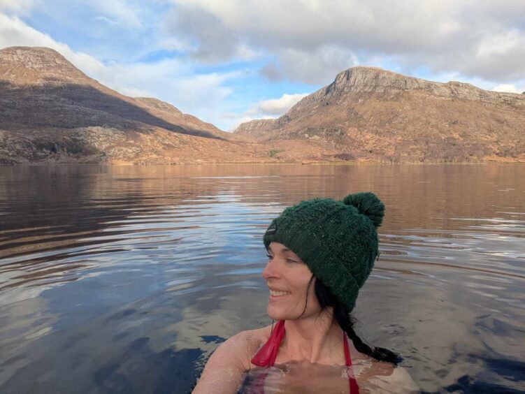
I won’t lie – it wasn’t warm. I stayed in for less than five minutes but wow, what an invigorating experience.
Once I’d warmed up with a flask of coffee – and my teeth had stopped chattering – I reluctantly made the long drive home.
My thoughts on the trail?
I took time to reflect on the fact that the waymarked trail around Beinn Eighe reserve – Britain’s only waymarked mountain trail – was much tougher than I had anticipated.
It’s no walk in the park, and for that reason, while I heartily recommend the trail, I’d suggest leaving plenty of time to admire the views and recover from the steep climbs.
I finished the the walk in just over three hours, but the booklet suggests it could take up to five.
Were it not for the fact that I had to long drive to make, I’d have allowed myself longer to enjoy the experience.
Trail has so much to offer
Essentially, it’s an absolutely cracking walk full of beauty, character, and surprise.
Just remember that mountain conditions can change rapidly – leaving the start point in sunshine doesn’t mean it will be warm or dry at the summit.
So be sure to take layers of warm and waterproof clothing.
Conversation