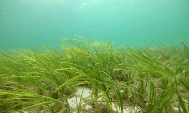
Under the Orkney seas there are whole meadows waiting to be discovered.
Below the surface of the clear waters surrounding the islands lies seagrass – and it turns out these flowering plants are crucial in the fight against coastal erosion, as well as having plenty of other benefits for the marine environment.
Knowing where to find them is vital – and now new technology is being used to locate these secret seagrass gardens around Orkney.
Earlier this year, Project Seagrass and IT and business consulting services firm CGI launched an algorithm which can help locate them.
Conservation charity Project Seagrass, with support from Marine Scotland, started mapping seagrass around Orkney in 2021.
What does seagrass do?
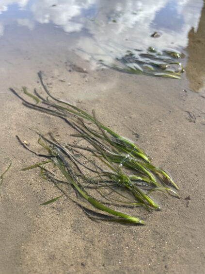
Seagrass helps defend the coast by binding the soil underneath the sea, protecting against erosion. It grows in shallow, sheltered environments around the coast – in Scotland usually it’s at a maximum depth of up to around seven metres.
The only flowering plant able to live in sea water, seagrass is also a vital natural resource for wildlife and fisheries as many species of fish and invertebrates lay their eggs within the meadows around the UK.
And it is also a carbon sink – which means it absorbs more carbon from the atmosphere than it releases.
Steve Vance, CGI’s director for consulting services, aerospace and assured space systems, said: “When you put those three things together, the coastal defence, the nurseries for our seas, but then the CO2 as well, it’s really a very important resource that is very, very rarely promoted around the UK.”
How are seeds from Orkney helping conservation elsewhere?
Co-founder and director of Project Seagrass, Dr Richard Lilley, explained there are a “whole host of reasons” why seagrass is important.
Globally there are 72 species of seagrass, and the UK is home to two species – Zostera Marina and Zostera Noltii, with the former being more common. Around Orkney, Richard says Zostera Marina is the only species they have mapped so far.
The conservation charity is involved in a number of restoration projects around the world. More recently it has been one of the organisations involved in the Restoration Forth – a major project led by the WWF in the Firth of Forth to restore seagrass and oyster habitats. Seeds collected from Orkney have been used to help rejuvenate lost seagrass meadows.
How many seeds have been collected so far?
Last summer 40,000 seeds were collected for the trials to see if the seeds would grow successfully at the three sites in the Restoration Forth project – Drum Sands, Tyninghame and Burntisland beach.
Richard said: “They successfully grew at all three sites and so this summer (2023) we collected many more, but we don’t have a final figure on the numbers yet as they are still being processed.”
Project Seagrass also has a citizen science programme called seagrassspotter.org, which allows people to record where seagrass is – so far there have been more than 7,200 sightings from 105 countries.
What methods are used to find seagrass?
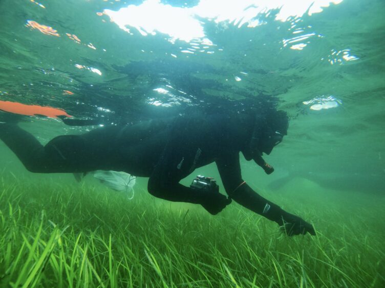
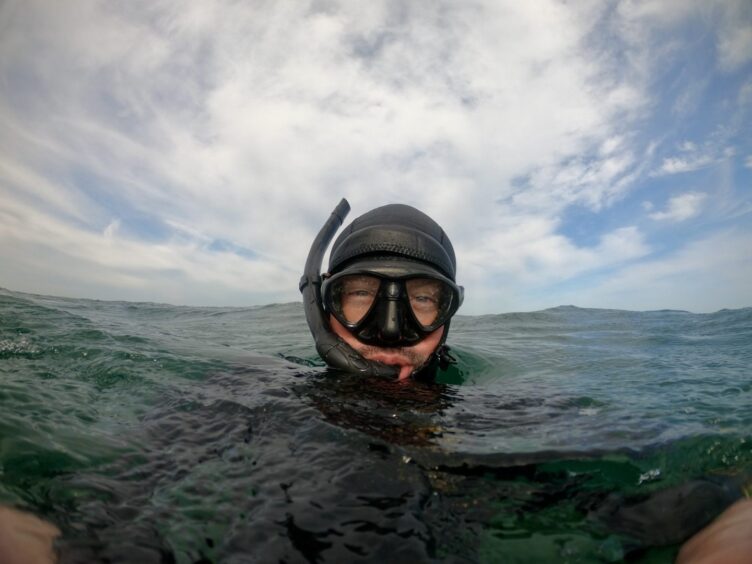
Typically methods such as drone and manual surveys have been used to find seagrass. A Scottish Government grant enabled the charity to buy a drone and funded training for Richard and a scallop diver to fly it.
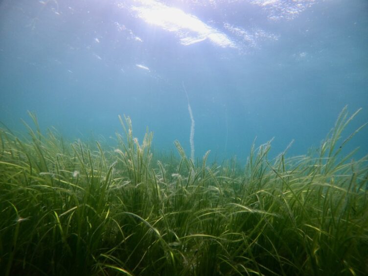
It can be harder to find seagrass elsewhere in the UK due to sediment levels, which makes the Orkney coast ideal due to its much clearer waters.
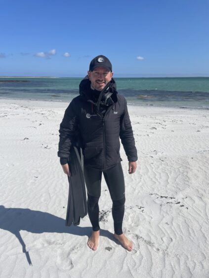
Speaking about the work that’s been done so far to map Orkney seagrass, Richard explained: “In that first year, in 2021, I was working with a local scallop diver to start mapping the meadows in Orkney. Because they are diving in the coastal waters around Orkney all the time, they obviously have very good local knowledge so they know where the seagrass is.
“So a combination of his local knowledge, and our drone flying meant we were able to start mapping seagrass meadows on drones. The nice thing about drones is they can provide very high resolution images of the coastal seascape, so you can get very good, accurate maps. They don’t work everywhere – but because all these waters are really very clear they’re very good for mapping in Orkney.
“So that combination of being in the water and actually confirming it’s seagrass and not kelp or algae, we call that ground truth. So we’re able to go into the water, ground truth the seagrass meadow, and then put the drone up.”
Why does seagrass need protection?
In Scotland, seagrass beds are classified as a priority marine feature, and beds are protected in 26 areas around the country.
Globally, seagrass has faced decline, and since the 19th Century it’s believed a third of the meadows have disappeared.
The threats to seagrass include activity from boats, where anchors for example could tear through the delicate roots of the meadows.
Other factors such as dredging, pollution have also contributed to their loss.
Steve Vance explained: “We really need to be very conscious when we’re making planning decisions in the coastal environment as to whether or not it is going to affect seagrass meadows. And the only way that you’re going to be able to protect it, is to know where it is.”
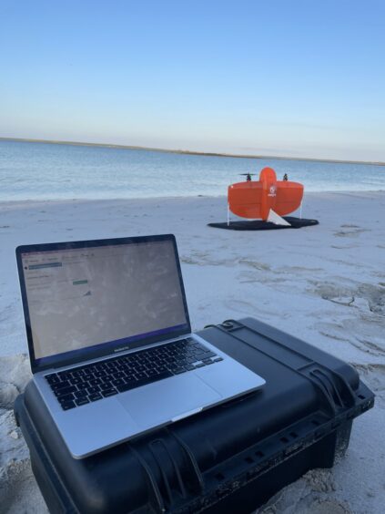
The usual methods of finding seagrass can be quite labour intensive, and Steve explained that’s how the idea of using remote sensing came about. It means huge swathes of sea can be scanned in a single satellite pass.
CGI has worked on the project pro bono and Steve explained: “We came up with the idea of using what’s called remote sensing to help inform them about where seagrass meadows may be, that they hadn’t considered before.
How does the remote sensing technology work?
On March 1, which was the United Nations’ first-ever World Seagrass Day – the charity and CGI launched a new algorithm, designed to detect seagrass meadows.
The algorithm is designed for people to contribute to it online – known as open source.
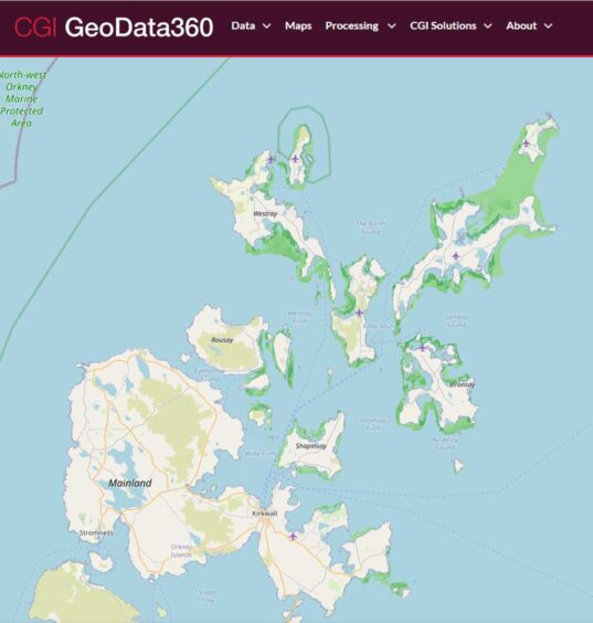
Through information gathered on the ground, in this case by Project Seagrass, it helps pinpoint the location of seagrass meadows through CGI’s GeoData360 Earth observation data processing platform.
This platform then applies data and imagery from the EU Corpernicus Satellite to further survey the sea from space, helping locate and identify more seagrass meadows for conservation.
Steve explained: “Remote sensing is the process of using satellites in space, which have big cameras on them. We use a lot of the ones from the Copernicus mission, which is run by the European Space Agency, and we process the imagery which comes off those satellites.
“By looking for particular properties of the image that we can decode using computers; we’re able to understand where the seagrass is by looking through the water and effectively lifting the lid on the water to see underneath and through it.”
What impact will it have on finding seagrass elsewhere?
It is already yielding results. In the summer, Project Seagrass mapped 17 hectares at Otterswick Bay, off Sanday, using a number of data sources including CGI’s Geo360.
And the GeoData360 platform and the ESA Earth observation imagery can be trained to create new algorithms which could be used to deliver seagrass identifications anywhere in the world, with access to relevant data.
Richard says the impact of the new algorithm will be “vital” going forward.
He added: “The exciting part here is the journey, I would imagine in five years’ time, if we can continue down this path, then there’s a huge opportunity to be able to map seagrass meadows from space.”
Richard continued: “Seagrass meadows are found in that coastal zone, and they’re found in waters which are murkier sometimes – which is a challenge. But the nice thing about Orkney is the waters are crystal clear, and it’s a really good training ground. If we can crack Orkney, then we can start to build out these algorithms for places like the Clyde or the Firth of Forth where the water is not crystal clear.”