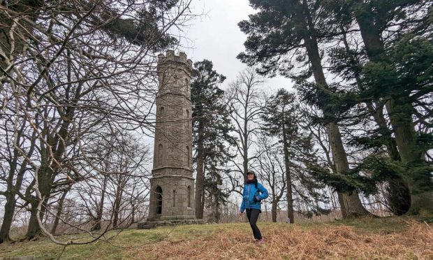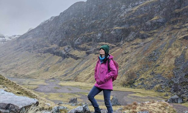
Morven and Roar Hill, Aberdeenshire
A few years back, I came across a guide book for walks in Northumberland which catered perfectly for friends of differing abilities who wanted to go out together.
It provided two route options for every walk – one high, one low – and meant everyone could start the walk together before splitting to tackle their respective paths, then join up again later.
There are many places in Scotland where this idea would work well, where those who want to do a higher or tougher route could still be accompanied by those with less lofty ambitions. The advantages are many but shared travel costs and a more social aspect to the day are the key points.
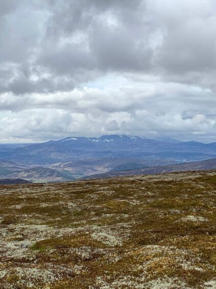
Morven, that distinctive Aberdeenshire peak which can be seen for miles around, is a fine example of how this high-low approach can work.
Although it reaches a height of 872 metres, this Corbett on the eastern edge of the Cairngorms National Park isn’t too strenuous a climb and should be within the fitness capabilities of most with a good path making steady progress to a magnificent summit viewpoint.
But those looking for a more leisurely day can start off with their companions before waving goodbye for a few hours as they make their way round a lower circuit round the foot of the ‘Big Hill’.
The starting point is a small parking area just before the rough access road to Groddie, and is reached along a minor road from the A97 west of Logie Coldstone.
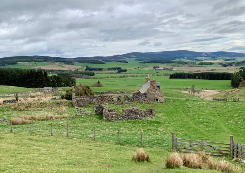
Farm tracks lead up past the crofting ruin of Balhennie then uphill and over a fence on to the open hillside and the parting of the ways. Those wanting to scale the heights take the path trending right, while the rest head straight uphill.

The paths through the heather are indistinct to start but soon become more obvious. The low route continues high above the line of the Coinlach Burn at first and then drops to cross the water as it swings north underneath Roar Hill.
It’s a short ascent to the top of this modest rise where the southern views are surprisingly expansive, and the drop-off the other side to each a track is short and sweet as well. A left turn begins the zig-zag descent, eventually leading to a re-acquaintance with the burn and a set of stepping stones to help you avoid wet feet.
From there the path makes its way out to Milton of Whitehouse for the brief walk back up the road.
Meanwhile, those on the higher route should be on the way back down after enjoying their sandwiches at the busy summit of Morven and the view across to the northern corries of Lochnagar.
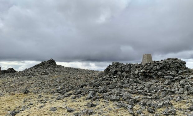
The path which started fairly indistinctly in the heather and boulder cover gradually became more pronounced as it breached a flat shoulder and then passed a couple of cairned tops on its way to the big shelter cairn wrapped round the trig pillar at the top.
The return can be varied by dropping off before the shoulder to reach the incoming path by the Coinlach Burn then reversing the early part of the low route.
And if you are really lucky in your choice of friends, you can complete a fine traverse by heading directly south from the summit to pick up paths running all the way through to Ballater where they will be waiting to welcome you. Remember though – you’ll be buying the drinks.
LOW ROUTE
From parking area, go left on farm track and take fork going left through gate beside information board. Continue on grassy track to pass Balhennie ruins, heading uphill towards farm gates.
Cross one on right and walk through field with fence to your left, then go through pedestrian gate and take path (indistinct at first) going straight uphill.
Path becomes clearer as it climbs through heather with Coinlach Burn off to left. Continue until path meets track close to burn.
Turn left to take track over Roar Hill to reach track junction.
Turn left on track going left and downhill to reach stepping stones over burn.
After crossing burn, go through pedestrian gate and follow grassy track.
At fork, take right-hand branch with trees on right. Pass through gate, walk past storage buildings and turn left on to minor road to head back to parking.
HIGH ROUTE
Follow as per low route past Balhennie ruins.
Continue as per low route, but after passing through pedestrian gate take path going steadily uphill to right to reach shoulder.
Climb steeply past rocky outcrop (Little Cairn) then another big cairn, cross slight dip and continue to summit shelter cairn and trig point.
Retrace steps past Little Cairn but just before shoulder drop south-east then south to meet path at Coinlach Burn.
Follow path north-east to return to Balhennie ruin and then retrace steps to parking.
INFORMATION
Distance: Low route (6km/3.75mls); High route (8.5km/5.5mls).
Ascent: Low route (350m/1150ft); High route (655m/2150ft).
Time: Low route 2.5-3.5 hrs; High route 3.5-4.5 hrs.
Grading: Choice of route around the high peak of Morven to suit varying fitness levels on hill paths and rough estate and farm tracks. For the higher way, walkers should be suitably equipped and have relevant hill skills. Farmland route – dogs under close control. Please remember to close all gates.
Start/finish: Parking area just before Groddie (Grid ref: NJ 410043), rough roads west off A97.
Map: Ordnance Survey 1:50,000 Landranger Map 37 (Strathdon & Alford); Ordnance Survey 1:25,000 Explorer sheet OL59.
Tourist Information: VisitScotland, Ballater iCentre, Station Square, Ballater, AB35 5QB (Tel 01339 755306).
Public transport: None to start point.