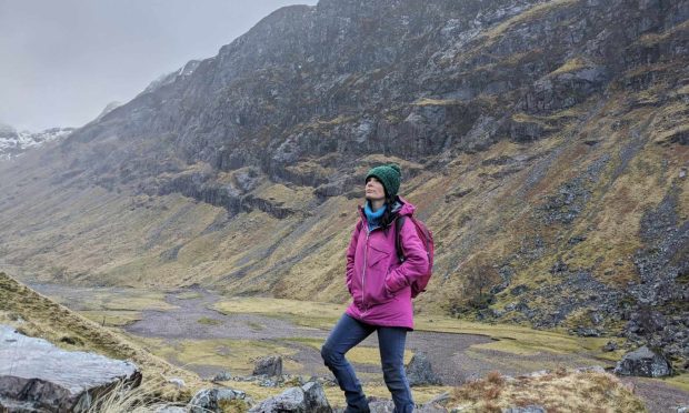
Slewdrum Forest, Nr Banchory, Deeside
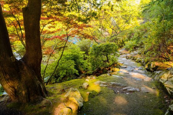
Slewdrum is the woodland at the eastern end of the stretch of forestry which decorates the serpentine twists of the River Dee all the way along from Banchory.
As is the case with the adjoining Blackhall Forest and the northern slopes of Scolty Hill, the tracks that weave their way through the trees are beloved bike trails, as well as providing fine walking routes for ramblers and dog owners.
Slewdrum has its own little place in history. It was an ancient Crown Common, the last of its kind in Scotland until it was handed over in 1954 by the Commissioners of Crown Lands to the Secretary of State for Scotland for planting by the Forestry Commission.
In 2006, it was bought by the Birse Community Trust and is managed to promote the common good of the inhabitants of the parish and for wider public benefits.
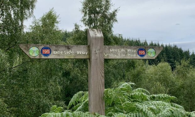
The section of the Deeside Way which runs between Aboyne and Banchory is the longest at 11 miles (17.5km) and provides a handy link from Potarch Green as it travels through Slewdrum.
The large car park was originally the site of an old market and fair but nowadays the neighbouring green space is a favourite picnic and leisure spot for families.
From the back left corner, I followed the Deeside Way sign taking the path heading into the trees and over a small wooden bridge with the Old Military Road close by to the left. After a short distance, the Way exited left to cross the road and continued on the other side.
It was now simply a case of following the trail as it climbed gently for another 3.5km or so, passing alternately through clumps of mixed woodland and alongside fields of cattle, crossing a series of little bridges and squeezing between passages of encroaching high bracken.
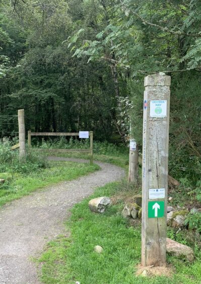
The first entrance to Slewdrum was passed – this will be your exit point – and about 1.5km further on I reached the main entrance. This is known as the Shooting Greens car park, supposedly because soldiers involved in building the military road used to also practise their marksmanship in these woods.
Still following signs for the Deeside Way, I turned left and passed a vehicle barrier to take the track downhill, ignoring a branch off to the right to reach a junction further on. This is where I left the Way, going left and then keeping left as the track curled round the forested height of Muckle Ord.
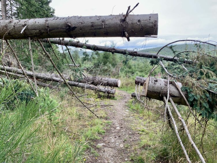
I had expected to encounter some bikes on the trail, but had the place to myself. I wondered if the number of fallen trees across the path was a factor even though they had all been cut through to allow easy passage.
The track split again a little further on, and I left the main drag to head downhill on a rougher ramp which crossed a stream then switched back for a short distance before continuing north-east. Again, any fallen trees had been cut.
Despite being in close proximity to the Dee, the river largely remained invisible, only the merest glimpses of blue through the tree cover as I made my way round the eerily silent wood and the delightfully named Horse Hillock.
After passing a small fenced-off sub-station, the track swung to the left to emerge back on the Deeside Way at the first entrance passed on the way in. The metal barrier gate was open, but even if it is down it won’t impede foot passengers.
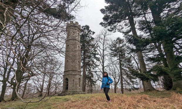
There’s a handy memorial seat nearby if you want to take a minute to drink in the expansive views, otherwise it’s just a case of retracing your route back along the Way to the car park.

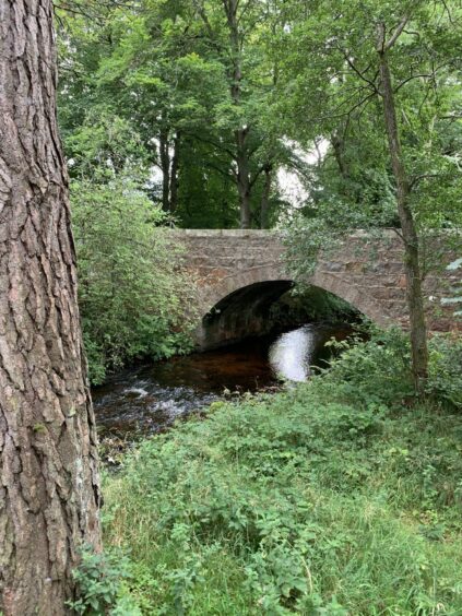
If you have the time, it’s well worth making the short detour to take a look at the elegant Potarch Bridge which arches over the Dee. The three-span structure was completed in 1813 from a design by Thomas Telford.
This is also the alternative starting point for the Slewdrum walk if you arrive by public transport via the A93.
ROUTE
1. Take Deeside Way (signed) from back of car park and head south-east with Old Military Road on your left.
2. After 1km, cross road to continue on Deeside Way through sections of woodland, past fields and over several small bridges.
3. Pass first track entrance for Slewdrum Forest (this is your exit point) and continue straight on to main entrance and car park.
4. Turn left and take track past vehicle gate, still on signed Deeside Way route. Ignore offshoot going right keeping straight on to next junction where you leave Way and branch left.
5. Follow this as it twists north-west. Ignore branch going sharp right and continue to next split where you take rougher right-hand branch sloping downhill.
6. This drops to cross bridge and turns right briefly then left again. Follow it round, passing small sub-station, before emerging at entrance passed earlier.
7. Turn right and retrace your steps along the Deeside Way and back to car park.
INFORMATION
Distance: 10km/6.25miles
Ascent: 200m/656ft
Time: 2.5-3.5 hours
Grading: Pleasant easy woodland walk along surfaced path and forest tracks, suitable for all ages and fitness ability. One road crossing, care needed. Be aware that forest tracks are shared bike trails. Dogs under close control near farm livestock.
Start/finish: Potarch Green parking area (Grid ref: NO 607973).
Map: Ordnance Survey 1:50,000 Landranger Map 37 (Strathdon & Alford) or Map 45 (Stonehaven & Banchory); Ordnance Survey 1:25,000 Explorer sheet OL59.
Tourist Information: VisitScotland, Ballater iCentre, Station Square, Ballater, AB35 5QB (Tel 01339 755306).
Public transport: Bus service to Potarch Bridge (No 201).


Conversation