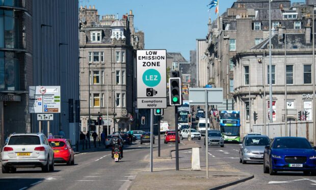
Enforcement of the Aberdeen Low Emission Zone (LEZ) will start in little more than a year’s time, but do you know where its boundaries start and end?
The city’s LEZ officially commenced last May, but enforcement isn’t due to begin until June 2024.
So far, no signs have been erected and no cameras are in place, despite there being just over 12 months until people in high-pollution vehicles can expect to start being fined.
In fact, there is absolutely nothing on the streets yet to indicate where the LEZ is in Aberdeen.
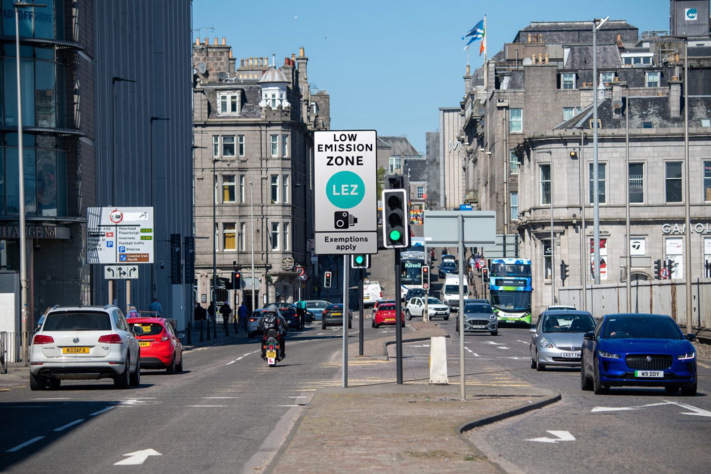
So to help you get ready, we’ve created 12 artist’s impressions of what the LEZ could actually look like once signage starts appearing in Aberdeen to show its boundaries.
Touch the blinking green dots on this boundary map to see what Aberdeen could look like with Low Emission Zone signs in place
Scroll down for analysis on each area of the map to see what roads are in or outside the Aberdeen Low Emission Zone…
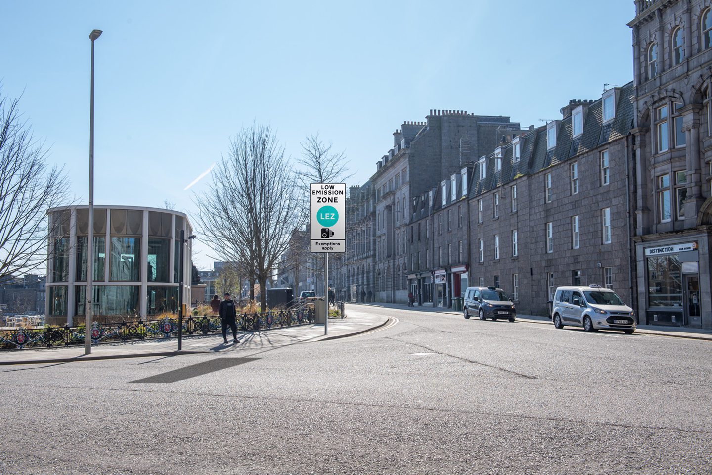
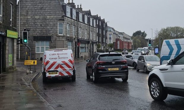
1. Willowbank Road

The Aberdeen Low Emission Zone takes in the majority of Willowbank Road, except the western end from the junction with Hardgate up to Holburn Street.
But east of this junction, drivers of vehicles that don’t meet the emissions requirements will be fined from June next year.
The zone covers Willowbank Road from this junction all the way east, past Bon Accord Terrace Gardens, and extends along Springbank Terrace and Wellington Place, before ending at College Street.
2. Holburn Street
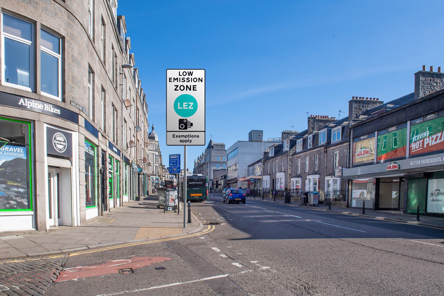
The LEZ will prevent access to banned vehicles at the very top of Holburn Street.
Facing north towards Union Street, the zone starts at the junction with Ashvale Place, just outside Alpine Bikes and Papa John’s pizza.
3. Albyn Place
Drivers in banned motors won’t be able to go past the junction of Albyn Place and Victoria Street once the zone enforcement begins in June 2024.
The LEZ starts just after the turn-off to Victoria Street if you’re on Albyn Place travelling towards Union Street.
Victoria Street itself is just outside of the zone, but everything behind the sign in this artist’s impression is inside it.
4. Thistle Street
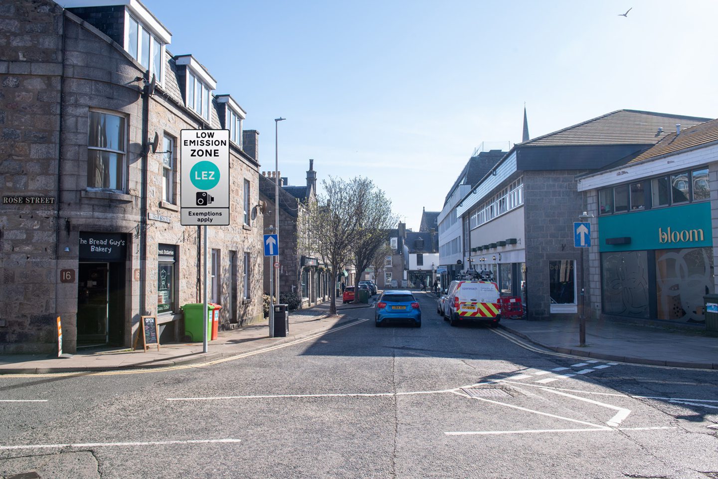
Thistle Street is cut in half by the LEZ.
All of the road on the eastern side of the junction with Rose Street falls inside it, but the rest of Thistle Street does not.
This means that businesses like the Foodstory cafe are inside the zone, but the Baskin Robbins ice cream shop is not.
Rose Street is inside the zone from the south of the Rose Street/Thistle Street junction — everywhere to the right of Bloom in the above photograph.
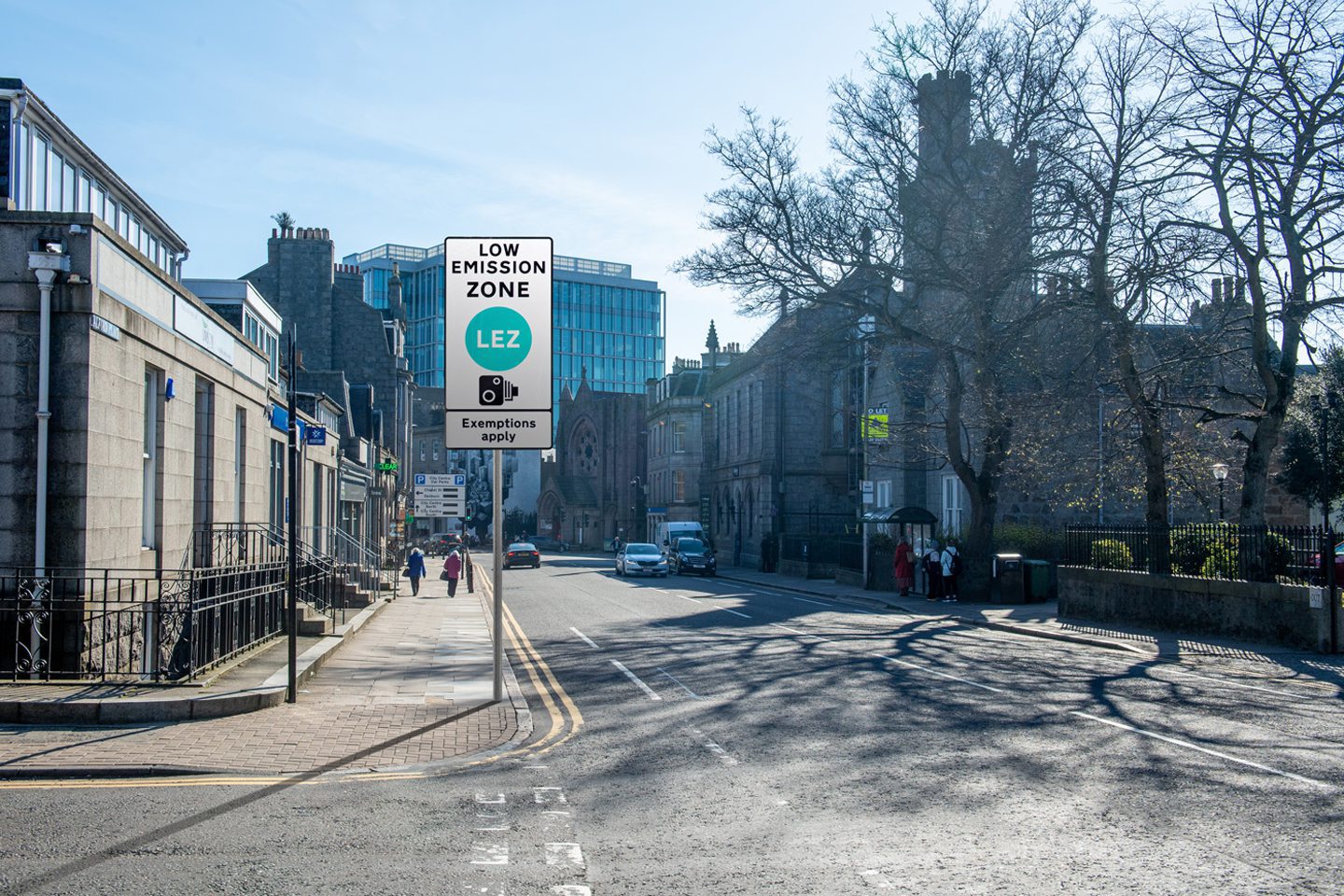
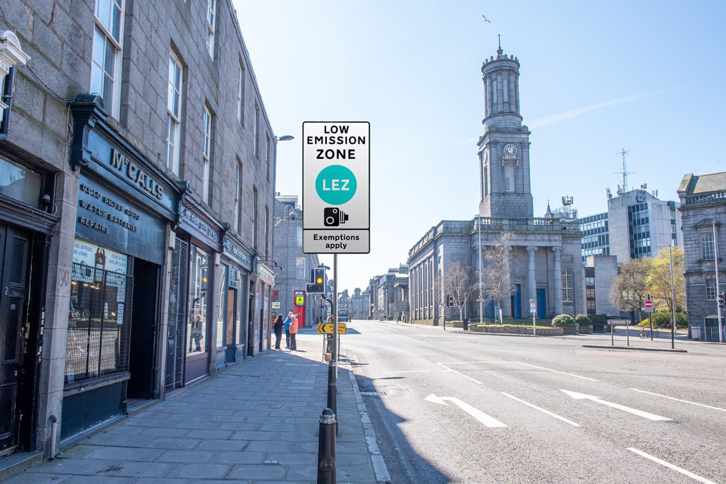
5. Union Terrace
Anyone will be able to freely drive along Rosemount Viaduct, but you will need a car that complies with the LEZ’s emissions rules in order to go on Union Terrace after June next year.
Other roads near to this photograph are not in the Aberdeen Low Emission Zone include Skene Street, Blackfriars Street and much of Schoolhill — but not all of it…
6. Schoolhill
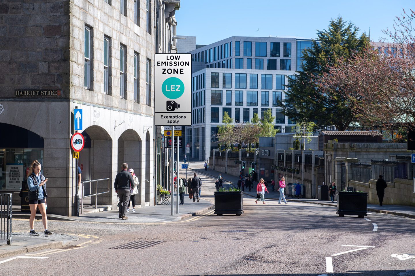
The zone starts on Schoolhill just after the junction with Harriet Street, where the current pedestrian and cyclist only rules apply.
Everything west of this junction, including the Art Gallery and the restaurant FreshMex, isn’t in the zone.
This means anyone will still be able to drive along Schoolhill from the west and go into the Harriet Street multi-storey car park.
But only vehicles that aren’t banned will be permitted inside Schoolhill beyond this junction — such as those permitted for loading during certain times.
Nearby Back Wynd also falls inside the LEZ.
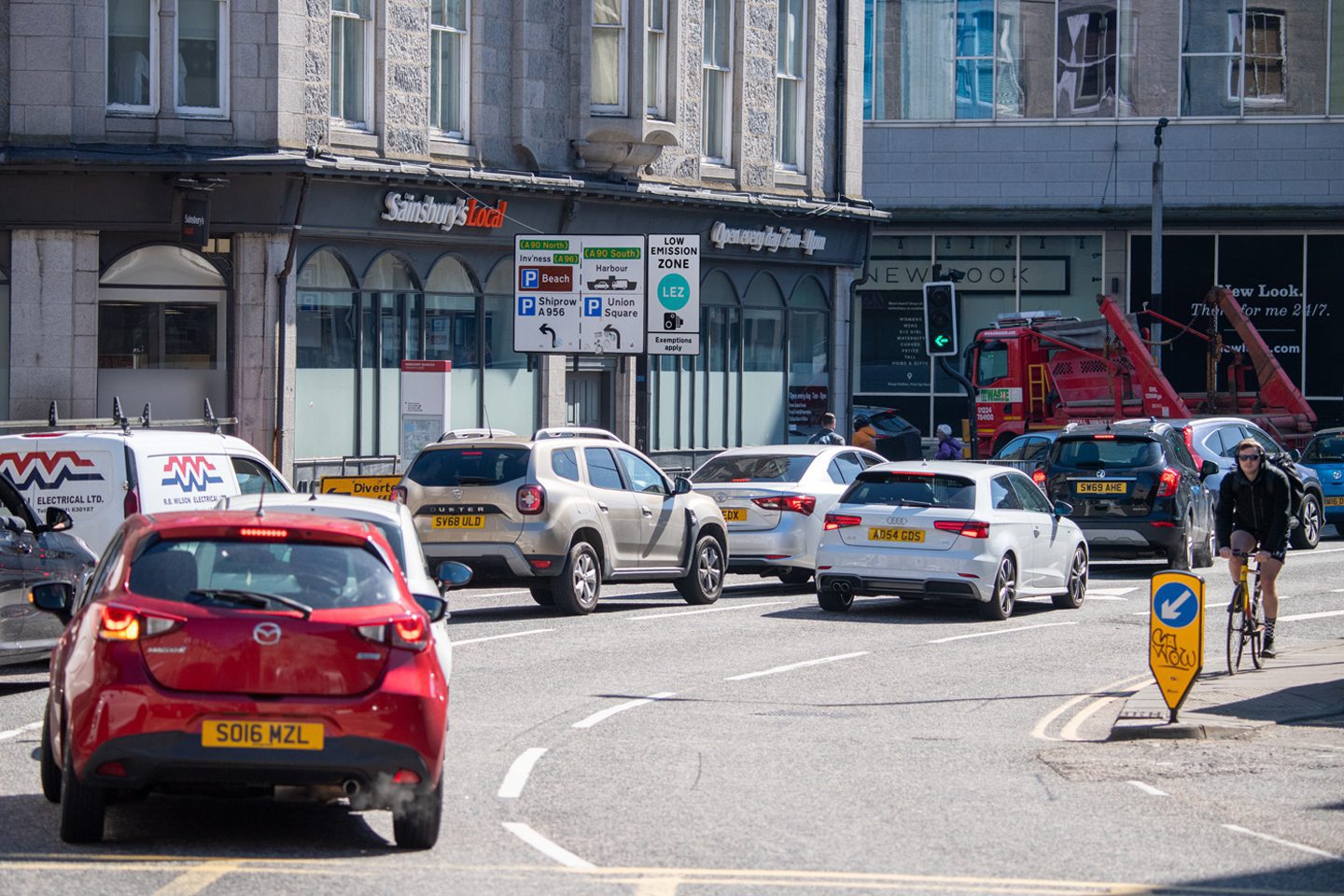
7. Upperkirkgate/Gallowgate

Another boundary for the zone lies on Gallowgate, just past the junction with Littlejohn Street and after the Brewdog pub.
You’ll be able to drive a banned vehicle from the north all the way up to and including the door of Brewdog, but no further south towards Broad Street unless you want to pay a fine.
Littlejohn Street is entirely outside of the LEZ.
8. King Street
The LEZ does not cover any of King Street north of the junction with East North Street and West North Street.
But, everything south of this junction near the Aberdeen Arts Centre falls inside the zone.
So, in the above photograph, you’d be able to turn left if you were driving a non-compliant vehicle, but you’d be fined if you went straight ahead onto the section of King Street beyond that joins onto Union Street.
9. Virginia Street
All four lanes of the Virginia Street dual carriageway in its entirety are inside the Aberdeen LEZ.
This starts at its junction with Commerce Street, but no parts of Commerce Street are within the zone.
Other nearby streets that aren’t inside the zone include Miller Street and much of Regent Quay.
But Regent Quay, as well as Virginia Street, both flow onto Trinity Quay, which is inside the zone.
As is the northern stretch of Market Street…
10. Market Street
Market Street will be a no-go zone for drivers in banned vehicles from next June everywhere north of the road into the bus station, just behind Decathlon at Union Square.
All drivers will still be able to travel up Market Street from the south to get into parking at Union Square, or go to the Aberdeen ferry terminal.
But nearby roads like the eastern side of Guild Street and Trinity Quay being part of the LEZ means for drivers of high-polluting vehicles, they will no longer be able to access the eastern Union Square car park from the north.
11. Wapping Street/Carmelite Street
The LEZ does not include Wapping Street, South College Street or Rennie’s Wynd.
As a result, all drivers will still be able to access the Trinity Centre car park.
But, you will no longer be able to turn left at the Sainsbury’s at the bottom of Carmelite Street onto Guild Street, as all of Guild Street east of this junction is inside the LEZ.
However, all of Guild Street from the front of Union Square’s entrance west up to Bridge Street and College Street isn’t in the LEZ.
12. Bridge Street
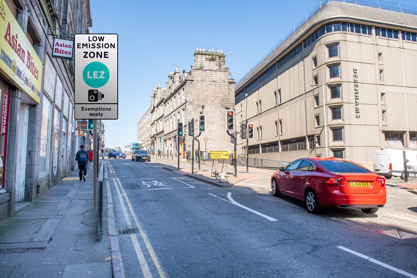
Once it’s fully up and running, banned drivers won’t be able to head north from College Street and onto Bridge Street, as the LEZ starts just before the turn-off right towards Wapping Street.
Enforcement for the zone will mean anyone in a vehicle that breaks the emissions rules wishing to drive from Bridge Street to the north side of the city centre, at Rosemount Viaduct and His Majesty’s Theatre, will be in for a lengthy detour.
Nearby Denburn Road is also covered by the LEZ between its junction with Wapping Street and where it goes underneath Rosemount Viaduct.
So the only way to get from Bridge Street to Rosemount for some drivers will be via the West End.
Find out if your car will be banned from the Aberdeen Low Emission Zone here, if your street is inside the LEZ here, and everything else you need to know here.
You can find the council’s official LEZ page here.
Conversation